Recently, information about the summary report and main products of the scientific and technological task "Research and assessment of the current status and influencing factors as a basis for proposing solutions to preserve Hon Trong Mai, Ha Long Bay" of the Institute of Geosciences and Mineral Resources (Ministry of Natural Resources and Environment) has made people and tourists worried.
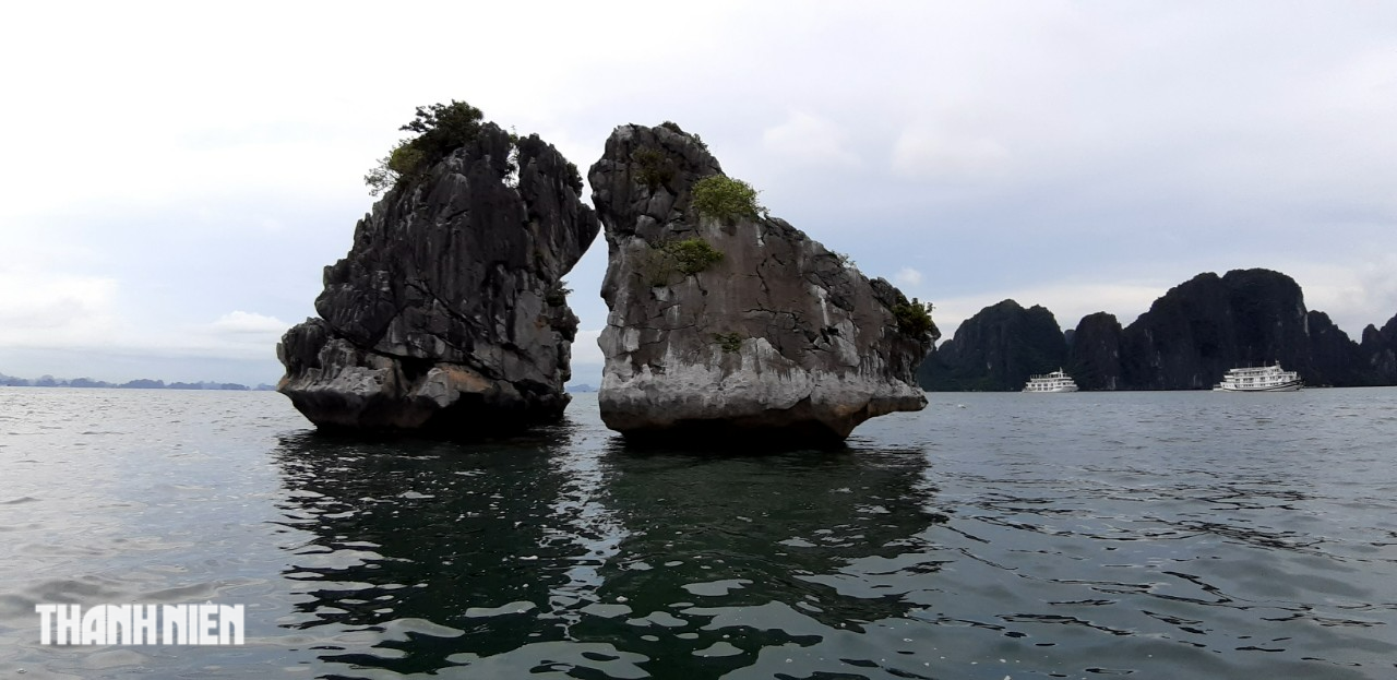
Hon Trong Mai, the symbol of Ha Long Bay, is at risk of collapsing.
According to Institute of Geological Sciences and Mineral Resources , through the process of geological activities, tectonic and impact of sea water, Hon Trong Mai has a monoclinic structure with many systems of cracks that pose a risk of landslides, landslides or deformation, causing the loss of the symbolic image of the world heritage Ha Long Bay. Worthy Note, at locations such as the crest of Hon Trong and the beak of Hon Mai or the tail, there is a high risk of landslides, which will cause the image of the pair of chickens bestowed by nature to disappear.
Specifically, Dr. Tran Diep Anh, researcher of the Department of Tectonics and Geomorphology (Institute of Geological Sciences and Mineral Resources), said that the results of detailed investigation and measurement of the Hon Trong Mai area combined with satellite image analysis, 3D model building... have determined that there are 40 blocks at risk of landslides and collapse in the Hon Trong Mai area. Of which, Hon Trong has 11 blocks and Hon Mai has 29 blocks.

Over the years, the tour boat fleet on Ha Long Bay has surrounded the Rooster and Hen Islet, taking tourists to take photos and check-in this unique pair of chickens.
A total of 13 blocks are at risk of flat sliding (Hon Trong 6, Hon Mai 7); 4 blocks are at risk of wedge sliding (Hon Trong 3, Hon Mai 1); 23 blocks are at risk of landslides and toppling (Hon Trong 3, Hon Mai 21)...
Concerned about the risk of landslides on Trong Mai island, the Department of Transport of Quang Ninh province recently requested the Ha Long Bay Management Board Propose the functional units of the Management Board Ha Long Bay and the Inland Waterways Port Authority have advised ship owners and captains carrying tourists when passing through the Trong Mai Islet area to reduce their speed to a minimum of 10 km/h to avoid creating waves hitting the rocky mountains; keep a distance of about 70m from Trong Mai Islet. This is to avoid waves hitting the rocky mountains, increasing corrosion; and at the same time, limit the risk of ships colliding with Trong Mai Islet.
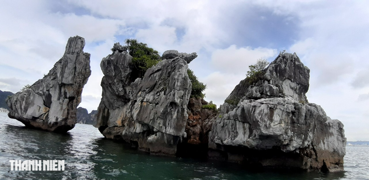
After many years, the Rooster and Hen Islet is being weathered and losing its original appearance as a pair of chickens.
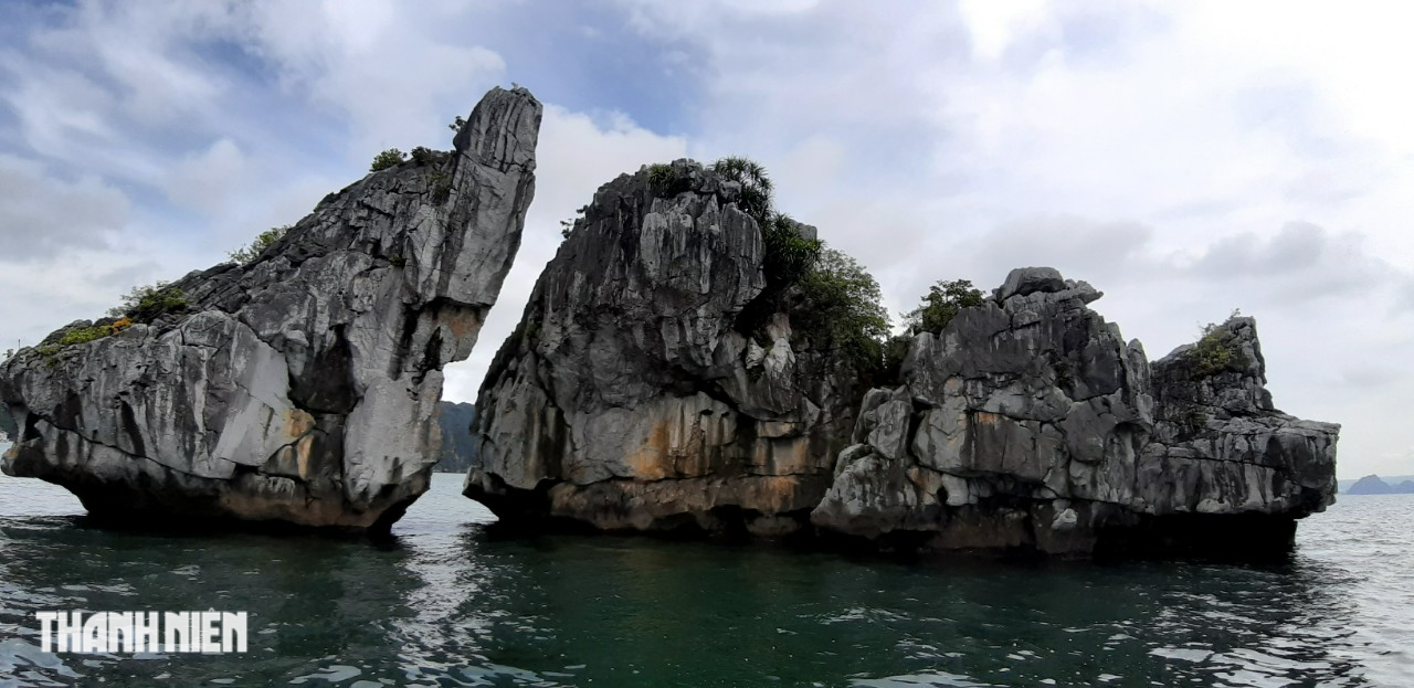
Coming closer, you will see many large cracks appearing on the limestone mountain pair.
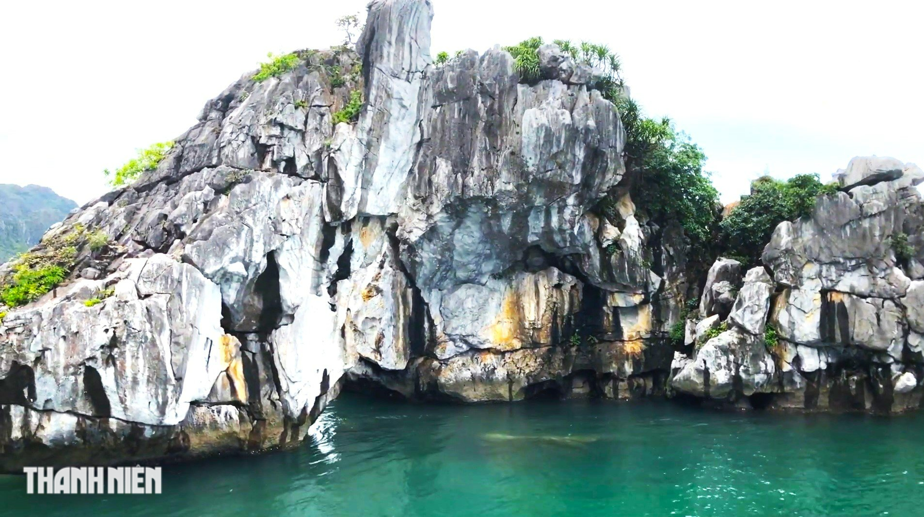
According to the Institute of Geological Sciences and Mineral Resources, the crest and mines of Hon Trong Mai are at risk of landslides.

On low water days, visitors can clearly see the imbalance at the foot of Hon Trong Mai.

Authorities of Quang Ninh province are restricting the speed of boats passing through the Hon Trong Mai area as well as limiting the viewing distance of this tourist attraction to about 70m.

Hon Trong Mai seen from the front clearly shows the uniqueness that nature has bestowed upon this place.
Hon Trong Mai, also known as Hon Ga Choi, is chosen as a symbol for tourism in Ha Long, Quang Ninh. The image of a pair of limestone rocks shaped like a pair of roosters and hens putting their heads together has become a famous check-in spot for tourism in Ha Long.
Interestingly, if viewed from different angles, this pair of limestone mountains gives visitors a different appearance. Only this angle can show the image of a pair of roosters and hens.
Source link





























































Comment (0)