

The mountainous region of Quang Tri province receives a significant amount of annual rainfall, while its population is distributed across areas with high hills and mountains, and numerous rivers and streams. Therefore, the area frequently faces the risks of landslides, flash floods, and mudslides. To respond, the mountainous districts in the province have been, are, and will continue to proactively develop effective prevention and mitigation measures to minimize damage caused by natural disasters.
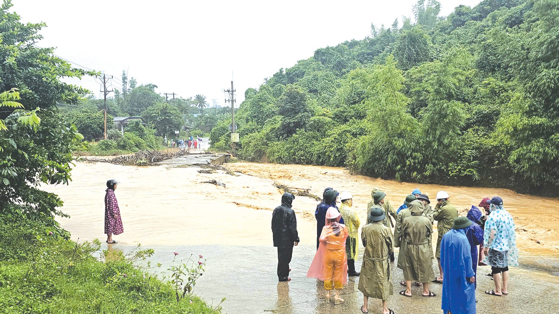
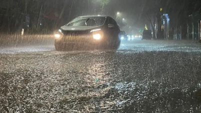
Whenever there is heavy rain, the La La bridge area on provincial road DT.587 through Huc commune, Huong Hoa district, is deeply flooded, posing a danger to residents - Photo: LT
Dozens of locations in mountainous areas are at risk of landslides and flash floods.
According to the results of the research project " Scientific basis for developing criteria and identifying high-risk areas for landslides, mudslides, flash floods, and mudslides in mountainous and midland areas of Vietnam" conducted by the Institute of Geological Sciences and Mineralogy in 2021, Quang Tri province has 27 communes at risk of landslides and flash floods, mainly concentrated in the two mountainous districts of Huong Hoa and Dakrong.
In Huong Hoa district, according to statistics from the authorities, in 2024, the entire district had approximately 45 locations with nearly 600 households/2,617 people in areas at risk of landslides. Of these, 19 areas with very high landslide risk are distributed in villages belonging to the communes of Huc, Huong Tan, Huong Viet, and Ba Tang, affecting a total of nearly 300 households/1,322 people.
Most of these areas are located in regions with heavily dissected terrain due to the system of rivers and streams along the mountain slopes. These areas receive a significant amount of rainfall annually, concentrated at certain times, which easily causes the mountain ranges to fracture, leading to landslides. In some places, the slopes are so steep that continuous heavy rainfall combined with strong currents poses a high risk of flash floods with devastating consequences.
According to observations in Miet Cu village, Huong Linh commune, this area has many houses of ethnic minorities built on both sides of a deep ravine, surrounded by high hills and mountains. During the rainy season, this area frequently faces the risk of landslides and flash floods that can occur at any time. Living next to the western branch of the Ho Chi Minh Highway, Mrs. Ho Thi Pun's family in Miet Cu village, Huong Linh commune, built their house right on a newly leveled piece of land, with a stream below and the Rao Quan hydroelectric reservoir in front.
Every time it rains, Mrs. Pun and many other nearby households have to constantly check around their homes. “My neighbors and I are very worried because the risk of landslides is always lurking. But what can we do? Our families are too poor; moving elsewhere means we don't have land to build houses, so we have to accept living like this. Whenever there's heavy, prolonged rain, the local authorities offer assistance to relocate us to schools, but we're still afraid of losing our homes and land,” Mrs. Pun worried.
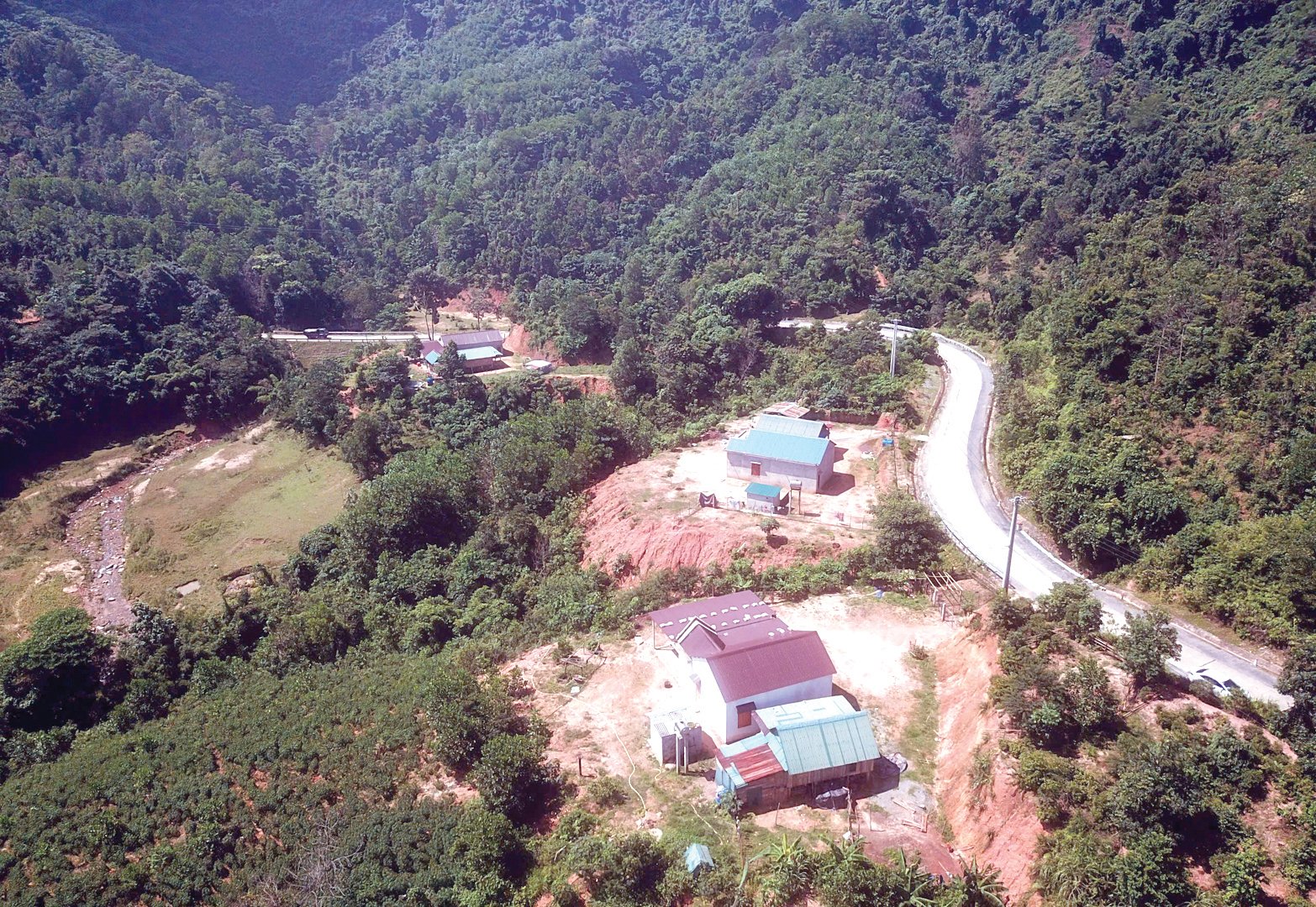
Many houses built along the western branch of the Ho Chi Minh Highway in Huong Linh commune, Huong Hoa district, are situated on land at high risk of landslides - Photo: LT
According to statistics from the Disaster Prevention and Search and Rescue Command Board of Dakrong district, in 2024, the entire district had 13 communes with 78 villages located in high-risk areas for landslides and flash floods, affecting nearly 1,500 households/6,504 people, requiring evacuation plans during the rainy season. In addition, Dakrong district has 8 areas with over 250 households/1,044 people identified as living along riverbanks at risk of landslides.
It is urgent to have a plan to ensure the safety of the people.
To proactively prevent and respond promptly and effectively to the risks of landslides and flash floods, mountainous localities annually strengthen and improve the capacity of the Disaster Prevention and Search and Rescue Command Boards at the district and commune levels; assigning specific tasks to each member to ensure suitability with the practical situation.
According to Hoang Dinh Binh, Head of the Agriculture and Rural Development Department and Deputy Head of the Disaster Prevention and Search and Rescue Command Board of Huong Hoa district, to proactively prevent and control natural disasters in general, the locality regularly pays attention to information dissemination, propaganda, warnings, and guidance on disaster response measures to the people, especially in remote areas and ethnic minority communities. The top priority is early prevention of risks caused by natural disasters.
This includes focusing on developing emergency relocation plans for people in mountainous areas at risk of landslides and flash floods; and arranging safe accommodation in case of emergencies. In the long term, the locality has an urgent need to build eight resettlement areas for people in high-risk areas for landslides and flash floods; however, due to limited resources, only three have been built so far.
Therefore, to ensure the safety of thousands of people living on mountain slopes and along rivers and streams, who constantly worry about the risk of landslides and flash floods whenever there are storms, the district requests that competent authorities create conditions and mobilize resources to support the locality in completing the construction of resettlement areas as soon as possible, in order to create safe living places for the people.
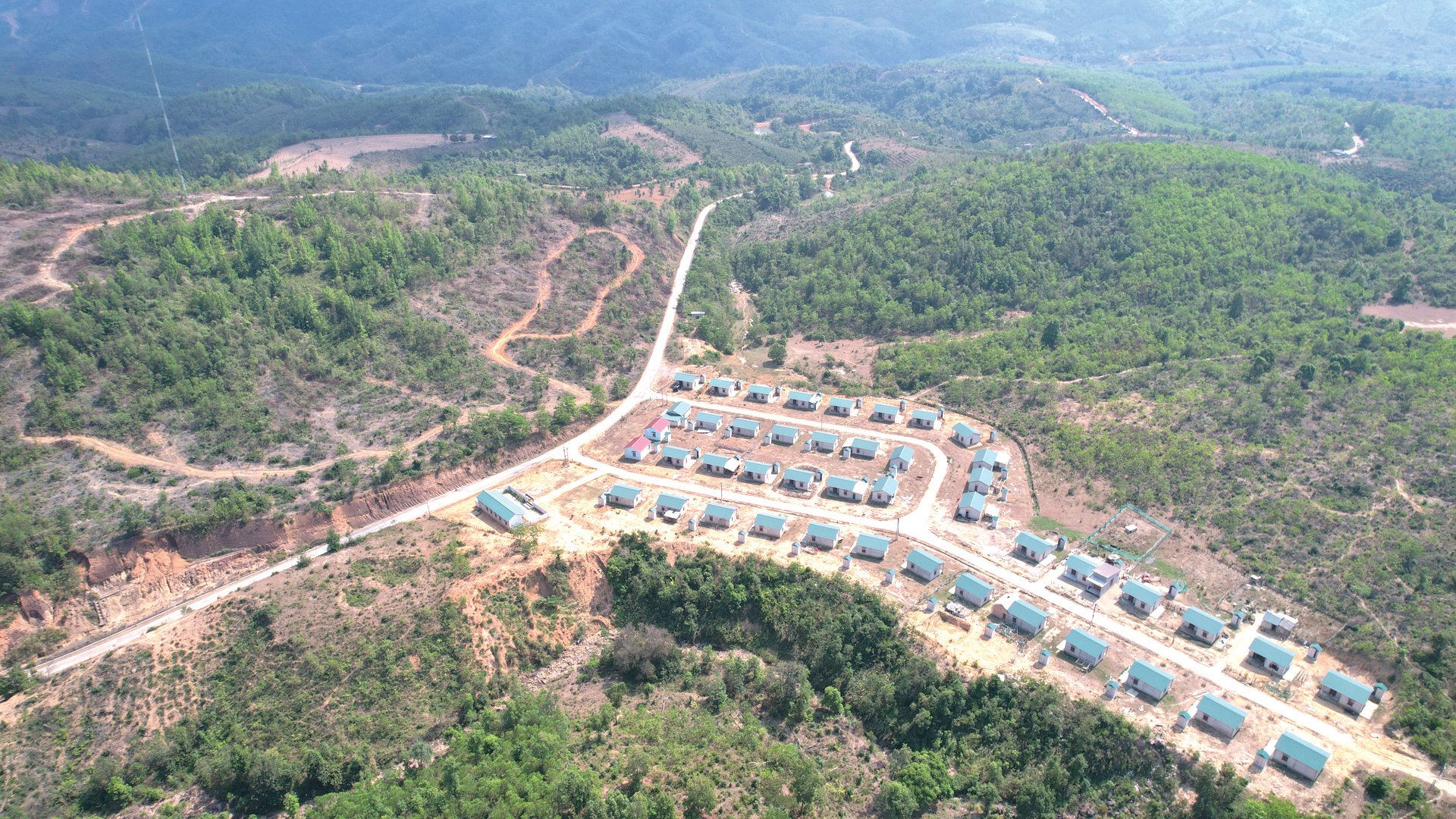
The Ra Ly Rao resettlement area in Huong Son commune, Huong Hoa district, is a well-built and safe location designed to relocate households from landslide-prone areas - Photo: LT
According to information from the Department of Natural Resources and Environment (TN&MT), in March 2024, the Ministry of Natural Resources and Environment issued a plan assigning the Vietnam Geological Survey to lead the task of investigating, building a database, and creating current status maps, risk zoning maps, and landslide and flash flood risk zoning maps at a scale of 1:10,000 and larger for 150 high-risk areas for landslides and flash floods under the Government's "Early Warning System for Landslides and Flash Floods in Mountainous and Midland Areas of Vietnam" project. However, the list of 150 areas planned for this research and assessment does not include Quang Tri province.
Therefore, in order to assess the priority level and provide a complete list of areas at risk of landslides and flash floods in the province, the Department of Natural Resources and Environment has submitted a proposal to the Provincial People's Committee requesting a response from the Vietnam Geological Survey to consider adding some high-risk areas for landslides and flash floods to the aforementioned plan.
Therefore, there is a basis for proposing that the Vietnam Geological Survey implement programs and research projects on the application of science and technology to prevent and mitigate landslides and flash floods in the province in the future. At the same time, it is necessary to improve communication capacity and utilize early warning information to support the response to dangerous phenomena such as landslides and flash floods during the rainy season.
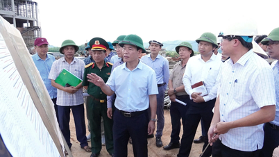
Recently, during an inspection of storm prevention and control efforts related to typhoon No. 4 and floods in Huong Hoa district, Vice Chairman of the Provincial People's Committee Le Duc Tien requested the locality to urgently coordinate with relevant departments and agencies, and the Provincial Military Command to conduct a detailed review of locations at risk of landslides and flash floods in order to develop immediate and long-term response plans.
In particular, special attention must be paid to implementing proactive response measures, preparing means and personnel to safely evacuate people when situations arise; and proactively preparing sufficient supplies of food, necessities, and other essential goods to ensure adequate provision for people in the event of prolonged natural disasters.
Le Truong
Source: https://baoquangtri.vn/chu-dong-ung-pho-sat-lo-dat-and-lu-quet-o-mien-nui-189503.htm




![[Photo] Standing Committee member of the Party Central Committee Tran Cam Tu working with the Central Inspection Committee](https://vphoto.vietnam.vn/thumb/1200x675/vietnam/resource/IMAGE/2026/05/28/1779969579668_ndo_br_bnd-2495-jpg.webp)


















































































Comment (0)