
 |
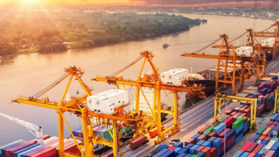
| Due to climate change, sea levels around Singapore are predicted to rise by up to 1m by 2100. (Source: Straits Times) |
Singapore's Minister for the Environment and Sustainability Koh Poh Koon said on March 2 that the country is about to launch a $125 million research program to enhance the island nation's flood management and coastal protection capabilities.
According to the National Water Authority PUB, the program aims to By better identifying the impacts of climate change on Singapore's coastal areas, it can aid coastal protection studies nationwide and flood-prone coastal and inland areas.
Programme will include research aimed at developing innovative, sustainable and smart solutions for the urban environment – a challenge that many other coastal cities also face.
Sustainable coastal protection solutions, based on nature such as mangrove planting, or smart management such as using artificial intelligence are also being researched and applied.
The programme is implemented by the National University of Singapore, with partners including Nanyang Technological University, Singapore University of Technology and Design, Singapore Institute of Technology and the Agency for Science , Technology and Research.
“We will conduct about 100% of the survey,” said Ms Hazel Khoo, head of PUB’s Coast Guard Division. 40-50 new studies (in the field of coastal protection and flood control) and training of about 20-30 postgraduate students, from which a team of local experts can be built for coastal research work".
Due to climate change, sea levels around Singapore are predicted to rise by 1m by 2100. Storms may become more frequent, leading to increased flood risks. Therefore, it is important for the country to increase its resilience to floods.
The programme will help build knowledge about the occurrence of extreme sea levels, waves and storms, and how coastal areas will be affected by sea level rise and climate change, Ms Khoo said.
This will be important in determining the impacts of sea level rise and climate change on coastal and inland areas, in order to find and develop optimal solutions.
Common regional issues
Climate change is having a devastating impact on Southeast Asia. Rising sea levels are threatening infrastructure and the lives of people in the region.
According to research by the Asian Development Bank (ADB), the Southeast Asian region is particularly vulnerable to climate change, due to its densely populated coastal areas.
According to the Deltares Research Institute (Netherlands), about 157 million people are living in places 2 meters below sea level, this number will continue to increase if sea levels rise in the coming decades.
The Intergovernmental Panel on Climate Change (IPCC) warns that sea levels could rise by 0.8m by 2100. If sea levels rise by 1m, some densely populated deltas will be submerged, and 28 million people in Indonesia, 23 million people in Thailand and 38 million people in Vietnam could face this risk.
Ms Cheryl Tay - a PhD student at the Asian School of Environment at Nanyang Technological University (NTU) in Singapore noted that many coastal cities in Asia are currently growing and urbanizing rapidly, so the exploitation of groundwater to meet domestic water needs is increasing.
Satellite imagery of 48 coastal cities from 2014-2020 recorded an average sinking rate of 16.2mm per year. Some cities are sinking at rates of around 43mm per year. Currently, the Indonesian city of Jakarta is sinking at a rate of 4.4mm per year.
“Floods can damage property and infrastructure. In extreme cases, floods can affect livelihoods by damaging agricultural land and forcing people to move when they are no longer habitable,” said Cheryl Tay.
The current global average sea level rise is 3.7mm per year. In Singapore, the average sea level is rising at a rate of 3-4mm per year. Data from the Singapore Meteorological Department shows that sea levels here have risen by 14cm since pre-1970 levels.
The Indonesian capital Jakarta is also sinking due to subsidence. The city’s water supply is inadequate, and residents rely on well water drawn from shallow aquifers, causing the ground above to sink further and further.
According to National Geographic , in 15 years, 80% of northern Jakarta will be below sea level. In 50 years, current streets could be at least 30 cm below sea level.
With more than 50 deaths and 300,000 people forced to evacuate, the 2007 floods were a wake-up call for Jakarta as water submerged more than a third of the city.
Planting mangroves to prevent seawater
Besides measures such as building sea dykes and drainage systems, planting mangrove forests is an effective way to prevent rising sea levels.
According to research by the University of Southampton (UK), the University of Auckland and the University of Waikato (New Zealand), mangroves help prevent erosion of coastal areas because the roots hold the soil. Furthermore, mangroves also create a system of canals, which are gradually shallowed by sediment, forming a system to prevent tidal water from flooding further inland.
Ms Cheryl Tay said that governments should build coastal defense systems such as sea walls, or use nature-based solutions such as planting mangroves.
“Governments should also address the root causes of the problem. If the exploitation of resources such as groundwater, oil and gas is the reason for land subsidence in a particular city, appropriate solutions are needed,” she stressed.
Cities need to find other water sources to replace groundwater use, and need to replenish groundwater to limit the increasingly serious subsidence.
International


Comment (0)