
Review the entire system and adjust forecasts to better reflect the needs of the people.
Starting from July 1st, the two-tiered local government system nationwide officially came into operation, requiring weather forecasts to be adjusted and updated to suit the new administrative boundaries, ensuring accuracy and timeliness in each area, down to each commune, ward, and special zone.
According to Comrade Nguyen Thuong Hien, Director of the Department of Meteorology and Hydrology, Ministry of Agriculture and Environment , immediately after the Central Government decided to reorganize administrative units, following the Ministry's directive, the Department of Meteorology and Hydrology conducted a comprehensive review of meteorological and hydrological forecasting and warning work and natural disasters. In particular, special attention was paid to adjusting bulletins to suit the new communes, wards, and special zones, helping people and local authorities to quickly access, understand, and act promptly.
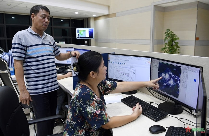 |
Leaders of the Department of Meteorology and Hydrology, Ministry of Agriculture and Environment, inspect the weather forecasting duty. Photo: LA DUY |
This is no small task. Previous weather forecasts were designed to correspond to the old administrative boundaries, from the provincial level down to some districts. The mergers, divisions, and name changes of local units require the meteorological sector to update its entire database, meteorological maps, and forecasting zoning system.
Previously, the National Center for Hydro-Meteorological Forecasting only provided detailed forecasts for 63 locations, corresponding to 63 provinces and cities. However, the system will now expand, updating detailed forecasts for all 3,321 new communes/wards and special zones. Each location will be linked to continuous 24/7 weather forecast information, with forecasts available 1 to 10 days in advance.
Furthermore, the Center is also developing a weather application for mobile phones and computers. Expected to launch in August 2025, the application will provide free, detailed weather information to the public: from daily weather to warnings about natural disasters such as flash floods, landslides, thunderstorms, tornadoes, tropical depressions , heatwaves, and high tides…


![[Image] Pleasant weather helps students enter the 10th grade entrance exam with confidence.](https://vphoto.vietnam.vn/thumb/1200x675/vietnam/resource/IMAGE/2026/05/29/1780034401612_ngay-1-thi-lop-10-minh-duy-8-5009-jpg.webp)


![[Photo] Ba Lang An Lighthouse - the "eye of the sea" amidst the "rock museum" of Quang Ngai province.](https://vphoto.vietnam.vn/thumb/1200x675/vietnam/resource/IMAGE/2026/05/29/1780038698840_anh-man-hinh-2026-05-29-luc-14-10-42.png)


Comment (0)