

The Red River – the center of all cultural creativity.
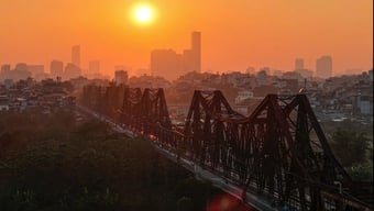
Hanoi is a city closely associated with rivers, among which the Red River is the largest. In the minds of Hanoians, it is not only the mother river that nourishes the people, but over time, the Red River has also shaped the cultural landscape, the rich history of the country, and the prosperity of the ancient Thang Long capital and present-day Hanoi.
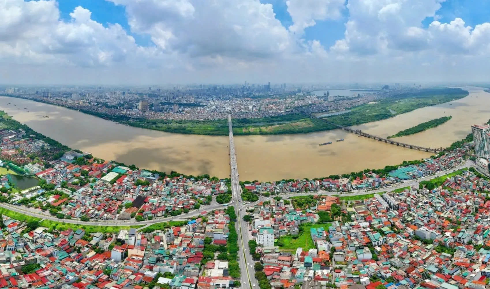
From its very beginnings, the history of Thang Long (Hanoi) has been closely linked to the Red River, a vital transportation and trade route. The Red River system provides irrigation water for agriculture in the Northern Delta and serves as an important transportation artery for goods. Furthermore, the Red River has witnessed countless glorious victories of the Vietnamese people throughout their thousand-year history of fighting foreign invaders.
According to Professor Nguyen Quang Ngoc, Vice President of the Vietnam Historical Science Association, despite undergoing many changes, the Red River has always been the center of all livelihood activities and cultural creations. From urban planning (" The Red River flows from the West to the East / Kim Nguu and To Lich are rivers on this side ") to the architecture of neighborhoods, markets, trading posts, the Ke Cho port, craft villages, trade streets, festivals, beliefs, customs, from folk games to court activities, and resistance against foreign invaders... all bear the imprint or embodiment of the Mother River - the Red River. This is the most distinctive and unique characteristic of Thang Long - Hanoi culture.
“Thang Long - Ke Cho is a thousand-year-old city, and its thousand-year vitality is mainly derived from the resources of the Red River. Although, formally, this city developed more towards one side of the river, it was truly a city that opened onto the river, using the Red River as its facade and the center of all interactions and economic, social, and cultural activities,” Professor Nguyen Quang Ngoc remarked.
According to Professor Dr. Le Hong Ly, President of the Vietnam Folk Arts Association, the Red River will be the main axis of Hanoi's development. This represents a fundamental change in both economic and cultural space. Over time, Hanoi has expanded in all four directions and today has reached a much larger scale; the Red River will now be the main axis of the city. This makes Hanoi similar to many major cities around the world such as Moscow (Russia), Paris (France), London (England), Seoul (South Korea)... with a large river as its main axis.
Professor Le Hong Ly further analyzed that, from a cultural planning perspective, along the Red River axis are cultural entities such as the system of relics along both banks of the river from the source within Hanoi's territory to the South, among which the relics dedicated to the Trung Sisters, Chu Dong Tu - Tien Dung, and other deities stand out. Accompanying these relics is a system of festivals of the villages that worship these deities. Along with these festivals is a system of customs, rituals, and performances of the village communities that have lived here for generations.
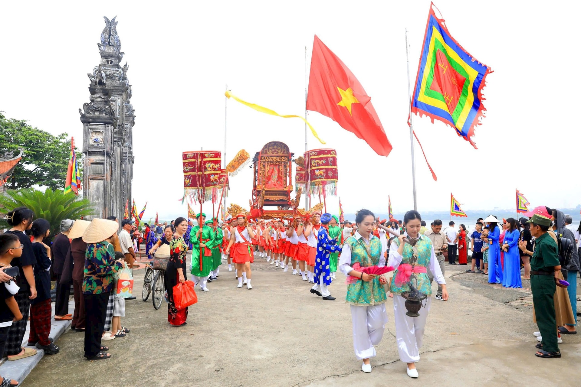
The Red River is an ancient river, and therefore the inhabitants living on both sides have long inherited cultural traditions from the ancient Red River civilization. Along with festivals, customs, and folk performances, there is a system of craft villages on both banks of the Red River. These are valuable legacies for planning cultural values to develop Hanoi's economy, including Co Do silk, Bat Trang pottery, and other craft villages. The entire tangible and intangible cultural heritage of the villages on both sides of the Red River will make a significant contribution to the Red River cultural axis in the future.
Unlocking the potential for breakthrough development.
Representatives from the Hanoi Department of Planning and Architecture stated that throughout its development, the effort to erase spatial barriers, utilize and maximize the potential of land on both banks of the Red River, and make the river a driving force for the development of the "Cultural - Civilized - Modern" capital city has always been emphasized and focused on in various programs, projects, cooperation initiatives, and related planning schemes.
Notable milestones include 1994, when a Singaporean investor chose to build a riverside urban area project on land outside the dike in the An Duong area. In 2000, Resolution No. 15-NQ/TW of the Politburo stated: "Early research on the rectification of the Red River and planning for the exploitation of both sides of the river." In 2011, Decision 1259/QD-TTg dated July 26, 2011, of the Prime Minister approved the General Planning for the Construction of the Capital City until 2030, with a vision to 2050, identifying the area on both sides of the Red River as the central landscape axis of the Capital City. In 2012, the Hanoi People's Committee issued Decision No. 4770/QD-UBND approving the planning task at a scale of 1/5000 for the Red River Urban Sub-area…
Notably, in 2021, the Standing Committee of the Hanoi City Party Committee agreed on major orientations for the Red River Subdivision Planning. In 2022, the Hanoi City People's Committee issued Decision No. 1045/QD-UBND dated March 25, 2022, approving the Red River Urban Subdivision Planning project, at a scale of 1/5000 (section from Hong Ha Bridge to Me So Bridge), with the perspective of sustainable urban development based on the harmony of three factors: economy, environment, and society; harmony between preservation and development, maximizing the potential, strengths, and traditional cultural values of the areas on both banks of the river, reflecting the identity of the thousand-year-old capital city. Accordingly, instead of "turning its back" on the river, the Red River Urban Subdivision Planning project has laid the foundation for the city's development in the direction of "looking at the river, leaning against the mountains"; Simultaneously, continuing the scientific and artistic values in the history of Vietnam's urban formation and development, Hanoi connects the human living environment with the natural landscape, making it a green, clean, "Cultural - Civilized - Modern" city.
According to Dr. Nguyen Quang Anh from the University of Social Sciences and Humanities, Vietnam National University, Hanoi, the Hanoi Capital City Planning for the period 2021-2030, with a vision to 2050, identifies the Red River axis as the main landscape axis, the economic, commercial, service, and cultural tourism axis, and the central axis located between the urban areas south and north of the Red River. Along both banks of the river, a heritage road will be built to recreate the thousand-year history of nation-building and defense; to recreate traditional cultural festivals from all over the country; and to connect with the West Lake area and the Old Quarter to form a space for developing nighttime economic activities...
“This strongly reaffirms the central position of the Red River as the main axis throughout history, developing the capital in a balanced, harmonious, rapid, strong, and sustainable manner, reaching far and wide to both banks of the Red River. Thus, the thousand-year-old model of a city "facing the river and leaning against the mountains" by Ly Thai To has been correct and will certainly remain correct for decades, even centuries to come. The goal of developing Hanoi into a cultured, civilized, and modern capital, a driving force for the development of the Red River Delta region, the key economic zone of Northern Vietnam, and the entire country; a globally connected city on par with the capitals of developed countries in the region, will certainly become a complete and vibrant reality,” commented Dr. Nguyen Quang Anh.
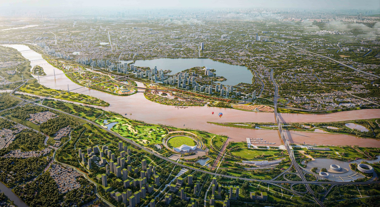
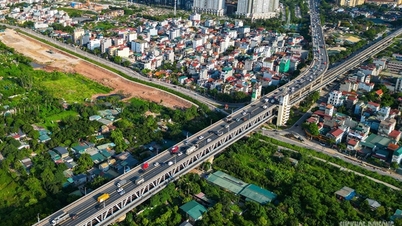
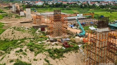
In particular, the Red River Landscape Boulevard Construction Project – a project of special importance and strategic significance for the long-term development of the capital city – has recently commenced with a preliminary total investment of approximately 855,000 billion VND, implemented under the public-private partnership (PPP) model. The project covers an area of approximately 11,000 hectares, extending from Hong Ha Bridge to Me So Bridge, within the administrative boundaries of 19 communes and wards of Hanoi. Upon completion, the Red River Landscape Boulevard will not only be a transportation infrastructure project but will also create a modern cultural, ecological, and landscape space; ensure flood control and safety; contribute to urban reconstruction, improve the quality of life for the people, create momentum for socio-economic development, and make a significant contribution to the double-digit growth target for the 2026-2030 period.
Furthermore, the proposed Master Plan for the Capital City with a 100-year vision, reflecting a strategic and groundbreaking vision, also identifies the Red River axis as the backbone of development for urban expansion to the North and East. The Red River Landscape Boulevard will become a heritage axis connecting creative cultural spaces, museums, and themed parks, creating a unique identity for Hanoi. According to Dr. Nguyen Viet Chuc, Director of the Thang Long Cultural Research Institute, the creation of the Red River space cannot be viewed from a single perspective or only at a specific point in time, because it is a long-term strategy of great scale. “Projects like bridges across the Red River or the Riverside Landscape Boulevard are not simply transportation projects. They are also stories about culture, economics, ethics, and the revival of an entire river intertwined with the nation's history. These values intertwine and complement each other, creating a driving force for sustainable development. Here, it's not just about clearing the river, but about unlocking the endless source of history that is rising up,” emphasized Dr. Nguyen Viet Chuc.
Source: https://hanoimoi.vn/ha-noi-trong-dong-chay-van-hoa-song-hong-734221.html
![[Image] Pleasant weather helps students enter the 10th grade entrance exam with confidence.](https://vphoto.vietnam.vn/thumb/1200x675/vietnam/resource/IMAGE/2026/05/29/1780034401612_ngay-1-thi-lop-10-minh-duy-8-5009-jpg.webp)
![[Photo] Ba Lang An Lighthouse - the "eye of the sea" amidst the "rock museum" of Quang Ngai province.](https://vphoto.vietnam.vn/thumb/1200x675/vietnam/resource/IMAGE/2026/05/29/1780038698840_anh-man-hinh-2026-05-29-luc-14-10-42.png)



![[Infographic] Key points in the Hanoi Master Plan with a 100-year vision](https://vphoto.vietnam.vn/thumb/402x226/vietnam/resource/IMAGE/2026/05/26/1779750297385_quyhoach100nam-97685526052946271833906-43228536014852394887250.webp)
















































Comment (0)