
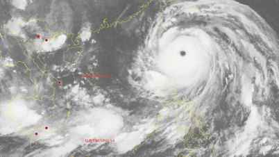
Forecast of location and direction of tropical depression at 1am September 17 - Photo: VNDMS
According to the National Center for Hydro-Meteorological Forecasting at 1:00 a.m. this morning, the center of the tropical depression was located in the sea east of Luzon Island (Philippines).
The strongest wind near the center of the tropical depression is level 7 (50-61km/h), gusting to level 9.
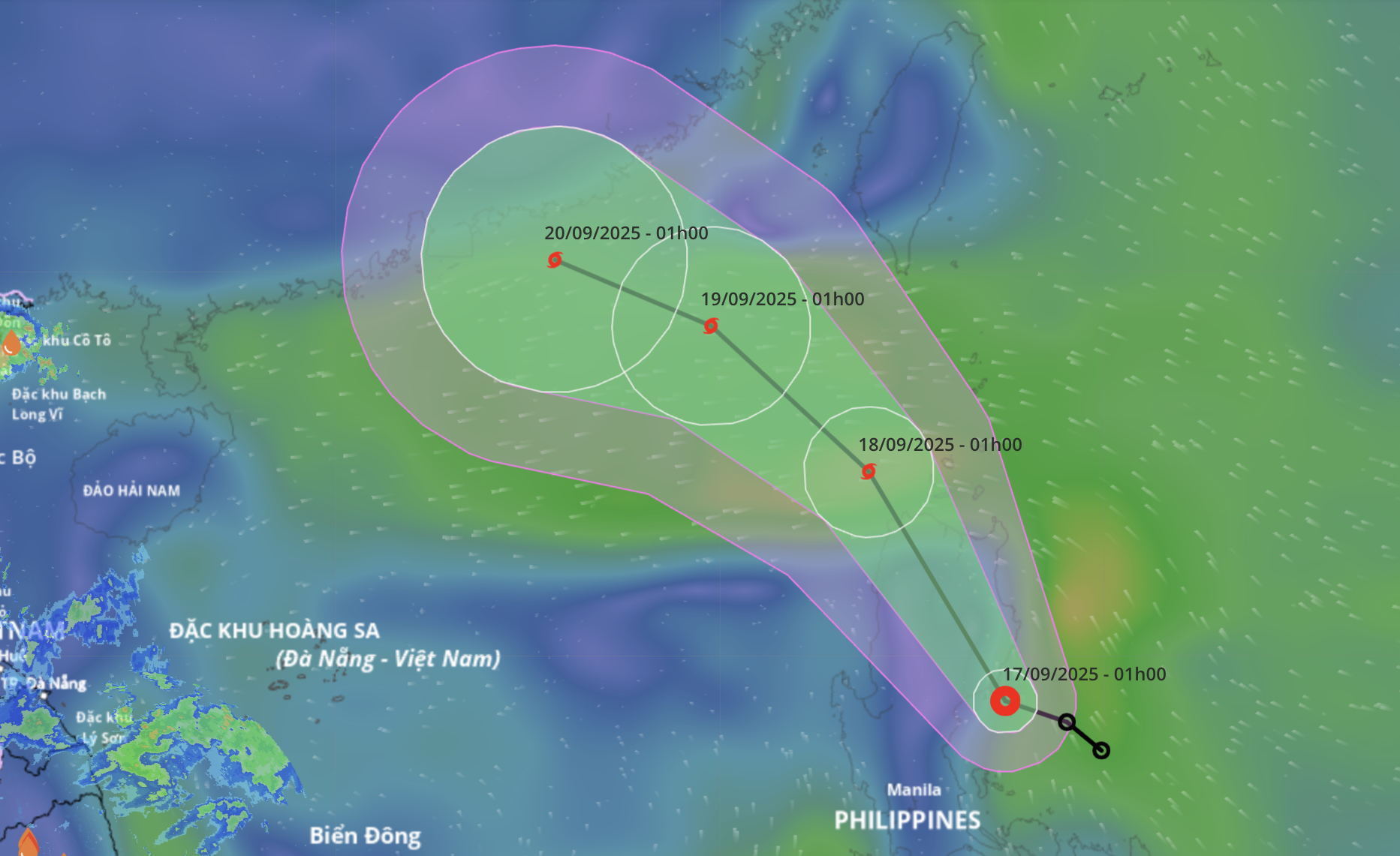
It is forecasted that in the next 24 hours, the tropical depression will move northwest at a speed of about 15km/h and is likely to strengthen into a storm.
By 1am tomorrow morning, the storm center will be in the sea north of Luzon Island, with storm intensity at level 8, gusting to level 10.
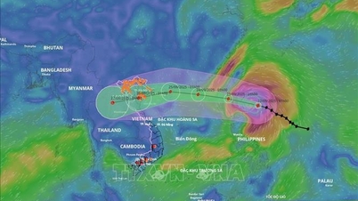
In the next 24 to 48 hours, the storm will move west-northwest at a speed of 15-20km/h and is likely to enter the East Sea. If it enters the East Sea, it will be the 8th storm this year.
At 1:00 a.m. on September 19, the storm center was in the northeastern sea area of the northern East Sea, with storm intensity of level 8-9, gusting to level 10.
From the next 48 to 72 hours, the storm will move mainly in the west-northwest direction, traveling 10-15km per hour, with little change in intensity.
Due to the influence of a tropical depression, possibly later a storm, from tonight, in the northeastern sea area of the northern East Sea, winds will gradually increase to level 6-7, gusting to level 9, near the storm center, winds will increase to level 8, gusting to level 10, waves 2.5-4.5m high.
Vessels operating in the above mentioned dangerous areas are susceptible to the impact of storms, whirlwinds, strong winds and large waves.
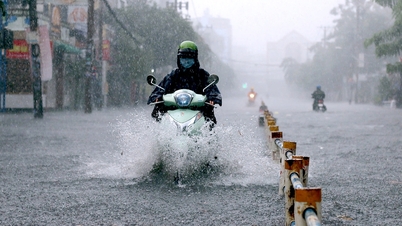
This afternoon and tonight, from Hue to the South, there will be heavy rain in some places.
Last night and early this morning (September 17), in the area from Hue to Khanh Hoa, there were scattered showers and thunderstorms, with some places experiencing heavy rain such as Quang Dien (Hue City) 68mm, Ia Kenh station (Gia Lai) 88mm, Song Hinh station ( Dak Lak ) 51mm,...
It is forecasted that in the afternoon and night of September 17, the area from Hue to Lam Dong and the South will have scattered showers and thunderstorms with rainfall of 15-30mm, with some places having heavy rain of over 80mm.
Thunderstorms may produce tornadoes, lightning, hail, and strong gusts of wind. Localized heavy rain may cause flash floods in small rivers and streams, landslides on steep slopes, and inundation in low-lying areas.
Tuoitre.vn
Source: https://tuoitre.vn/hom-nay-ap-thap-nhiet-doi-gan-bien-dong-kha-nang-manh-len-thanh-bao-20250917062029989.htm

![[Photo] General Secretary To Lam attends the 50th anniversary of the founding of the Vietnam National Industry and Energy Group](https://vphoto.vietnam.vn/thumb/1200x675/vietnam/resource/IMAGE/2025/9/21/bb0920727d8f437887016d196b350dbf)


![[Photo] General Secretary To Lam presents the First Class Labor Medal to the Vietnam National Energy and Industry Group](https://vphoto.vietnam.vn/thumb/1200x675/vietnam/resource/IMAGE/2025/9/21/0ad2d50e1c274a55a3736500c5f262e5)


Comment (0)