

In a statement posted on social media this morning (May 21), the Persian Gulf Straits Administration (PGSA) said: “Iran has defined its surveillance area in the Strait of Hormuz as follows: To the east, the line connecting the Kuh Mabarak area of Iran to the southern part of Fujairah city of the United Arab Emirates (UAE), the boundary line connecting the end of Qeshm Island of Iran to the Umm al-Qaiwain area of the UAE.”
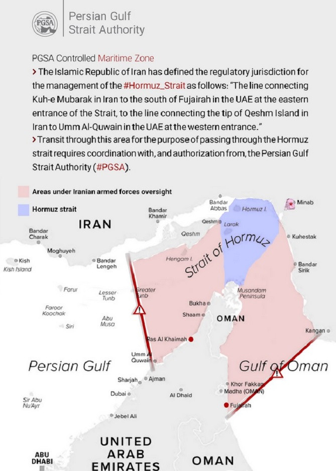
PGSA subsequently emphasized that vessels wishing to pass through areas under Iranian surveillance in the Strait of Hormuz must coordinate with and obtain permission from the agency.
According to the map published by PGSA, the red-colored areas in the Persian Gulf and Gulf of Oman, west and east of the Strait of Hormuz respectively, are under Tehran's surveillance. To date, the UAE and Oman have not commented on the map.
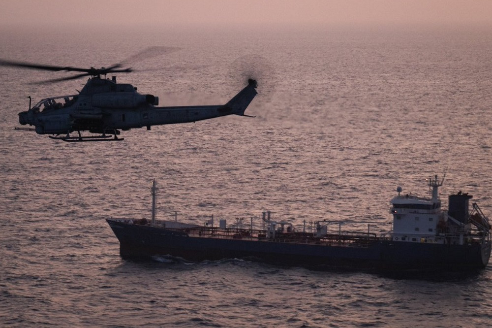
Iran's move comes amid heightened tensions in the strategic strait in recent months following the US launch of Operation "Flame" against Tehran. The situation worsened after Washington imposed a naval blockade on Iranian ports near the Strait of Hormuz last month.
Source: https://vietnamnet.vn/iran-cong-bo-ban-do-vung-tehran-giam-sat-o-eo-bien-hormuz-2517800.html
![[Image] Hanoi's urban life under the challenge of a "scorching hot" environment](https://vphoto.vietnam.vn/thumb/1200x675/vietnam/resource/IMAGE/2026/05/25/1779706979265_nang-nong-t5-2026-minh-duy-7-4636-jpg.webp)

![[Image] Close-up view of the interchange connecting the two expressways and Long Thanh Airport.](https://vphoto.vietnam.vn/thumb/1200x675/vietnam/resource/IMAGE/2026/05/25/1779703378210_ndo_br_z7863716673926-224453a31600126cce10622af6290afd-4549-jpg.webp)



























































































Comment (0)