
The Vietnam School of Earth Observation (VSEO) is jointly organized annually by the Rencontres du Vietnam, ICISE Center; Paris Institute of Geophysics (IPGP), Paris Cité University, France; University of Science and Technology of Hanoi (USTH), within the framework of the Rencontres du Vietnam, with the aim of contributing to training the community of young scientists in Vietnam in this field.
In 2024, VSEO4 is honored to welcome prestigious scientists in the field to participate in teaching, including: Dr. Ho Tong Minh Dinh, French National Institute for Agriculture , Food and Environment, France; Professor Stéphane Jacquemoud, Paris Institute of Geophysics (IPGP), Paris Cité University, France; Professor Le Trung Chon, Ho Chi Minh City University of Natural Resources and Environment; Dr. Antoine Lucas, Paris Institute of Geophysics (IPGP), Paris Cité University, France; Mr. Jean-Philippe Malet, School and Earth Science Observatory (EOST)-Institute of Geophysics Strasbourg (IPGS), France...
 |
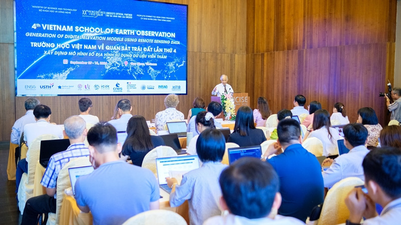
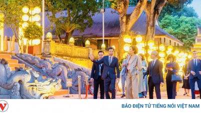
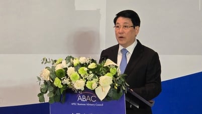
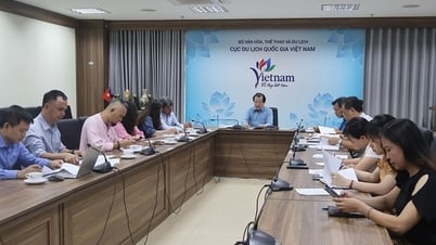
Professor Tran Thanh Van, Director of ICISE Center, spoke at the opening ceremony. |
Speaking at the opening ceremony, Professor Tran Thanh Van, President of the Vietnam Rencontres du Sciences Association and Director of the ICISE Center, said that observing and analyzing data about the Earth is playing an increasingly important role in modern life. From natural disaster forecasting, natural resource management to urban planning, data from satellite images and UAV images have brought us important information.
Through VSEO4 School this year, students will not only improve their professional knowledge but also have the opportunity to practice practical skills through practical lessons. I believe that the knowledge and skills that students acquire from this school will become a solid foundation, helping them to contribute positively to the sustainable development of the country.
 |
The ceremony was attended by many professors, doctors, and leading scientific researchers in the world. |
In recent decades, the use of satellite remote sensing data for Earth observation has become indispensable for many applications and research programs in Vietnam. Currently, a large amount of remote sensing data on the Earth's land surface, ocean and atmosphere, including Vietnam and the Southeast Asian region, is being collected and analyzed.
VSEO4 provides fundamental and in-depth knowledge on collecting, processing and analyzing satellite and drone imagery to build and exploit digital elevation models (DEM). Using remote sensing data to create digital elevation models provides highly accurate results, with the ability to be applied in many fields, from urban planning, water resources management, disaster risk assessment to climate change response.
 |
Delegates take souvenir photos at ICISE Center. |
Digital elevation models are important and essential terrain data for many scientific fields, including geomorphology (coastal surveys, soil science), vegetation studies (agriculture, forestry), defense, hydrology, natural disasters such as floods, landslides, as well as urban areas, and archaeology…
Currently, there are three popular remote sensing techniques for building digital elevation models, including: Image correlation, Topographic LiDAR and InSAR (Interferometric synthetic-aperture radar).
Source: https://nhandan.vn/khai-mac-truong-hoc-viet-nam-ve-quan-sat-trai-dat-lan-thu-4-post829505.html


Comment (0)