See images from above - where the Vinh - Thanh Thuy expressway is expected to pass through
Recently, information about the Vinh - Thanh Thuy expressway project (part of the Hanoi - Vientiane expressway) is about to be implemented, which has attracted great attention from the people. Let's join Nghe An Newspaper reporters to see the images from above - where this route is expected to pass through.
Báo Nghệ An•24/05/2025
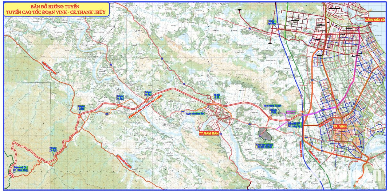
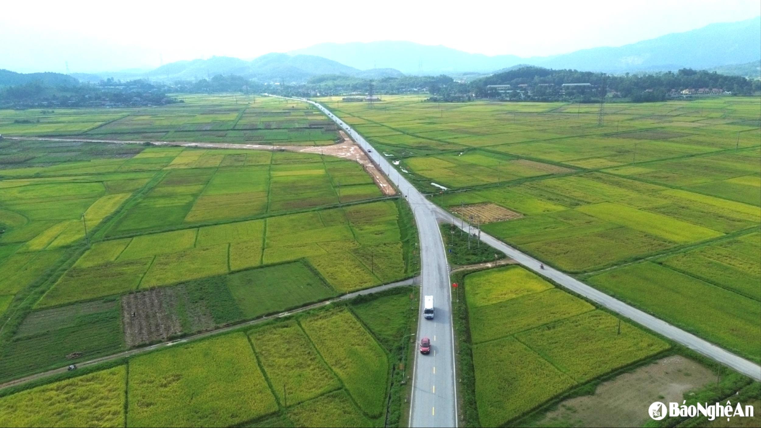
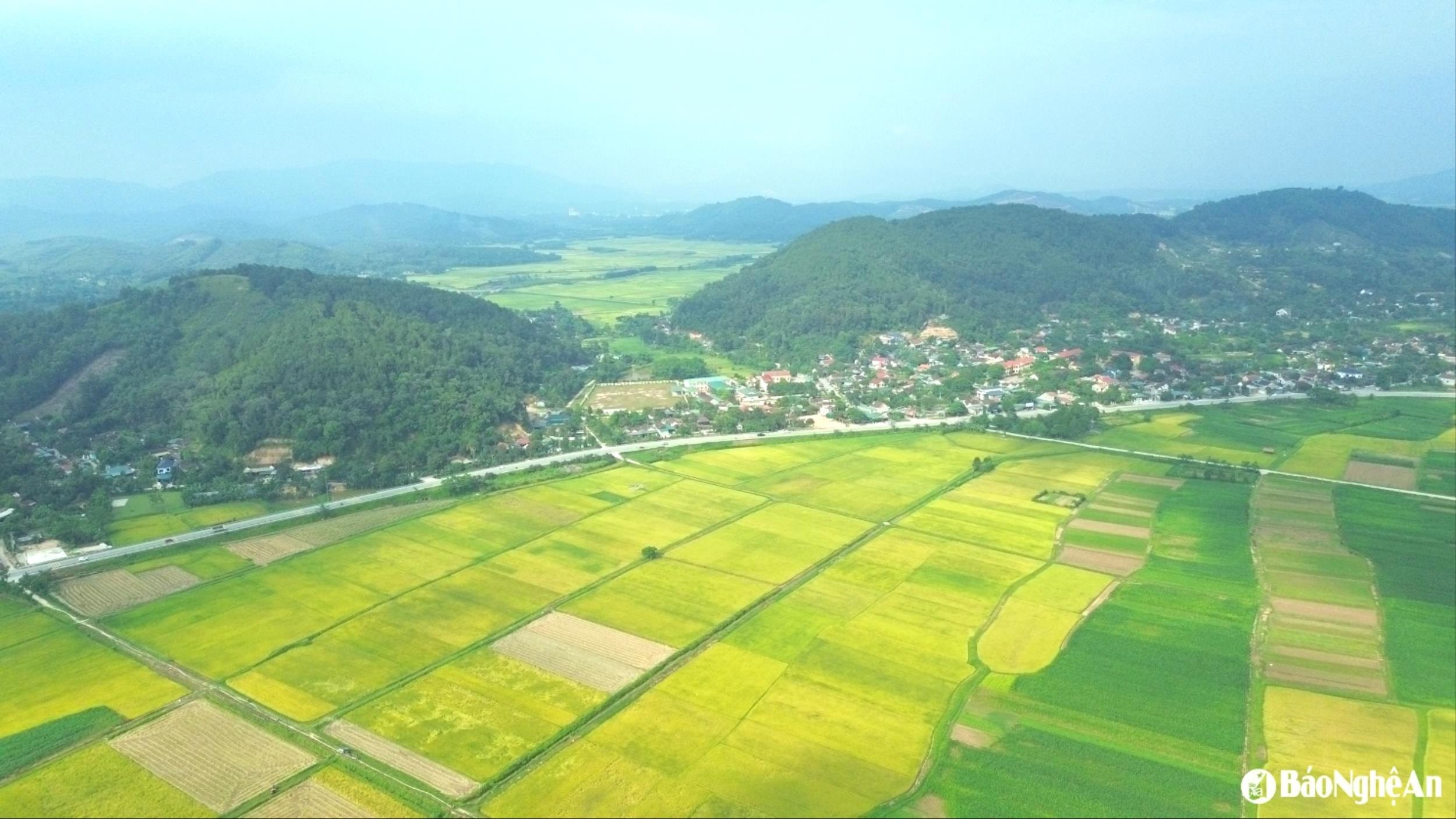
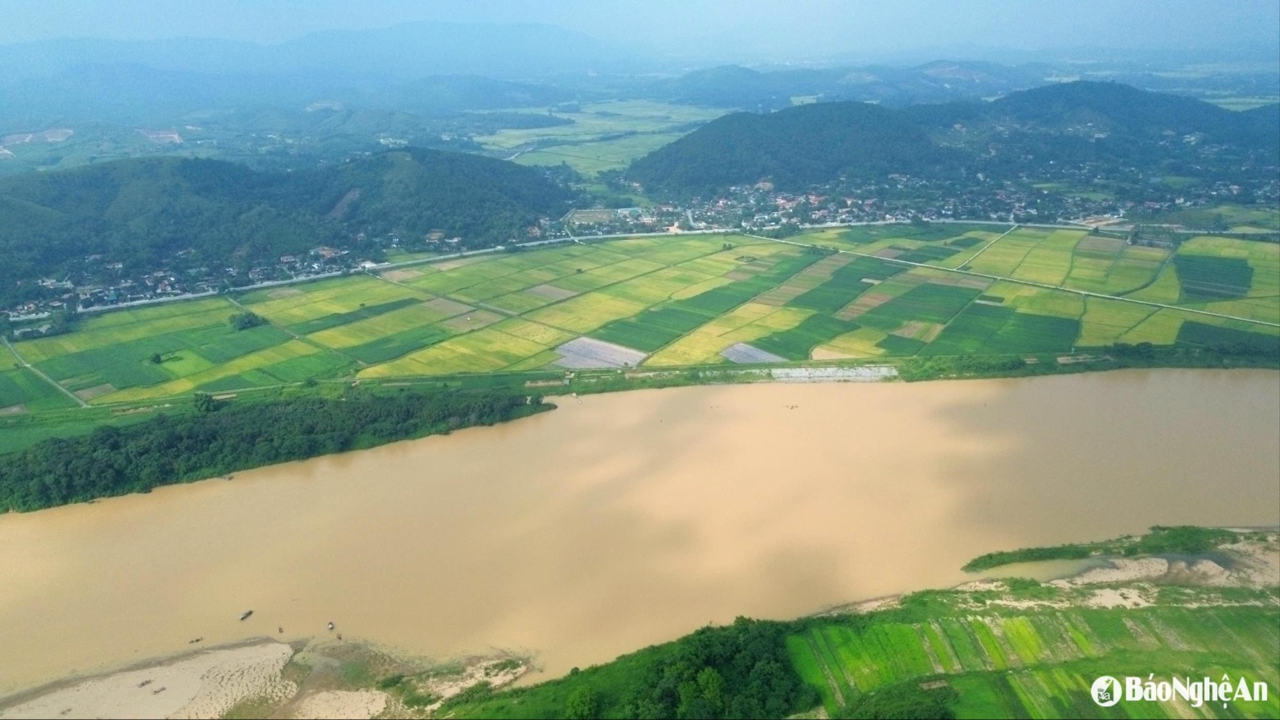
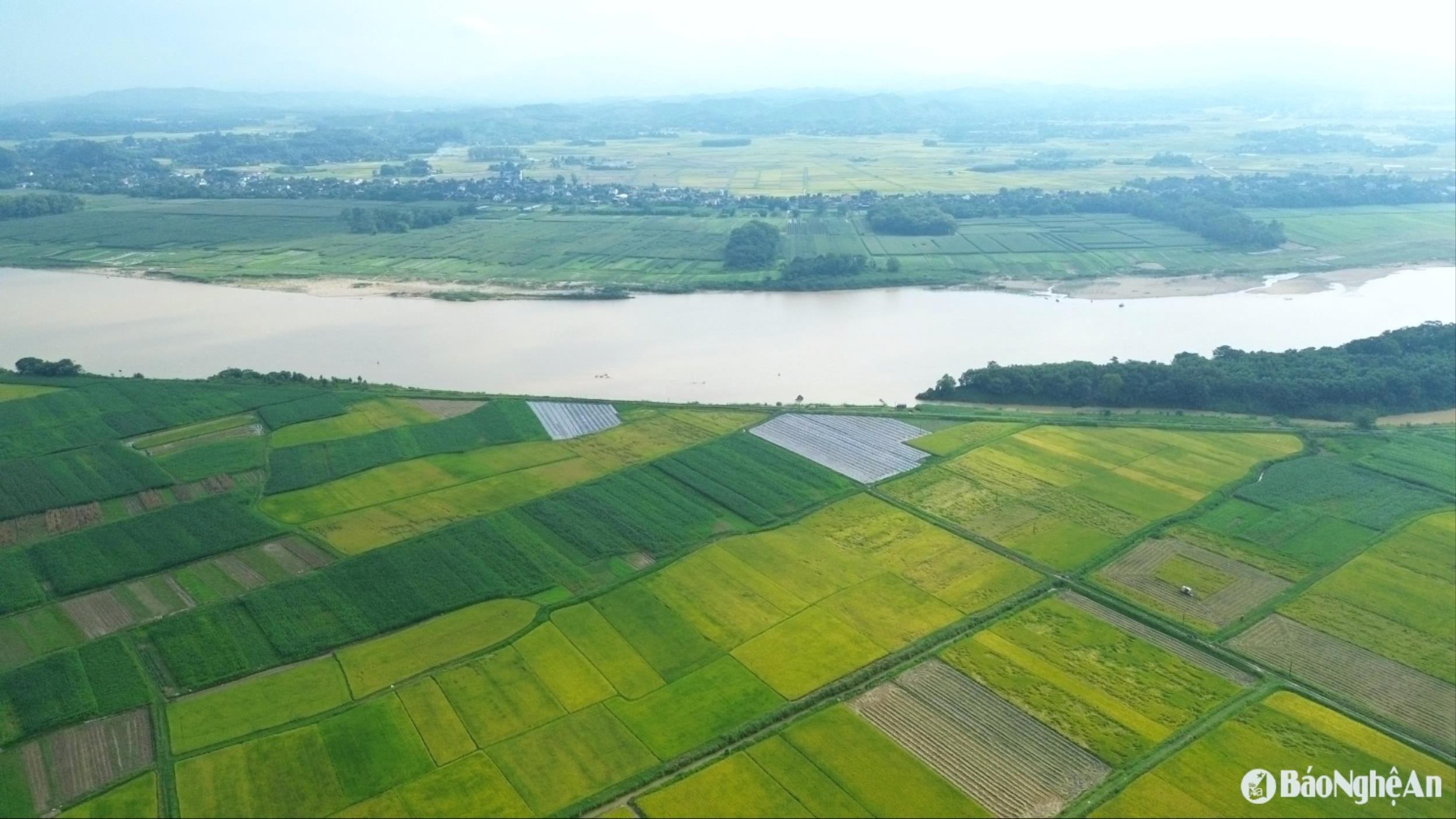
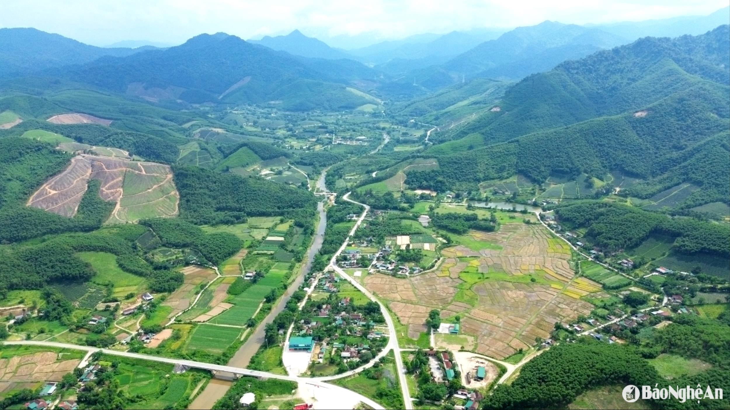
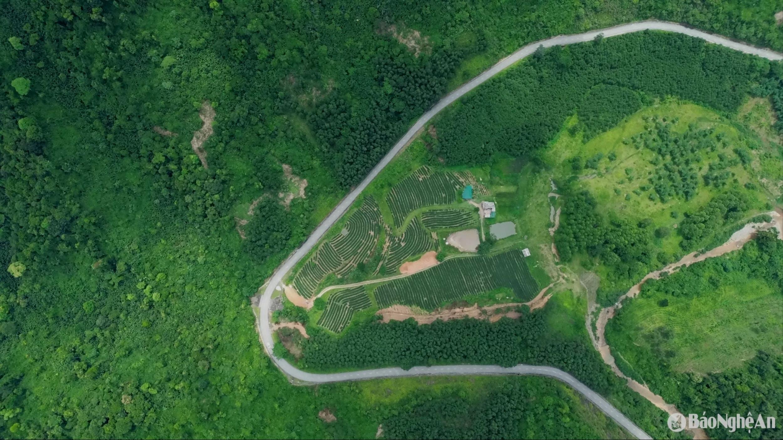
The Vinh – Thanh Thuy Expressway is a key project to connect Vinh City with Thanh Thuy Border Gate (Vietnam – Laos border). With a length of about 65 km, the route starts from Hung Tay intersection (Hung Nguyen district, Nghe An ) and ends at Thanh Thuy – Nam On Border Gate area. Photo: CQCNCC Hung Tay Interchange on the North-South Expressway, expected to be the starting point of the Vinh-Thanh Thuy Expressway. Photo: Tien Dong It is expected that there will be 6 intersections on this highway, facilitating people's movement, optimizing the transportation of goods and connecting with famous tourist destinations such as Kim Lien National Special Relic Site, Truong Bon National Historical Relic Site, Thanh Chuong Tea Island Tourist Area... In the photo is the area where the intersection between the highway and National Highway 15 is expected to be located, including a section running parallel to the Nam Dan town bypass. Photo: Tien Dong The area where the intersection with National Highway 46 is planned to be located in Xuan Duong Commune (Thanh Chuong), the expressway will run between the waist of the two mountain ranges in the photo. Photo: Tien Dong The expressway is expected to cross the Lam River between Xuan Duong and Kim Bang communes (former Thanh Long commune) of Thanh Chuong district. Photo: Tien Dong The Lam River Overpass is the largest bridge on this highway and will also be a highlight creating a landscape for both banks, where there are vast fields. Photo: Tien Dong After crossing the Lam River, this expressway continues to intersect with National Highway 46 at the Kim Bang commune intersection (formerly Vo Liet commune). Photo: Tien Dong Thanh Thuy junction area, where Highway 46 intersects with the current Ho Chi Minh Road. This highway will also have an intersection with Ho Chi Minh Road to help connect and develop the forestry economy in the area. Photo: Tien Dong Thanh Thuy commune area, considered a new economic zone of Thanh Chuong district, has a large area of natural forest. Photo: Tien Dong Currently, the movement to Thanh Thuy Border Gate depends on the only route, Highway 46. Once the highway is built, it will play a key role in connecting Vietnam with Laos, shortening the time for transporting goods and passengers between the two countries. In the photo is the current status of Highway 46 passing through the people's tea hills. Photo: Tien Dong The closer to the border gate, the more winding Highway 46 is with many steep passes. Photo: Tien Dong QL46 appears and disappears amidst the mountains and forests, creating a majestic landscape. It is known that if this highway is built, in addition to a large area of residential land, production forest land, rice land... that must be reclaimed and converted for other purposes, there will also be 98.48 hectares of upstream protective forest that must also be converted for other purposes. Photo: Tien Dong
.jpg)
.jpg)
.jpg)
.jpg)
.jpg)
 Báo Nghệ An•24/05/2025


Comment (0)