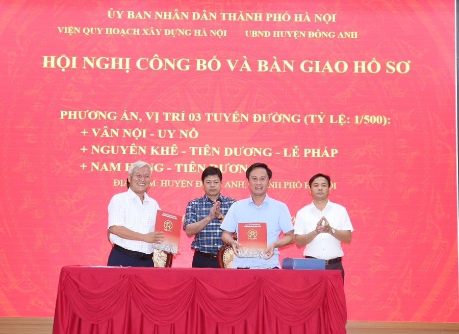
Accordingly, the following decisions were signed by the Vice Chairman of the Hanoi People's Committee, Duong Duc Tuan: Decision No. 3313/QD-UBND approving the plan and location of the Van Noi - Uy No road, at a scale of 1/500. The section from the planned road B = 30m east of the Nhat Tan - Noi Bai axis to the planned road LK48, belonging to the Van Noi - Uy No road;
Decision No. 3338/QD-UBND approves the plan and location of the Nam Hong – Tien Duong road, at a scale of 1/500, for two sections of the Nam Hong – Tien Duong road; Decision No. 3416/QD-UBND approves the plan and location of the Nguyen Khe – Tien Duong – Le Phap road, at a scale of 1/500. These road plans were prepared by the Hanoi Institute of Construction Planning and appraised by the Hanoi Department of Planning and Architecture.

Specifically, for the Van Noi – Uy No route, the starting point intersects with the planned road (B = 30m) east of the Nhat Tan – Noi Bai axis, and the ending point intersects with the planned road LK48 (B = 40m), with a length of approximately 1.2km. It runs east-west, in accordance with the approved General Planning for the Construction of the Capital City, the Capital City Transportation Planning, and the N7 urban sub-area planning. The typical cross-section (B = 40m) includes the following components: 2 x 11.25m carriageways (6 lanes), a 3m central median, and 2 x 7.25m sidewalks.
For the Nam Hong – Tien Duong route, section 1 runs from Vo Van Kiet road to the planned B = 30m road west of the Nhat Tan – Noi Bai axis, approximately 4.5km long; section 2 runs from the planned B = 30m road east of the land use rights auction area north of Road 23B in Tien Duong commune to the Van Noi – Uy No road, approximately 1.6km long. The route alignment is consistent with the approved General Planning for the Construction of the Capital City, the Capital City Transportation Planning, and the approved N3, N7, and GN urban sub-area planning.
The typical cross-section width is B = 30m, including the following components: a 15m carriageway (4 lanes) and two 7.5m sidewalks. Local widening of the road cross-section is implemented in specific sections as follows: The section connecting to the intersection with Vo Van Kiet Street has a local widening cross-section width of B = 42m. The section intersecting with the existing North Hong – Ha Dong national railway line has a local widening cross-section width of B = 40m. The sections with local widening where the road boundary coincides with the fences of land plots on both sides of the road include: Dong Anh Forest Management Unit, Hanoi Irrigation Development Investment Company, Dong Anh District People's Court, Dong Anh District People's Procuracy, Dong Anh District Medical Center, etc.
For the Nguyen Khe – Tien Duong – Phap Le route: Section 1, starting from the inter-regional road B = 40m north of urban sub-area N5 to the Nguyen Khe small and medium-sized industrial cluster, approximately 0.75km long; Section 2, starting from the Nguyen Khe small and medium-sized industrial cluster to the North Red River Ring Road 3, approximately 0.77km long; Section 3, starting from the intersection with the Van Noi – Uy No route to the North Dam Van Tri – Co Loa – Cau Duong route, approximately 1.38km long.
The North-South alignment is consistent with the approved General Planning for the Construction of the Capital City, the Capital City Transportation Planning, and the N5 and N7 urban sub-area planning. The typical road cross-section width is B = 40m, including the following components: 2 x 11.25m carriageways (6 lanes), a 3m median strip, and 2 x 7.25m sidewalks. At the section intersecting with the Hanoi- Lao Cai national railway and the North Red River Ring Road 3, a flyover bridge with 4-6 lanes will be constructed, with a cross-sectional width of B = 32m for the bridge construction land.
The Hanoi People's Committee also assigned specific tasks to: the Hanoi Department of Planning and Architecture to inspect and verify the drawings of the plan and location of the road according to the approval decision of the Hanoi People's Committee; the Hanoi Institute of Construction Planning to preside over and coordinate with the Dong Anh District People's Committee and relevant agencies to publicly announce the approved plan and location of the road so that relevant organizations and individuals are aware and can implement it. The approved plan and location of the road will be handed over to the Dong Anh District People's Committee to serve the planning management work and to organize the preparation and submission of the design documents for boundary marking; the Dong Anh District People's Committee and the People's Committees of Nam Hong, Van Noi, and Tien Duong communes will strictly manage land and construction order on both sides of the road according to the approved plan and location.
Source: https://kinhtedothi.vn/sap-khoi-cong-nhieu-tuyen-duong-giao-thong-quan-trong-tai-huyen-dong-anh.html


![[Photo] Prime Minister Pham Minh Chinh presides over a meeting on private sector economic development.](/_next/image?url=https%3A%2F%2Fvphoto.vietnam.vn%2Fthumb%2F1200x675%2Fvietnam%2Fresource%2FIMAGE%2F2025%2F12%2F20%2F1766237501876_thiet-ke-chua-co-ten-40-png.webp&w=3840&q=75)


Comment (0)