

 |
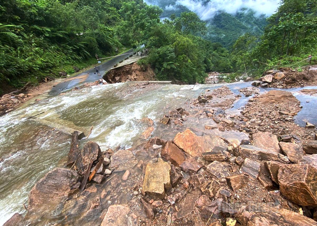
| Landslide points at km18+ km19 and km 24+ km25 in Lo Thang 1 village, Lung Tam commune... |
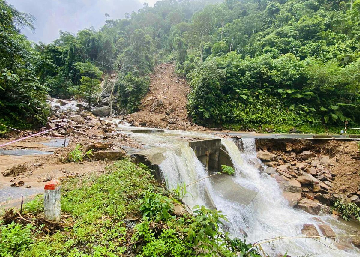 |
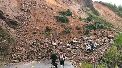
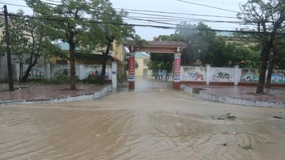
Recorded on August 22, in Lung Tam commune, there were many large and small landslides. Of which, there were 2 large landslides at km18 + km19 and km24 + km25 in Lo Thang 1 village in the direction of Thuan Hoa commune, the estimated length of the landslide was more than 20m, with a large amount of soil, rocks, trees and rainwater overflowing the road surface. Information from Lung Tam Commune Police said: “By 2:00 p.m. the same day, at 2 landslide points on the positive slope, rainwater and rocks were still flowing from above, of which 1 point could be crossed on foot, 1 point temporarily causing local traffic congestion. In addition, the negative slope at the landslide points was also washed away by rainwater, leading to cleft palates. Also on this route in Thuan Hoa Commune, a large, very dangerous landslide on the positive slope appeared, currently causing local traffic congestion. Fortunately, the landslide did not cause any damage to people or property.”
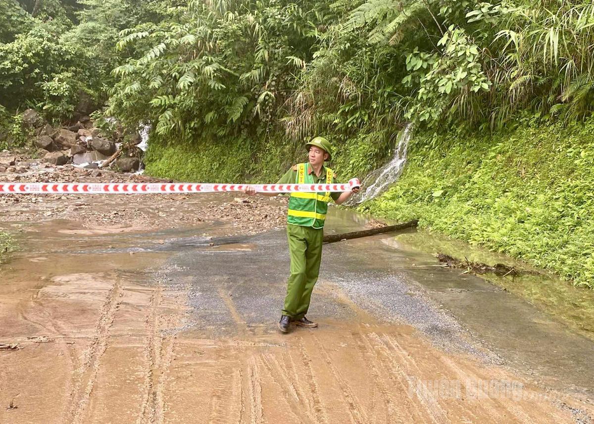 |
| Lung Tam Commune Police force stretched ropes and put up danger warning signs. |
Immediately after the landslide, the Lung Tam commune authorities promptly grasped the situation and proactively implemented the 4 on-site motto. They directed the commune police force to coordinate with functional forces to regulate traffic, put up warning signs, ensure traffic safety, control people and vehicles through spillways, fast-flowing water, areas where landslides have occurred or are at risk of flooding, flash floods, landslides, and resolutely not allow people and vehicles to circulate when safety is not guaranteed.
Currently, in the highland communes of Dong Van Stone Plateau of Tuyen Quang province, heavy rain occurs at various times of the day, many vulnerable areas are at high risk of landslides and slippery road surfaces. Vehicles traveling in rainy weather conditions in this area are advised to pay attention and comply with the regulations of the authorities.
News and photos: Hoang Chinh - Le Lam
Source: https://baotuyenquang.com.vn/xa-hoi/202508/sat-lo-tren-tuyen-duong-phia-dong-bac-tu-thuan-hoa-di-xa-lung-tam-23138f0/


![[Photo] General Secretary To Lam attends the 80th anniversary of Vietnam's diplomacy](https://vphoto.vietnam.vn/thumb/1200x675/vietnam/resource/IMAGE/2025/8/25/3dc715efdbf74937b6fe8072bac5cb30)


Comment (0)