
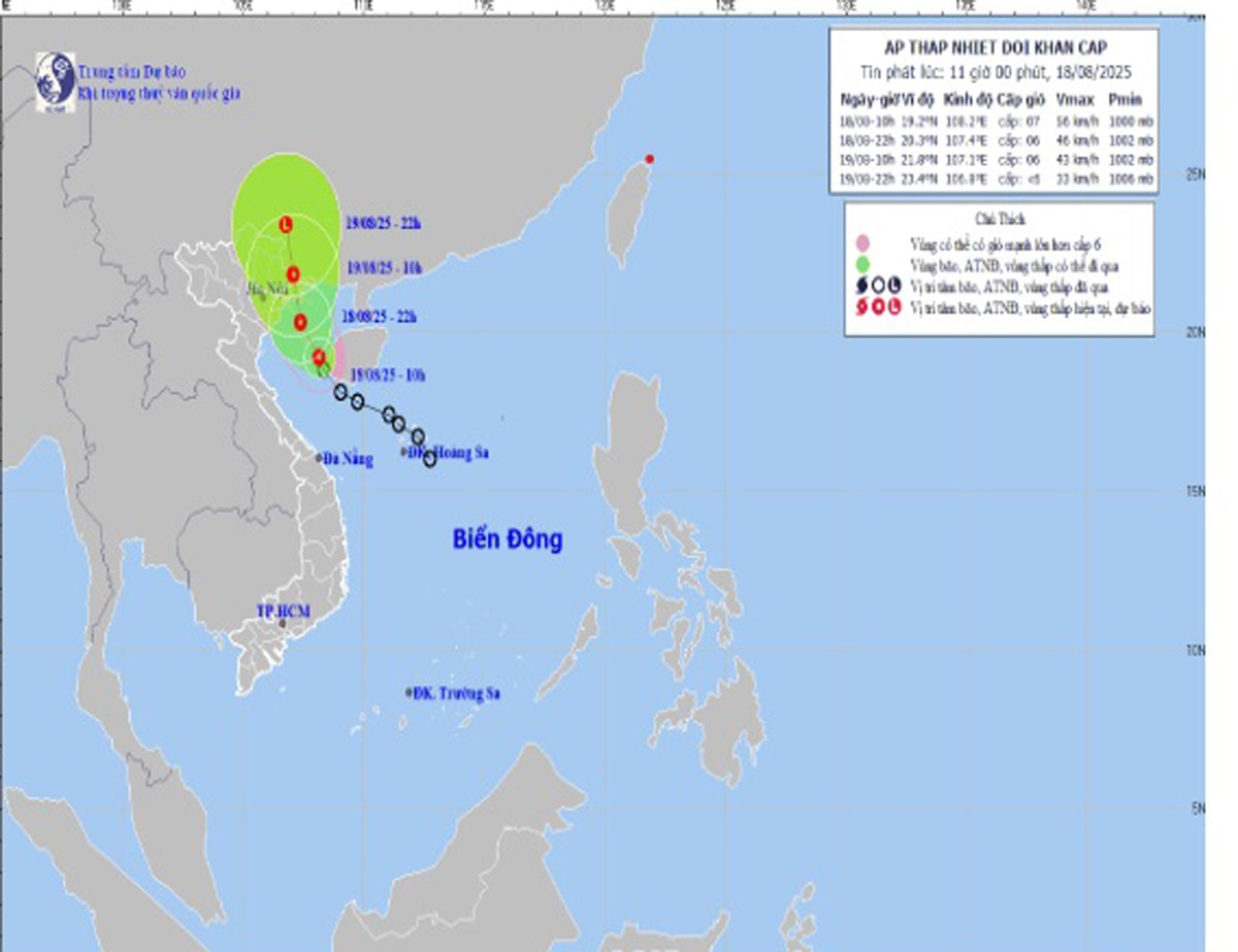
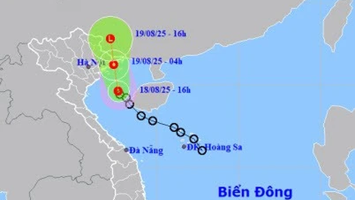
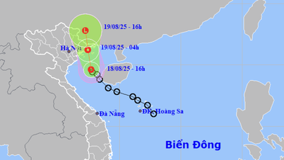
According to the city's Hydrometeorological Station, at 10:00 a.m. today, August 18, the center of the tropical depression was at about 19.2 degrees North latitude; 108.2 degrees East longitude, about 115 km South Southeast of Bach Long Vi.
The strongest wind near the center reaches level 6 - 7 (39 - 61 km/h), gusting to level 9, moving in the North Northwest direction at a speed of about 15 km/h.
It is forecasted that in the next 24-36 hours, the tropical depression will continue to move in a north-northwest direction, directly affecting the Northern region and will gradually weaken into a low pressure area when entering mainland China.
In Hai Phong , from the afternoon of August 18, coastal localities such as Do Son, Cat Hai, Duong Kinh, Tien Lang are forecast to have strong winds of level 6, gusting to level 8. Communes and wards located deep inland will have winds of level 3-4, gusting to level 5-6.
At sea, Bach Long Vi area and Bac Bo Gulf have strong winds of level 6-7, gusts of level 9, waves 2-3.5m high, rough seas.
In addition to strong winds, heavy rain is also a notable risk. From noon on August 18 to the night of August 19, the entire city will have moderate to heavy rain, with some places experiencing very heavy rain and thunderstorms.
Rainfall is expected to average 100-200 mm in coastal areas and 40-120 mm inland depending on the location. Heavy rains may cause localized flooding in low-lying streets and residential areas, and pose a risk of landslides in mountainous areas.
The city's Hydrometeorological Station warns of natural disaster risks due to storms at level 3 and heavy rains at level 1. People need to limit going out to sea, reinforce their houses, guard against strong gusts of wind, and proactively take measures to prevent flooding, ensuring safety for people and property.
PVSource: https://baohaiphong.vn/tin-ap-thap-nhiet-doi-khan-cap-hai-phong-co-gio-manh-mua-lon-518431.html


![[Photo] Prime Minister Pham Minh Chinh attends the opening ceremony of the National Data Center](https://vphoto.vietnam.vn/thumb/1200x675/vietnam/resource/IMAGE/2025/8/18/b5724a9c982b429790fdbd2438a0db44)


Comment (0)