
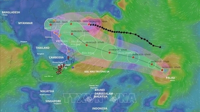
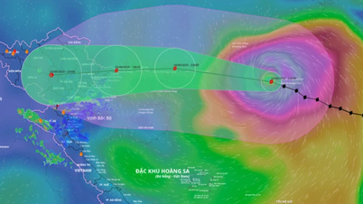
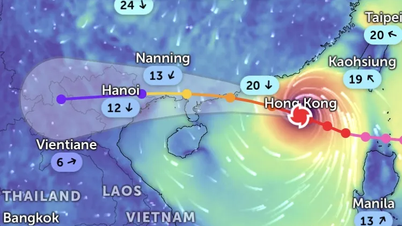
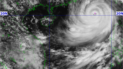
According to Associate Professor, Doctor, Director of the National Center for Hydro-Meteorological Forecasting Mai Van Khiem, currently, forecasts on the development of storm No. 10 are still very scattered. Forecasts from Europe and Japan predict that storm No. 10 will move north, towards the North or the South of China; however, forecasts from the US predict that the storm will move into the Central region (focusing on the provinces from Ha Tinh to Quang Ngai).
According to the assessment of the Vietnam Hydrometeorological Agency: The possibility of the storm moving into the Central region is the scenario with the highest probability because at this stage, according to the climate law, the storm will move into the Central region, the possibility of strengthening to the level of a super typhoon or a strong storm above level 13 is not high. The Hydrometeorological Agency is continuing to monitor and around September 25 will issue a storm warning near the East Sea.
Source: https://baotintuc.vn/van-de-quan-tam/xuat-hien-ap-thap-nhiet-doi-ophia-dong-cua-philippinesco-kha-nang-manh-len-thanh-bao-20250923150636777.htm
![[Photo] Prime Minister Pham Minh Chinh chairs the 14th meeting of the Steering Committee on IUU](https://vphoto.vietnam.vn/thumb/1200x675/vietnam/resource/IMAGE/2025/9/23/a5244e94b6dd49b3b52bbb92201c6986)


![[Photo] Editor-in-Chief of Nhan Dan Newspaper Le Quoc Minh received the working delegation of Pasaxon Newspaper](https://vphoto.vietnam.vn/thumb/1200x675/vietnam/resource/IMAGE/2025/9/23/da79369d8d2849318c3fe8e792f4ce16)


![[Photo] Solemn opening of the 1st Congress of Party Delegates of Central Party Agencies](https://vphoto.vietnam.vn/thumb/402x226/vietnam/resource/IMAGE/2025/9/24/82a89e250d4d43cbb6fcb312f21c5dd4)


Comment (0)