
The Long Xuyen Quadrangle (LGQ) in the West of the Mekong Delta is located in three provinces and cities: Kien Giang , An Giang and Can Tho. The four sides of this quadrangle are the Vietnam-Cambodia border, the Gulf of Thailand, the Cai San Canal and the Hau River. The four corners correspond to four urban areas: Long Xuyen, Rach Gia, Chau Doc and Ha Tien town.
Mr. Luong Sau, residing in Tri Ton district, An Giang province, recalls that before 1997, the TGLX was a low-lying area, heavily contaminated with alum and high salinity. With 6 months of dry fields and burnt grass, 6 months of flooded fields, people could only produce one crop a year, so life was very difficult.
Faced with that situation, with a far-sighted vision, daring to think, daring to do, creativity and determination, on April 22, 1997, Prime Minister Vo Van Kiet issued the order to start digging the T4, T5, T6 canals stretching from An Giang province through Kien Giang province and connecting to the West Sea with a length of more than 100 km. This is an irrigation project to quickly drain flood water from upstream to avoid damage caused by floods; at the same time exploiting the barren land of the Mekong Delta for the purpose of agricultural development. The T5 canal has the largest scale with a length of 48 km, a width of nearly 40 m, and a depth of 3.5 - 4 m. The starting point of this canal is adjacent to Vinh Te canal at the T5 estuary (Lac Quoi commune, Tri Ton district, An Giang province) and ends at Tuan Thong sluice (Binh Giang commune, Hon Dat district, Kien Giang province).
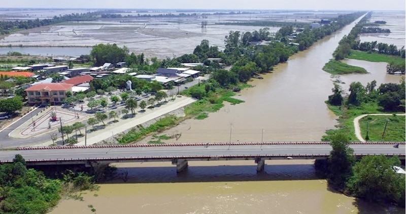 |
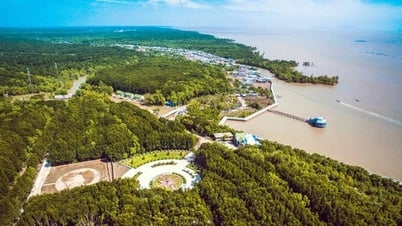
| T5 Canal is popularly known as "Vo Van Kiet Canal" in Lac Quoi Commune, Tri Ton District, An Giang Province (Photo: AG) |
When the T5 canal was basically constructed, the T6 canal (also in Lac Quoi commune) and the T4 canal (in Vinh Gia commune, Tri Ton district) were dug. The T4 and T6 canals had the task of supporting the entire construction system, so they were narrower and shorter. At the end of August 1997, the 48km long canal from An Giang to Kien Giang was completed.
The digging of a flood drainage canal system to the West Sea by Prime Minister Vo Van Kiet has brought about remarkable economic, social and national defense development for the vast land, the western border of the Fatherland. According to research by MSc. Duong Thi Ngoc Thu - Regional Political Academy IV and MSc. Duong Thi Tuyet Trinh - Vinh Long College, this canal system not only drains acidity, washes away alum, drains floods... but also plays a role in bringing fresh water and alluvium to the TGLX region to improve the soil. From there, a high-yield rice production area was formed, creating jobs for millions of people, while increasing rice and rice export output in the two provinces of An Giang and Kien Giang. Varieties of crops, vegetables and beans grown in the dry season after the rice harvest have helped improve people's lives. Science and technology quietly sticks to the people and the fields but changes the border area. Rice output has continuously increased. Land from being "given away for free" has increased to tens of millions of VND per hectare.
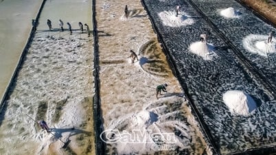
27 years after the investment in the flood drainage system, the Long Xuyen Quadrangle has now become one of the key areas for food production in the Mekong Delta with an area of 125,000 hectares that can grow 2-3 rice crops/year, with an estimated yield of 7-8 tons/ha, an output of more than 4 million tons of rice/year, accounting for about 25% of the region's output. During the harvest season, every place in the Quadrangle is covered in the golden color of ripe rice fields stretching from Thoai Son, Chau Thanh, Tri Ton, Tinh Bien districts to Hon Dat, Kien Luong, Giang Thanh..., changing the situation of copper sulfate exploitation in the Quadrangle, helping people expand agricultural production, and at the same time making Kien Giang and An Giang the leading localities in food production in the Mekong Delta, contributing to raising rice export output to world level. Currently, this system of works also plays an important role in storing fresh water and preventing drought in the Mekong Delta region.
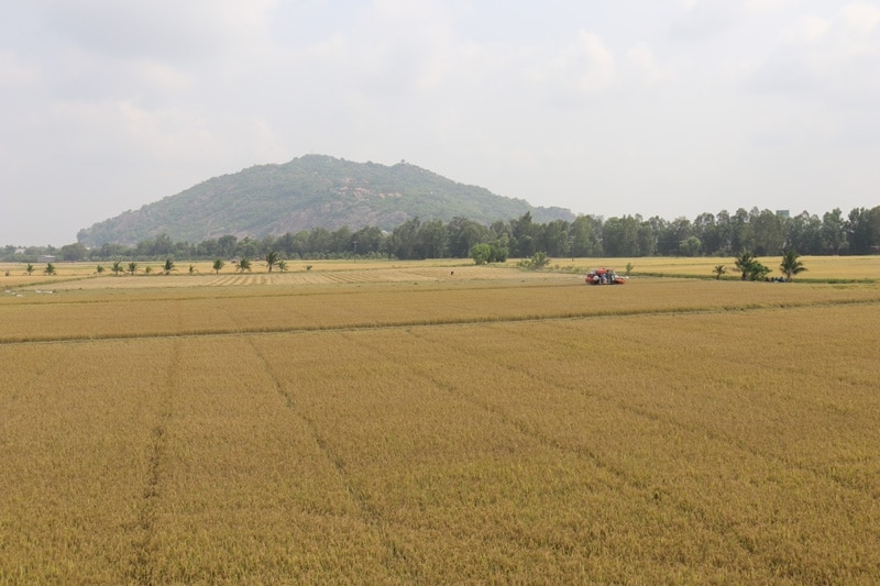 |
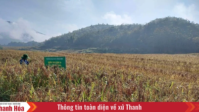
| Golden season in An Giang (Photo: Phuong Lien) |
From a precarious life, lacking everything, now, millions of residents of this land have settled down, many households have become billionaires thanks to the land and irrigation works that this land brings. Mr. Hai An - a long-time resident of this land said that people in the two provinces of An Giang and Kien Giang are always grateful to Prime Minister Vo Van Kiet, so they call the T5 canal "Mr. Kiet canal" or "Mr. Sau canal".
Also from this alum washing and flood drainage project, localities have developed additional transportation systems, electricity and water infrastructure, creating momentum for population development, forming many new rural areas, redistributing the population, contributing to ensuring national defense and security in the TGLX border area. Rural roads around the area are concreted, paved with smooth, smooth asphalt. On the roads, motor vehicles and trucks circulate; under the canals, boats carrying machinery, agricultural materials, and rice-buying boats move back and forth. Schools from kindergarten, primary school, and secondary school in Lac Quoi, Vinh Phuoc are built spaciously right next to the historic T5 canal. Students can conveniently go to school by bicycle. Rows of corrugated iron and tiled houses densely packed along the canals... have brought a new, vibrant face to the rural areas of the border area.
In the mountainous and border district of Tri Ton, An Giang province, along the main axis of the T5 canal and the sub-canals that have been asphalted and concreted, along with a relatively comprehensive power grid system, people from all over the country have come to settle down and make a living, firmly stick to the fields, be diligent and creative in increasing production. Currently, the average annual rice yield of Tri Ton district is 6.26 tons/ha and the annual rice output is 741,465 tons. The significant freshwater reserves provided by the T5 canal help the district strongly develop the garden economy and livestock, forming an area of 1,082 hectares of fruit trees with a variety of species such as mango, citrus, custard apple, coconut, avocado, durian, longan, etc.
Dr. Lam Quang Lang, An Giang Province Historical Science Association, said that the history of the formation and development of the TGLX area is the history of a long-term process of water control by the residents here. As the cradle of the brilliant Oc Eo - Phu Nam civilization, the TGLX is also the heart of the rice-producing agriculture of Southern Vietnam. The system of flood drainage channels to the West Sea has contributed to the remarkable development of the vast borderland, and at the same time played an important role in the socio-economic development of the southern land of the Fatherland from the time of exploration to the present./.
Source: https://dangcongsan.vn/kinh-te/an-cu-lac-nghiep-tren-vung-tu-giac-long-xuyen-679462.html


Comment (0)