
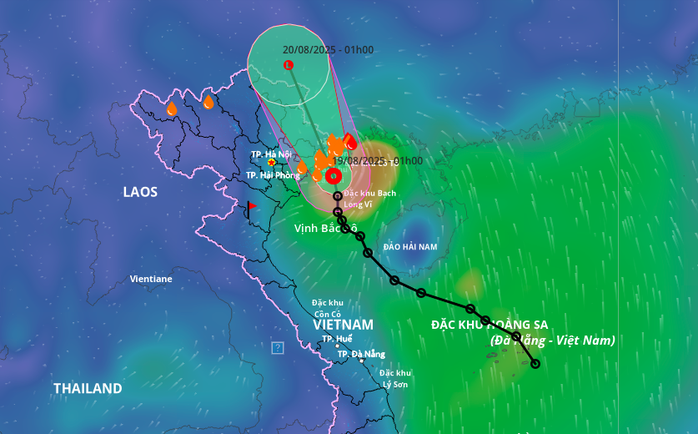
Forecast direction of tropical depression.
Due to the influence of the tropical depression, at Quang Ha station there are strong winds of level 6, gusting to level 9; Bach Long Vi station has strong winds of level 6, gusting to level 7; Co To station has strong winds of level 6, gusting to level 8, and Cua Ong station has strong winds of level 6.
Forecast until 4:00 p.m., the center of the tropical depression is located at 22.5 degrees North latitude - 106.8 degrees East longitude; on the Vietnam - China border area, moving to the North Northwest at a speed of about 15 km/hour and gradually weakening into a low pressure area.
Due to the influence of a tropical depression at sea, the northern area of Bac Bo Gulf (including the special zones of Bach Long Vi, Cat Hai, Co To and Van Don) has thunderstorms and strong winds of level 6, gusting to level 8, waves 2-3.5 m high, rough seas.
Ships operating in the above mentioned dangerous areas are likely to be affected by storms, whirlwinds, strong winds and large waves.
On land, coastal areas of Quang Ninh and Hai Phong have strong winds of level 6, gusting to level 8.
From early morning to night of August 19, the Northeast and Thanh Hoa regions will have moderate rain, heavy rain and thunderstorms with common rainfall of 40-100 mm, locally very heavy rain over 250 mm.
LP
Source: https://baothanhhoa.vn/ap-thap-nhiet-doi-di-vao-dat-lien-thanh-hoa-co-mua-to-nhieu-noi-258627.htm


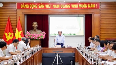
![[Photo] Politburo works with the Standing Committee of Da Nang City Party Committee and Quang Ninh Provincial Party Committee](https://vphoto.vietnam.vn/thumb/1200x675/vietnam/resource/IMAGE/2025/8/19/b1678391898c4d32a05132bec02dd6e1)

![[Photo] General Secretary and Prime Minister visit the National Exhibition and Fair Center](https://vphoto.vietnam.vn/thumb/1200x675/vietnam/resource/IMAGE/2025/8/19/f4503ad032d24a90beb39eb71c2a583f)
![[Photo] President Luong Cuong's wife and Queen of Bhutan visit Tran Quoc Pagoda](https://vphoto.vietnam.vn/thumb/1200x675/vietnam/resource/IMAGE/2025/8/19/62696af3852a44c8823ec52b03c3beb0)
![[Photo] Close-up of the first International Financial Center building in Ho Chi Minh City](https://vphoto.vietnam.vn/thumb/1200x675/vietnam/resource/IMAGE/2025/8/19/3f06082e1b534742a13b7029b76c69b6)

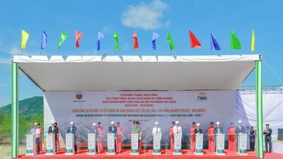
![[Photo] General Secretary To Lam attends the inauguration and groundbreaking ceremony of 250 projects to celebrate National Day](https://vphoto.vietnam.vn/thumb/1200x675/vietnam/resource/IMAGE/2025/8/19/3aa7478438a8470e9c63f4951a16248b)


Comment (0)