
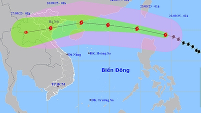
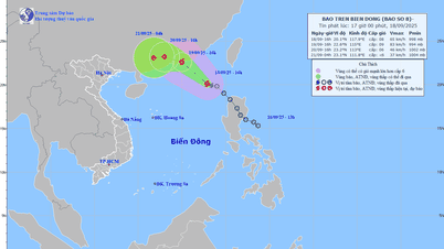
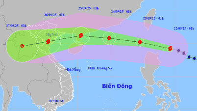
The tropical depression is moving rapidly and is likely to strengthen into a storm in the next 24 hours and has a high possibility (70% probability) of entering the Thanh Hoa to Quang Ngai area.

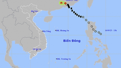
Forecast of location and direction of tropical depression at 4:00 p.m. September 17 - Photo: NCHMF
On the afternoon of September 17, Mr. Nguyen Van Huong, Head of the Weather Forecast Department, National Center for Hydro-Meteorological Forecasting, said that at 4:00 p.m. this afternoon (September 17), the tropical depression was in the eastern sea area of the North East Sea, about 620km east of Hoang Sa archipelago. The strongest wind near the center of the tropical depression was level 7 (50-61km/h), gusting to level 9.
According to Mr. Huong, it is forecasted that in the next 24 hours, the tropical depression will move quickly to the west, and is likely to strengthen into a storm (storm number 4 ) when reaching the area east of Hoang Sa archipelago.
After strengthening into a storm, the storm will move west-northwest. With such a direction of movement, Mr. Huong said that the circulation of the tropical depression/storm will cause strong winds of level 6-7, in the North East Sea, Hoang Sa archipelago, near the center of the storm, strong winds of level 8.
In the Quang Binh sea area, in the next 24 to 48 hours, the wind will gradually increase due to the tropical depression/storm moving in.
“Up to now (assessment on the afternoon of September 17), we assess the highest possibility (probability 70%) is that the tropical depression/storm moves into the Thanh Hoa to Quang Ngai area. The second possibility is that the tropical depression/storm moves to the Gulf of Tonkin or the south of the Central region, the probability of these two possibilities is only 15%” – Mr. Huong said.
According to Mr. Huong, with the scenario of a tropical depression/storm moving from Thanh Hoa to Quang Ngai, the sea areas of these provinces will be directly affected.
In the next 24 to 48 hours, the sea area of Quang Binh - Quang Ngai will have strong winds. From tomorrow, the sea area of the Central region will have rain. From tomorrow afternoon to September 21, on the mainland of the North Central and Central Central regions, there is a possibility of moderate to heavy rain over a wide area.
“Under the impact of the tropical low pressure circulation that will later strengthen into a storm, the North East Sea, Hoang Sa archipelago, and the sea area from Thanh Hoa to Quang Nam and Quang Ngai will be directly affected by strong winds and big waves.
Therefore, vessels operating in these areas need to move out of the danger zone or into anchorage and aquaculture areas that need to be reinforced, especially in Thua Thien Hue. It is necessary to guard against flooding in low-lying coastal areas,” Mr. Huong warned.
For the mainland, Mr. Huong noted that thunderstorms before tropical depressions/storms can cause strong storms and whirlwinds that can cause trees to fall, roofs and signs to be blown away by the wind.
“Heavy rain can also cause flooding in urban areas. Mountainous and midland areas in the North and Central Central regions need to be on guard against flash floods and landslides like the recent ones in the North,” said Mr. Huong.


![[Photo] Prime Minister Pham Minh Chinh chairs the first meeting of the Central Steering Committee on housing policy and real estate market](https://vphoto.vietnam.vn/thumb/1200x675/vietnam/resource/IMAGE/2025/9/22/c0f42b88c6284975b4bcfcf5b17656e7)


![[Photo] General Secretary To Lam presents the First Class Labor Medal to the Vietnam National Energy and Industry Group](https://vphoto.vietnam.vn/thumb/1200x675/vietnam/resource/IMAGE/2025/9/21/0ad2d50e1c274a55a3736500c5f262e5)


Comment (0)