
 |
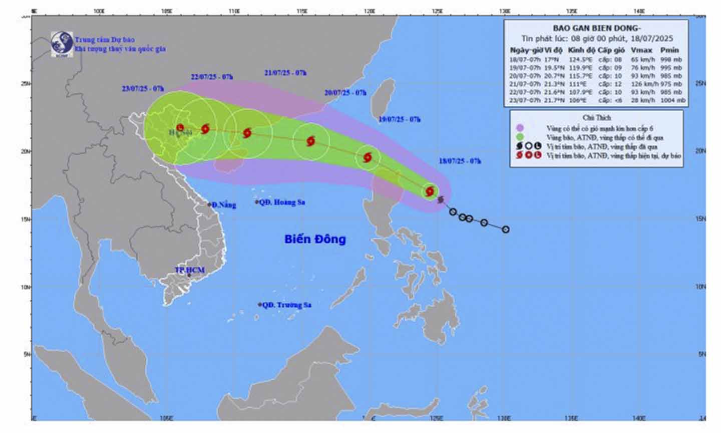
| Map of storm location and intensity on the morning of July 18. |
It is forecasted that in the next 24 hours, the storm will enter the East Sea and is likely to strengthen. By 7:00 a.m. on July 19, the storm center may be at about 19.5 degrees North latitude, 119.9 degrees East longitude, in the northeastern waters of the East Sea, with strong winds of level 8-9, gusting to level 11. In the next 48 to 72 hours, the storm will continue to move in a West-Northwest direction at a speed of 20 km/h and is likely to strengthen to level 11-12, gusting to level 15 when approaching the Leizhou Peninsula (China).
From this afternoon, the sea in the northeast of the East Sea will gradually increase in strength to level 6 - 7, near the storm center will increase in strength to level 8 - 9, gusting to level 11, waves from 3 to 5 meters high, very rough seas. Ships operating in this area need to pay special attention to storms, whirlwinds and big waves.
Meanwhile, the sea area from Lam Dong to Ca Mau , including the Go Cong Dong - Tan Phu Dong area, has southwest wind level 5, sometimes level 6 in the North, gusting to level 7 - 8; the sea is slightly rough, the sea is rough in the North. In Dong Thap, the weather is cloudy, sunny during the day, scattered thunderstorms in the evening, some places have moderate rain.
C. WIN
Source: https://baoapbac.vn/xa-hoi/202507/bao-wipha-dang-tien-vao-bien-dong-bien-dong-rat-manh-1046953/


![[Infographic] In 2025, 47 products will achieve national OCOP](https://vphoto.vietnam.vn/thumb/402x226/vietnam/resource/IMAGE/2025/7/16/5d672398b0744db3ab920e05db8e5b7d)


Comment (0)