
The latest assessments show that when entering the East Sea, Typhoon Wipha may strengthen to level 12, gusting to level 14, becoming a very strong storm. The forecast for the storm's development is still very complicated and unpredictable.
According to the National Center for Hydro-Meteorological Forecasting, at 2:00 p.m. this afternoon (July 18), the center of the storm was located at approximately 18.3 degrees North latitude; 123.5 degrees East longitude, in the sea northeast of Luzon Island (Philippines). Winds near the center of the storm were at level 8-9 (62-88 km/h), gusting to level 11. The storm moved northwest at a speed of 30 km/h.
The most likely scenario currently is that the storm will move quickly towards China's Leizhou Peninsula, then follow the northern part of the Gulf of Tonkin, before making landfall near the Vietnam-China border and moving deep into the northern mainland of our country early next week.
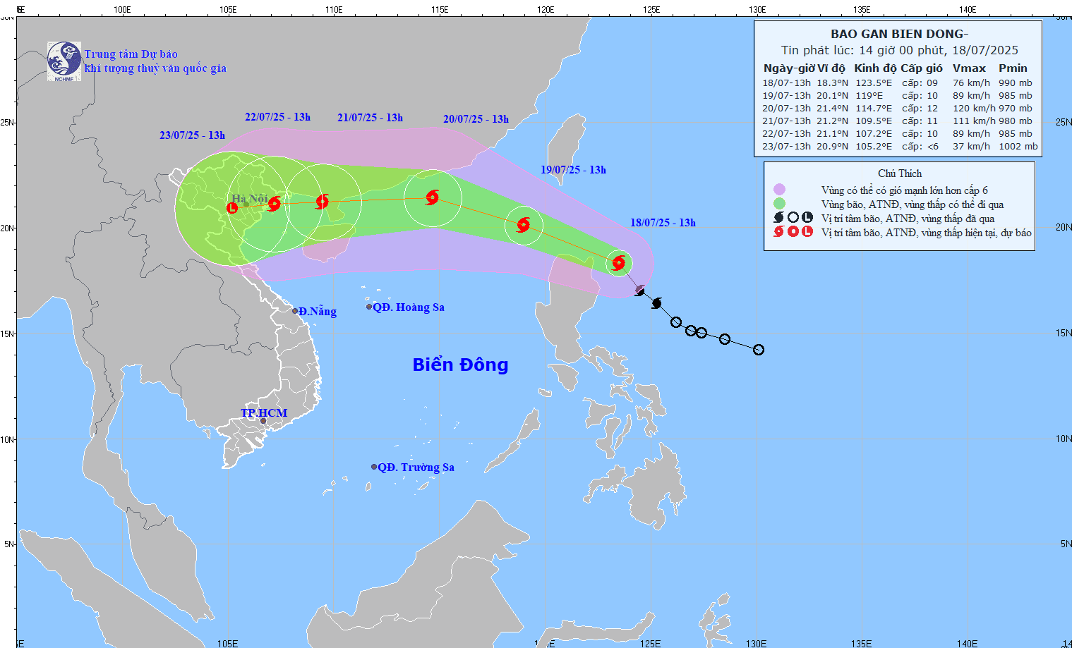 |
| Forecast location and path of storm Wipha. Photo: National Center for Hydro-Meteorological Forecasting |
It is forecasted that at 1:00 p.m. tomorrow (July 19), the storm will enter the East Sea and become stronger, with winds reaching level 10 and gusts reaching level 12.
At 1:00 p.m. on July 20, the storm was about 490km east of Leizhou Peninsula (China); strong winds of level 11-12, gusting to level 14.
At 1:00 p.m. on July 21, the storm was located in the sea west of Leizhou Peninsula (China); strong winds level 11, gusting to level 13.
Warning, from the next 72 to 120 hours, the storm will move mainly to the West, traveling 10-15km per hour and gradually weakening.
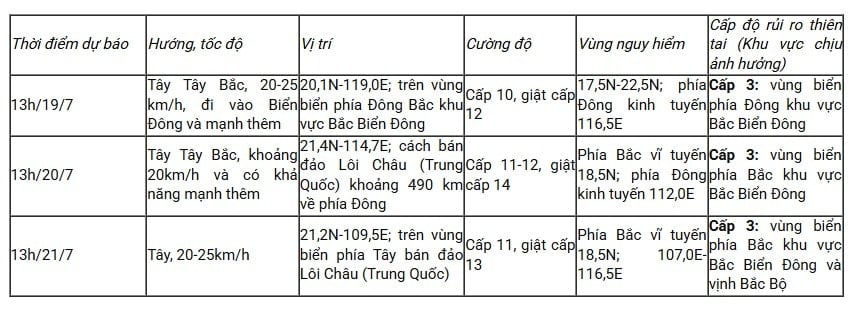 |
Forecast of storm developments in the next 24 to 72 hours. |
Due to the influence of the storm, the eastern sea area of the North East Sea has winds gradually increasing to level 6-7, the area near the storm's center has strong winds of level 8-10, gusting to level 12; waves are 3-5m high; the sea is very rough.
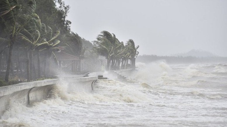 |
| Illustration photo: VGP |
Typhoon Wipha formed from a low pressure area off the coast of the Philippines, strengthened into a tropical depression on the morning of July 17, and continued to strengthen into a storm in the early morning of July 18. This is a strong, fast-moving storm with a high probability of making landfall directly in the North of our country, and its developments are still complicated and unpredictable. Therefore, the National Center for Hydro-Meteorological Forecasting reminds people to update the latest forecasts.
THANH HAI
* Please visit the Society section to see related news and articles.
Source: https://baolamdong.vn/bao-wipha-dang-tien-vao-bien-dong-kha-nang-anh-huong-dat-lien-nuoc-ta-382753.html


![[Infographic] In 2025, 47 products will achieve national OCOP](https://vphoto.vietnam.vn/thumb/402x226/vietnam/resource/IMAGE/2025/7/16/5d672398b0744db3ab920e05db8e5b7d)


Comment (0)