

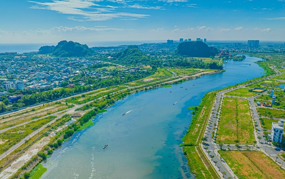
From the airplane, Co Co - known in books as Lo Canh Giang - is a river that runs along the coast, from Cua Dai Chiem - Hoi An to Cua Han - Da Nang.
Throughout centuries, this river has been the source of irrigation water for fertile and prosperous fields and gardens. Along with the history of agriculture, the river, with its two seasons of rain and sunshine, is intertwined with villages, houses, temples, shrines, folk legends, and the struggles against enemies to protect and build people's lives… all of which have shaped a rich cultural landscape connected to a vast land with many ups and downs in Quang Nam province…
The River of Memories and Legends
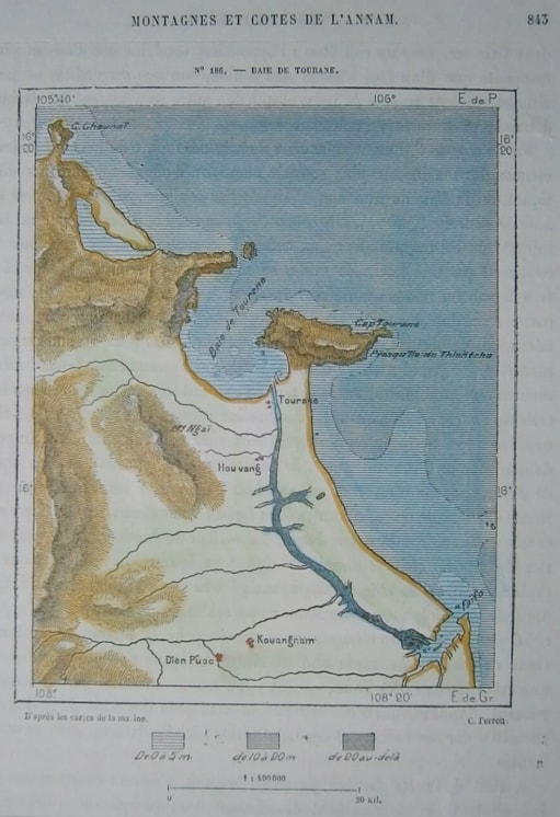
According to the Đại Nam nhất thống chí, Lộ Cảnh Giang is located in the area at the end of the two districts of Diên Phước and Hòa Vang, flowing from Thanh Châu commune northward, and joining the Cẩm Lệ River west of Ngũ Hành Sơn. This river is associated with stories steeped in legend…
The Lo Canh Giang River was a major trade route from the sea deep inland, and traces of large-scale, high-capacity sailing boats were found in a section of the river in Cam Thanh commune, former Hoi An city, dating back to 1991. A prosperous and developing Hoi An in the Dang Trong region, where waterway trade using sailing boats and the role of the Thu Bon, Truong Giang, and Lo Canh Giang rivers in connecting inland trade can be found in many old documents.
The thriving Han River estuary has transformed the once tranquil Hoi An into a vibrant ancient city. Young people today are capitalizing on this river in their own way through river tours .
For many years, river tours along the Lo Canh Giang estuary, simulating the activities of river fishermen, have offered visitors many interesting experiences. One of the familiar destinations that tourists are eager to visit is Tra Que vegetable village. It's a return to a cultural region shaped by this historical river: "...Whoever goes to Tra Que, let them go / Tra Que has the craft of fermenting mung beans / In the morning they sell onions / In the afternoon they water the plants, staying up all night before lying down..."
Those involved in tourism sometimes fail to fully understand the connection between today's unique tourism products and the historical significance of the river; they mostly view tourism and its benefits through the lens of contemporary thinking.
But it's different for farmers who have been involved in the profession for generations. The seaweed from the Co Co River has formed a farming tradition passed down from their ancestors. Day after day, people in the village go to the river to harvest seaweed; in all four seasons—spring, summer, autumn, and winter—the river silently produces and bestows this precious gift upon the riverside inhabitants. The river and the hardworking people, through the rhythm of rain and sunshine, have woven together a life that has lasted for millennia…
From Tra Que vegetable village, we followed the local officials' directions along the riverside road to find a ruin related to the old villages along Lo Canh Giang. The scenery that unfolded before us was truly impressive.
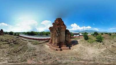
The desolate remnants of the An Bang village communal house, built entirely of stone, lie scattered amidst the weeds. "The old path where carriages once trod, now overgrown with autumn grass / The old foundation of the castle, now bathed in the twilight's shadow," behind the hazy shadows of time and memory, where are the once prosperous villages, the festivals and celebrations, the scenes of boats and ships sailing on the sea...?
Although few traces remain, they help us visualize the grandeur of the temple grounds, its scale, and especially the exquisite craftsmanship in every detail. The fact that there was once a single stone temple in the region proves that Lo Canh Giang historically made significant contributions to the lives of the inhabitants of a large area.
Convenient waterway transportation has left a profound mark on social institutions throughout the history of a river. These include riverside markets, where waterway transport was the only way to connect trading activities in the region.
Following the directions of the locals, we found our way to Cau Market. It's hard to imagine that Cau Market, once bustling with trade, now exists only in memory, standing desolate by the riverbank, with moss-covered bricks buried in the sand and a lingering nostalgia for a glorious bygone era…
Awakening the Lo Canh River
From Cau Market heading towards Da Nang, the river meanders around a famous scenic spot in the region: the Marble Mountains (Ngu Hanh Son). Even now, standing on these mountains, one can still see the ancient flow of the river flowing through the reed-covered alluvial plains along its banks.
The Marble Mountains and the River of Scenic View are a harmonious combination in a picturesque landscape. The river is a gentle, feminine element in the overall setting, alongside the five majestic mountains of the historically significant Quang Nam - Da Nang region.
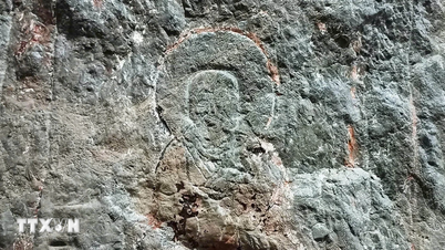
Mount Putuo is situated on the tranquil Hoa Son mountain, nestled beside the now-silted Lo Canh river. Behind this peaceful facade lie many legends. It is the oldest temple in the system of temples surrounding the Marble Mountains. Now, everything has changed except for the temple's name, written in bold on a rock face—a handwritten inscription by Emperor Minh Mang when he visited.
Located next to Phu Da Son, Hoa Son village communal house sits beside the river, still bearing traces of a fishing village. There is the Mausoleum of the Goddess, dedicated to Thien YA Na, a Cham goddess revered by the Vietnamese. There is also the Mausoleum of the Fisherman, a traditional worship of the whale god by coastal residents.
The complex of religious relics, built in 1825, reveals the profound history of a coastal fishing village that existed along the Lo Canh Giang River. It's easy to imagine from here, the majestic boats cutting through the waves to set sail during the fishing season and silently returning on stormy days…
Located along the Canh Giang River, Non Nuoc stone carving village is a renowned traditional craft village with a history spanning three to four hundred years. Several existing steles in ancient temples throughout Quang Nam province confirm this.
The Non Nuoc stone carving village has existed for centuries. Given the long-standing road transport barriers, what contribution did the Canh Giang River and other common water transport methods of that era make to the prosperity of such unique craft villages? The answer lies within the question itself.
The silting of the Lu Jingjiang River since the late 19th century offers much to ponder. The prioritization of agriculture has altered the river's destiny. How did the river's silting begin?
To restore the river to its former glory, a dredging and clearing project was discussed between the authorities of the former Quang Nam and Da Nang provinces many years ago. Yet, as of May 2026, the Co Co River clearing project – a vital waterway connecting Da Nang and Hoi An – remains in a state of "open on the north side, blocked on the south side."
In northern Da Nang, the infrastructure is now basically complete. The section of the river passing through the former Da Nang territory (approximately 10 km) has had its main components largely finished. The dredging of the riverbed and the construction of embankments along both banks of the river section passing through Ngu Hanh Son ward have been completed.
The urban landscape along the river in the FPT City and Hoa Quy areas has taken shape. Da Nang City is focusing on completing bridges across the river to synchronize transportation. Notably, in early 2026, the Dong No 2 bridge project, with an investment of over 128 billion VND, will begin implementation to enhance riverside infrastructure connectivity.
To the south, the nearly 20-kilometer stretch of river from Ngu Hanh Son to Hoi An remains impassable due to land acquisition and funding issues. Dredging work in this area is stalled because of difficulties verifying the ownership of agricultural land and shrimp ponds belonging to local residents. Besides the completed and operational Nguyen Duy Hieu bridge, the Nghia Tu bridge project was temporarily halted in mid-2025 due to land acquisition issues for the access road.
Although the river is not yet physically open for tourist boats to travel freely, the project has already generated significant development. The real estate market and urban areas along the Co Co River are becoming a new development axis for southern Da Nang. Once fully opened, the waterway journey from Da Nang to Hoi An will be shortened from 5-6 hours to less than 2 hours, opening up opportunities for high-end river tours.
The Lộ Cảnh Giang River will be revived, connecting the villages and riverbanks of a cultural region. That is a conceivable near future. Tourists will have the opportunity to better understand the river and the lands it flows through. And for the farmers who make their living daily on the familiar river around their homes, the story of their lives may be written in a different way, depending on the changes the river undergoes.
Reopening the Lo Canh Giang River is not just a dream or aspiration. More vigorous efforts are needed to make it a reality. Reopening the Lo Canh Giang River is a way to restore the river's destiny and role as it was in history, a step to extend the cultural flow from tradition to modernity, and a catalyst for future economic development in Da Nang city…
Like rivers across the country, Lo Canh Giang has accompanied the vicissitudes of a cultural region, its profound journey writing the history of Vietnamese villages… Time has shrouded the river's fate in mist, but after periods of obscurity and sedimentation, Lo Canh Giang now stands before new opportunities. Unblocking the river's flow is creating a new chapter for its revival, stemming from the dream of livelihoods linked to tourism and the deep-seated concerns about the cultural history of this rural area…
Source: https://baodanang.vn/ben-dong-lo-canh-giang-3336910.html
![[Photo] The heat at the fireworks display site on the opening night of the Da Nang International Fireworks Festival 2026](https://vphoto.vietnam.vn/thumb/1200x675/vietnam/resource/IMAGE/2026/05/27/1779889741485_ndo_br_z7872039145157-fecaba5112f39e8352544099d7ef4738-5140-jpg.webp)


![[Photo] The courage of new recruits of Brigade 144 on the training ground.](https://vphoto.vietnam.vn/thumb/1200x675/vietnam/resource/IMAGE/2026/05/27/1779881651341_anh-man-hinh-2026-05-27-luc-18-32-52.png)















































![[Photo] The courage of new recruits of Brigade 144 on the training ground.](https://vphoto.vietnam.vn/thumb/402x226/vietnam/resource/IMAGE/2026/05/27/1779881651341_anh-man-hinh-2026-05-27-luc-18-32-52.png)






















Comment (0)