
According to the National Center for Hydro-Meteorological Forecasting, around the afternoon and night of May 10, cold air will begin to affect areas in the North of our country (deepest to some places in the Central Central region).

From the night of May 10, the North and North Central regions will turn cool, and some mountainous areas in the North will be cold (below 18 degrees Celsius). It is worth noting that this cold spell appears out of season, so it comes with many risks that people in the affected areas should not take lightly.
On May 9, Dr. Hoang Phuc Lam, Deputy Director of the National Center for Hydro-Meteorological Forecasting, said the cause of this heavy rain and strong wind is the interaction between the cold air mass from the North and the hot and humid air mass covering the North and North Central regions.
“The strong conflict between these two opposing air masses makes the weather unstable and prone to extreme phenomena,” Dr. Lam warned.
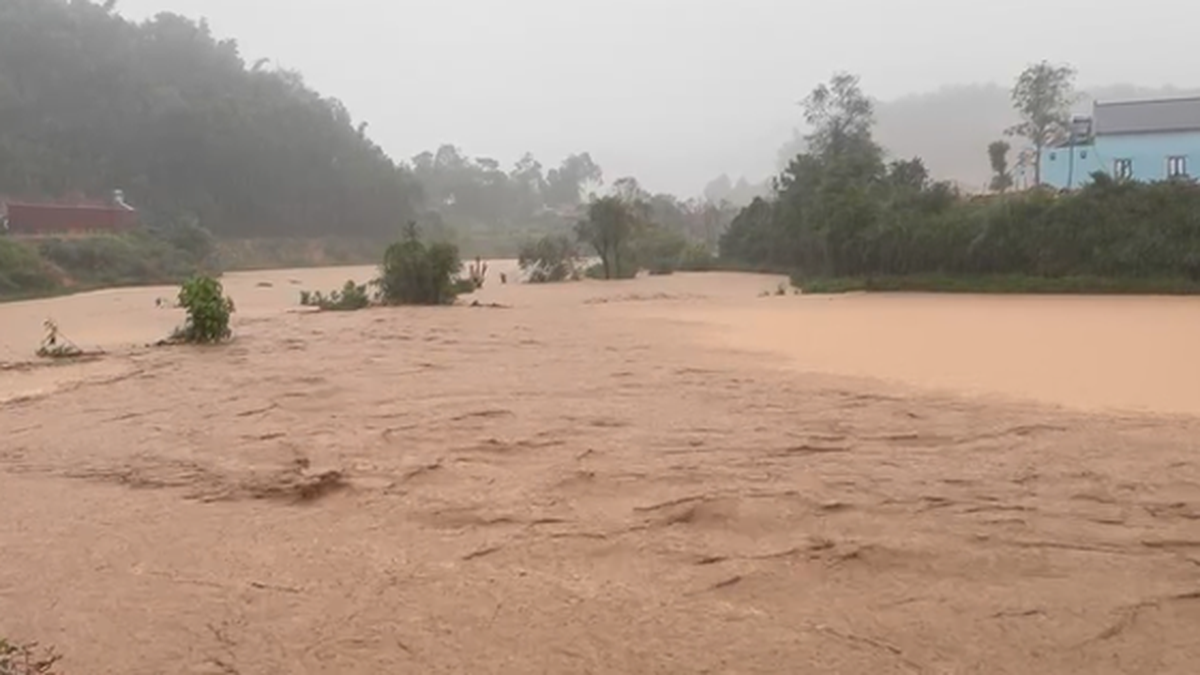
Thunderstorms with tornadoes, lightning, hail and strong winds can occur suddenly, especially in the late afternoon and at night. Heavy rain can also cause localized flooding in urban areas, flash floods and landslides in mountainous areas.
Specifically, according to the forecast model of the National Center for Hydro-Meteorological Forecasting, on the day and night of May 10, the mountainous areas of the North will have 20-50mm of rain, some places over 100mm. From the afternoon and night of May 10, the plains and midlands of the North will have 30-70mm of rain, some places with very heavy rain over 150mm. From the afternoon of May 10 to the morning of May 11, the North Central region will have 30-70mm of rain, some places with very heavy rain over 150mm. Worryingly, some places may have extreme rain with an intensity of over 80mm within just 3 hours.
Along with that, in the afternoon and night of May 10, the Central Central region, Central Highlands and the South also had 15-30mm of rain, with some places having over 60mm.

The meteorological agency also said that the cold air will cause northeast winds of level 2-3, coastal areas of level 3-4, gusting to level 6. At sea, from the night of May 10, the Gulf of Tonkin and the northern sea area of the North East Sea will have winds gradually increasing to level 6, sometimes level 7, gusting to level 8, rough seas, dangerous for ships.
According to Dr. Hoang Phuc Lam, the rain may gradually decrease from May 11. A positive point is that this rain will end the hot and humid weather that has lasted in the North in recent days. However, it comes with a series of risks that people should not be subjective about.
The National Center for Hydro-Meteorological Forecasting recommends that people cover their houses, protect crops and livestock, and pay special attention to safety when traveling in mountainous areas, low-lying areas, and urban areas during this rainy season. Fishermen should closely monitor weather reports and limit going to sea when there are warnings of strong winds and rough seas.
Source: https://www.sggp.org.vn/co-quan-khi-tuong-canh-bao-dot-mua-to-gio-manh-sap-xay-ra-post794517.html


Comment (0)