
Flowing into An Hoa estuary, there is also a coastal water flow called Truong Giang River, connecting An Hoa estuary in the south with Dai estuary (Hoi An City, Quang Nam ) in the north. Converging with Truong Giang before flowing into the sea is Tam Ky River and many small rivers originating from the low mountains and hills in the west, so geographers often call it Truong Giang - Tam Ky river system.

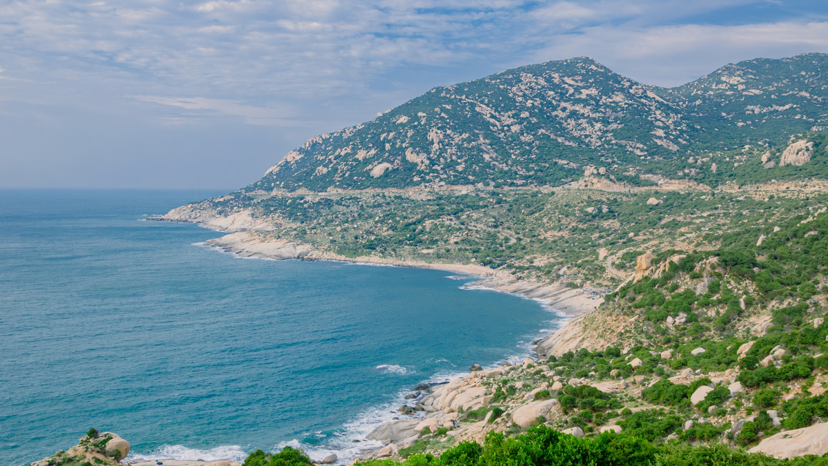
Ban Than Rock Beach
PHOTO: TAN VINH
The book Dai Nam Nhat Thong Chi by the National History Institute of the Nguyen Dynasty (Thuan Hoa Publishing House, 1992, page 374) wrote about this seaport as follows: "Located 62 miles east of Ha Dong district, also called Hiep Hoa seaport, is where the two rivers Ben Van and Tam Ky flow into the sea, the estuary is more than 40 truong wide, 6 meters deep at high tide, 4 meters 5 inches deep at low tide. At the beginning of Gia Long's reign, a sign language officer and a deputy with the guard were placed to patrol the sea. There is also Tieu Ap seaport about 7 miles from Dai Ap seaport, around Minh Mang's reign, it was filled with sand so the guard office merged with Dai Ap's guard office".
In the book Research on maps of Vietnamese river mouths and seaports in the 15th century ( Hanoi Publishing House, 2020) - a publication on historical geography, historical cartography, and modern Vietnamese transportation history by French scholar Gustave Dumoutier, first published in 1895, this seaport was mentioned by the name Hoa Hop Mon (和合門).
Hai Mon Ca (anonymous) is a song with 48 six-eight verses in Nom script, taken from the book Thong Quoc Duyen Cach Hai Chu , a handwritten copy of the Saigon Archaeological Institute. In 1972, when publishing the book Nam Ha Literature (Lua Thieng Publishing House, Saigon), Professor Nguyen Van Sam recorded the Hai Mon Ca , also with notes by Professor Buu Cam. The song describes the journey of the merchants of Dang Trong from Bo Chinh to Cao Mien (the land ruled by Lord Nguyen), mentioning the seaports from Bo Chinh district (present-day Quang Binh ) to Bien Hoa town (currently on the coast of Ba Ria-Vung Tau province), in which there are verses mentioning two different seaports , An Hoa and Hiep Hoa:
" Da Nang gate set patrol,
Dai Chiem door is gone for a day.
The water boat sailed for a whole watch,
Hiep Hoa over there, An Hoa here"
Professor Buu Cam's note says: Hiep Hoa "means Dai Ap gate of Tam Ky, Quang Nam", and An Hoa is "a bay in Tam Ky, Quang Nam" ( Nam Ha Literature , page 293).
Thus, between Dai Nam Nhat Thong Chi and Hai Mon Ca there are differences in determining the names and locations of An Hoa and Hiep Hoa estuaries. Is it possible that there was a mistake or a natural change that caused one of the two adjacent estuaries to disappear, a situation that often occurs in the estuaries of the Central region?

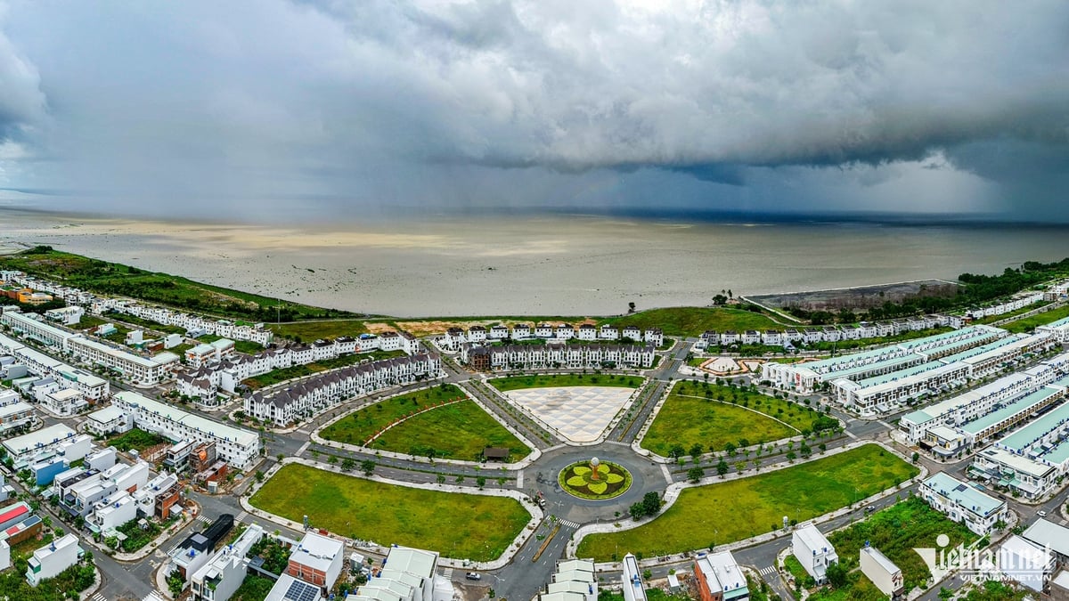
Ky Ha Port
PHOTO: TAN VINH
A local register currently kept at the National Archives Center I, a copy of the original from the 26th year of Tu Duc (1873), states: More than two centuries ago, An Hoa was the name of a commune under Thang Hoa prefecture. The people of An Hoa specialized in fishing, living scattered south of the Truong Giang River to An Hoa estuary. Belonging to An Hoa commune, there is a village named An Hoa. The territory of the village is described: the east borders the beach; the west borders the Truong Giang River, taking the river as the boundary; the south borders the Dai Ap port, also bordering the river, taking the river and sea as the boundary; the north borders the white sand of Long Phuoc commune, Diem Dien, also belonging to An Hoa commune, Ha Bac, from the bank of the O Ga river junction to the white sand of the sea, the two communes (An Hoa and Diem Dien) set up wooden pillars as the boundary.
Such descriptions show that the geographical location of An Hoa village has the characteristics of a river-sea intersection, where the rivers Truong Giang, Tam Ky, An Tan (Ben Van) and some small rivers and streams converge before flowing into An Hoa estuary. This is a village with rivers, seas and sand dunes, estuary islands, mangrove forests, and rocky rapids. At the time of establishing the land register, An Hoa village had a communal house, pagoda, Thanh Hoang temple, Quan Thanh De Quan temple (locals called it Quan Thanh pagoda), and a whale shrine (Nam Hai Linh Ngu).
The book Dai Nam Nhat Thong Chi (Nguyen Dynasty) recorded a historical event that took place in this land at the end of the 15th century, which was recorded in Dai Viet Su Ky Toan Thu (Le Dynasty): "History records that King Le Thanh Tong went to fight Champa, ordered the guerrilla general Le Hi Cat to bring the Chau Su to the Cuu Toa seaport at night to Sa Ky to block the enemy's way back; the king brought the Chau Su to the two seaports Tan Ap and Cuu Toa, raised the Emperor's flag, soldiers beat drums and cheered as they entered the Thai Can seaport. Tan Ap and Cuu Toa are now Dai Ap and Tieu Ap; Thai Can is Thai Can seaport, Quang Ngai province". Thus, according to official history, the place where King Le Thanh Tong established his headquarters and "raised the Emperor's flag" was Dai Ap seaport (An Hoa port, now in Nui Thanh district, Quang Nam) and Thai Can port (Sa Can port, now in Binh Son district, Quang Ngai) and not in Van Tuong (Binh Son district, Quang Ngai) as some recent authors have written.
Tieu Ap Gate, locally called Lo Gate. This sea gate sometimes erodes and sometimes deposits, the location of the eroded area shifts over time; currently Tieu Ap Gate is only separated from An Hoa Gate by a small mountain, called Ban Than.
Ban Than Mountain in Dai Nam Nhat Thong Chi is called Phu Xuan Mountain, described quite specifically: "Phu Xuan Mountain: named Ban Than Mountain, located 50 miles southeast of Ha Dong district, adjacent to Dai Ap beach to the north; the original mountain range from Chu Son mountain stretches back and divides, winding through Hoa Van and Phu Hoa communes to Phu Xuan village, then rises a large, round peak, the rock is as black as coal, from afar the mountain top looks flat and black, like a charcoal tray, so it is named like that; to the southeast there is a strip of ancient ramparts with traces still remaining, and to the southeast off the beach, forming many islands, including Mang Island, Rua Island, and Duong Island".

Chu Lai - Truong Hai Port
PHOTO: TAN VINH
According to geologists, the Ban Than area is an ancient sea shelf dating back 400 million years, surrounded by more than 90 hectares of coral reefs. Here, there is a black cliff over 2 km long, about 40 m high, stacked on top of each other, with many shapes and many marks due to the impact of waves and wind. The shape and color of the stone steps here represent the evolution of the earth's crust, related to the formation and expansion of the East Sea . Therefore, the Ban Than system is a unique geological heritage, not only of Quang Nam but also of the whole country.
In February 2023, the Ban Than scenic complex and two neighboring small islands, Hon Mang and Hon Dua, were ranked as National Historical and Cultural Relics by the Ministry of Culture, Sports and Tourism.
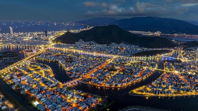
On the coast of Quang Nam and Quang Ngai, from An Hoa estuary to Sa Ky estuary, there are many deep-water bays with large seaports (such as Ky Ha, Dung Quat...) that have been invested in and built, playing an important role in domestic and foreign maritime trade, promoting economic development in the key economic region of the Central region. (continued)
Source: https://thanhnien.vn/cua-an-hoa-noi-vua-le-thanh-tong-dung-co-thien-tu-185250314205651614.htm


Comment (0)