
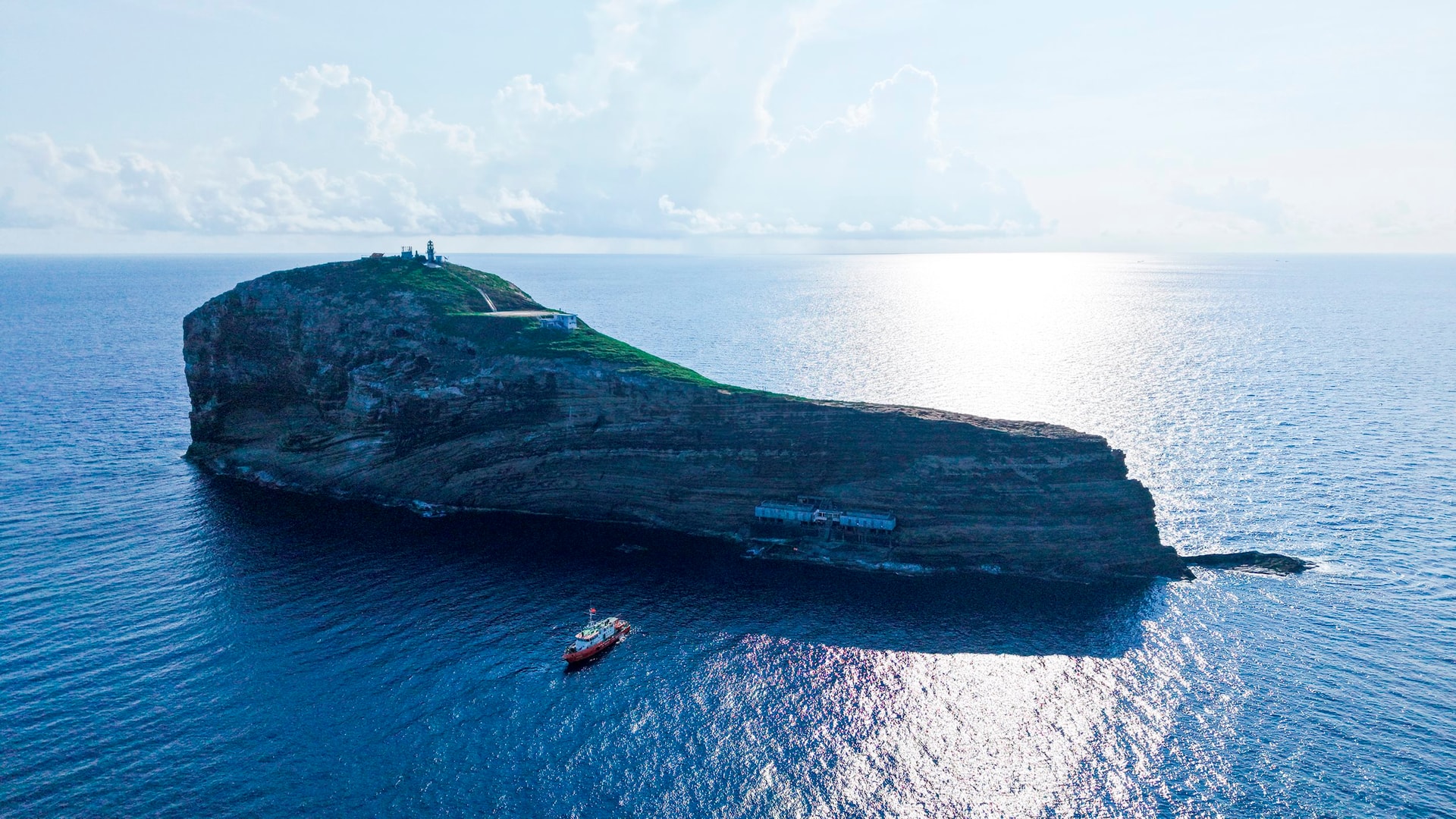
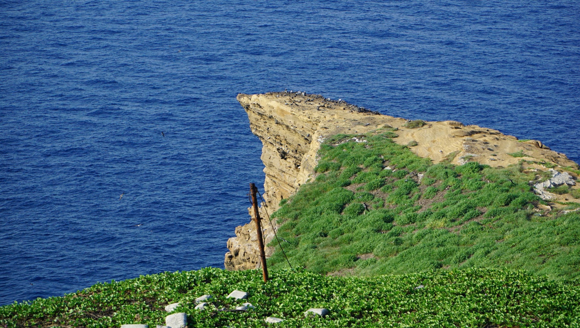
Hon Hai, also known as Hon Kham, is 38 nautical miles southeast of Phu Quy Island. Hon Hai Island is also point A6 marking Vietnam's baseline, which is considered the farthest point of our country's internal waters in the South East Sea.
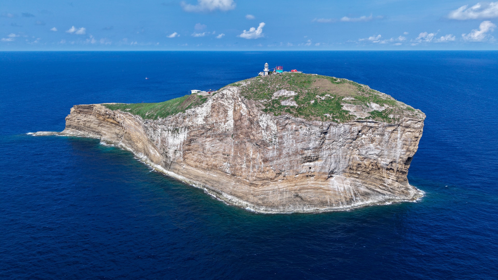
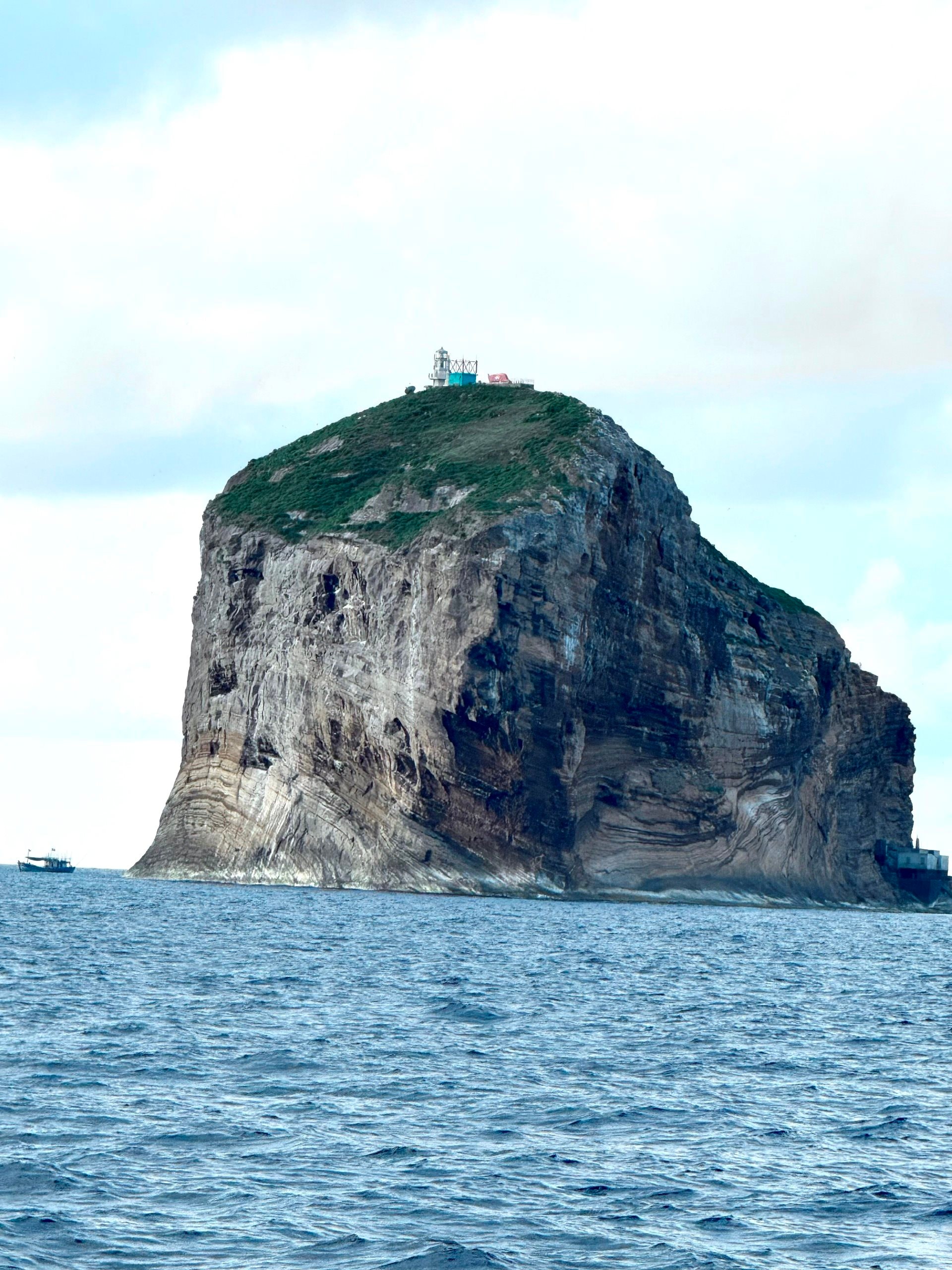
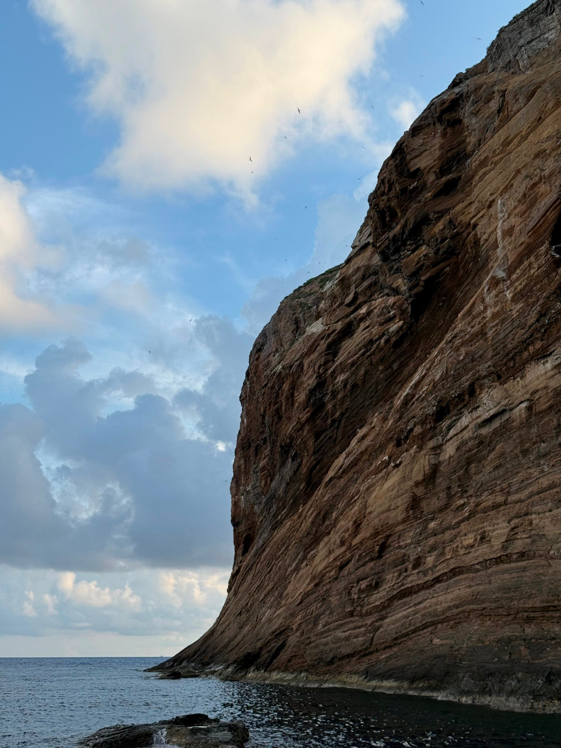
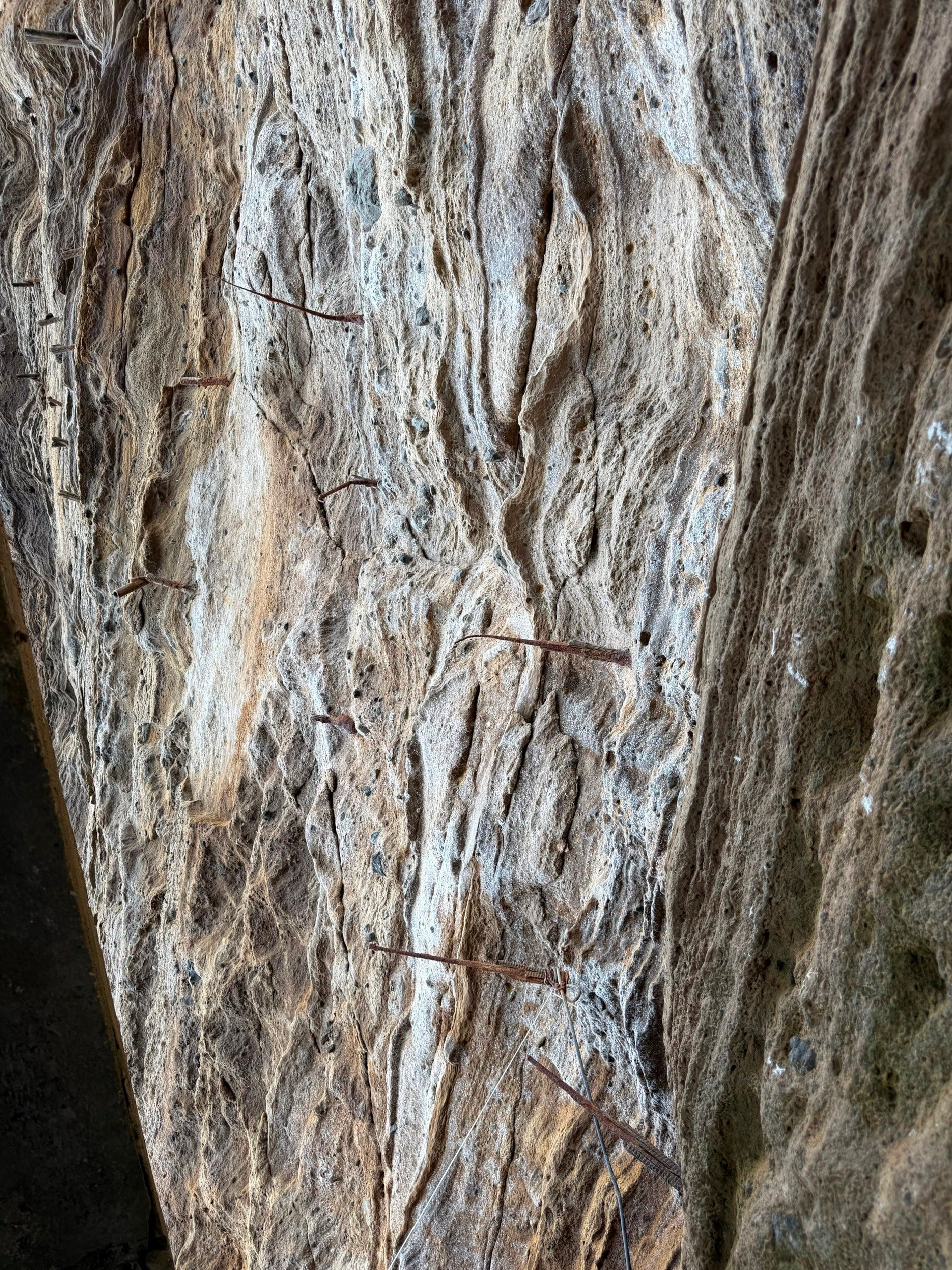
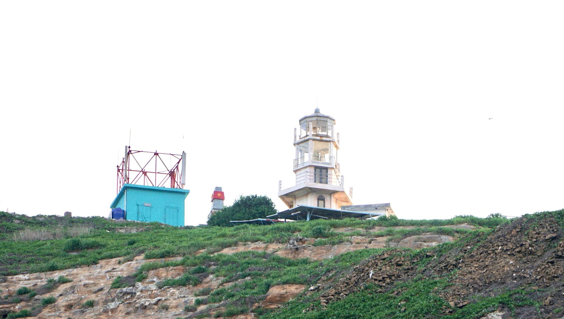
Hon Hai has a very complex topography and geology. With a length of about 900m, a width of about 60m at its widest point, and a highest point of about 115m from the sea level, with a vertical cliff over 100m high, Hon Hai looks like a giant rock rising in the middle of the sea.
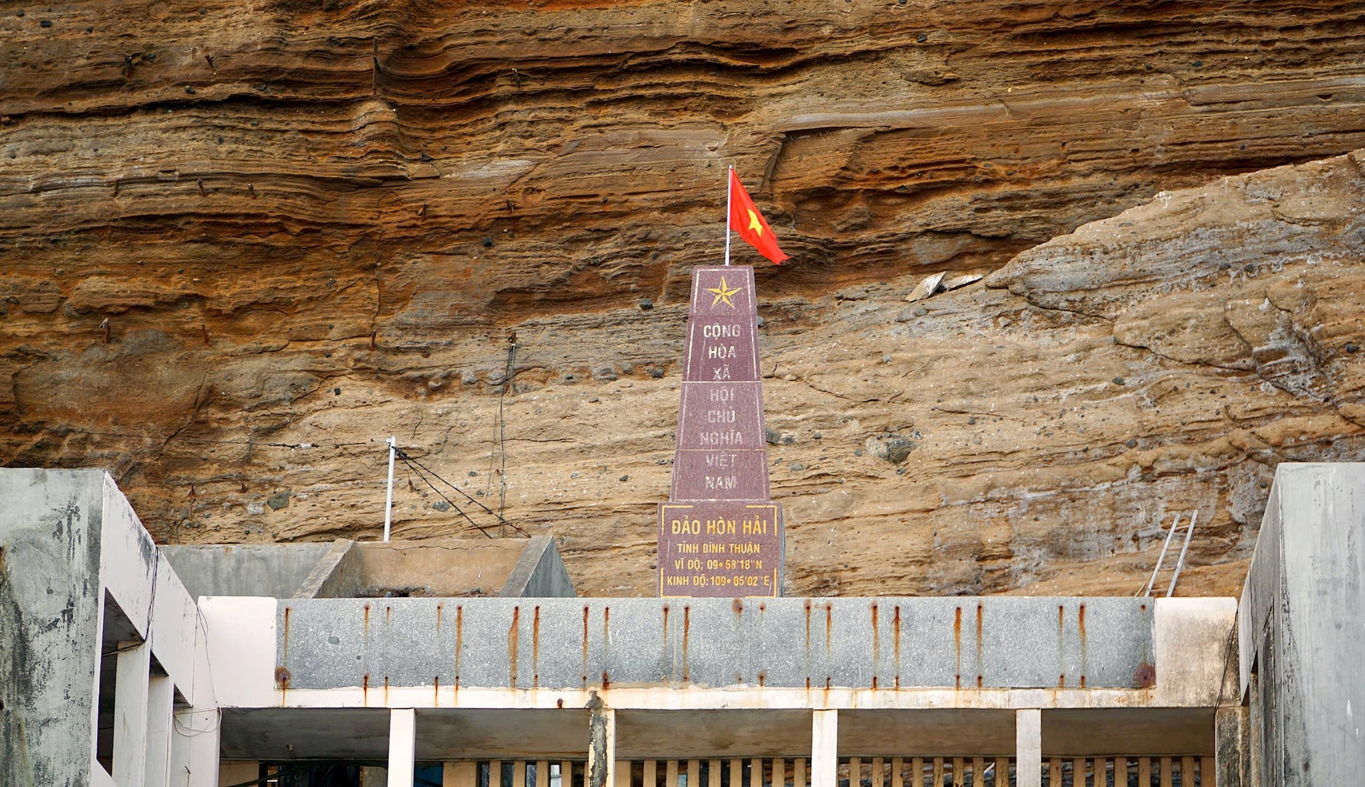
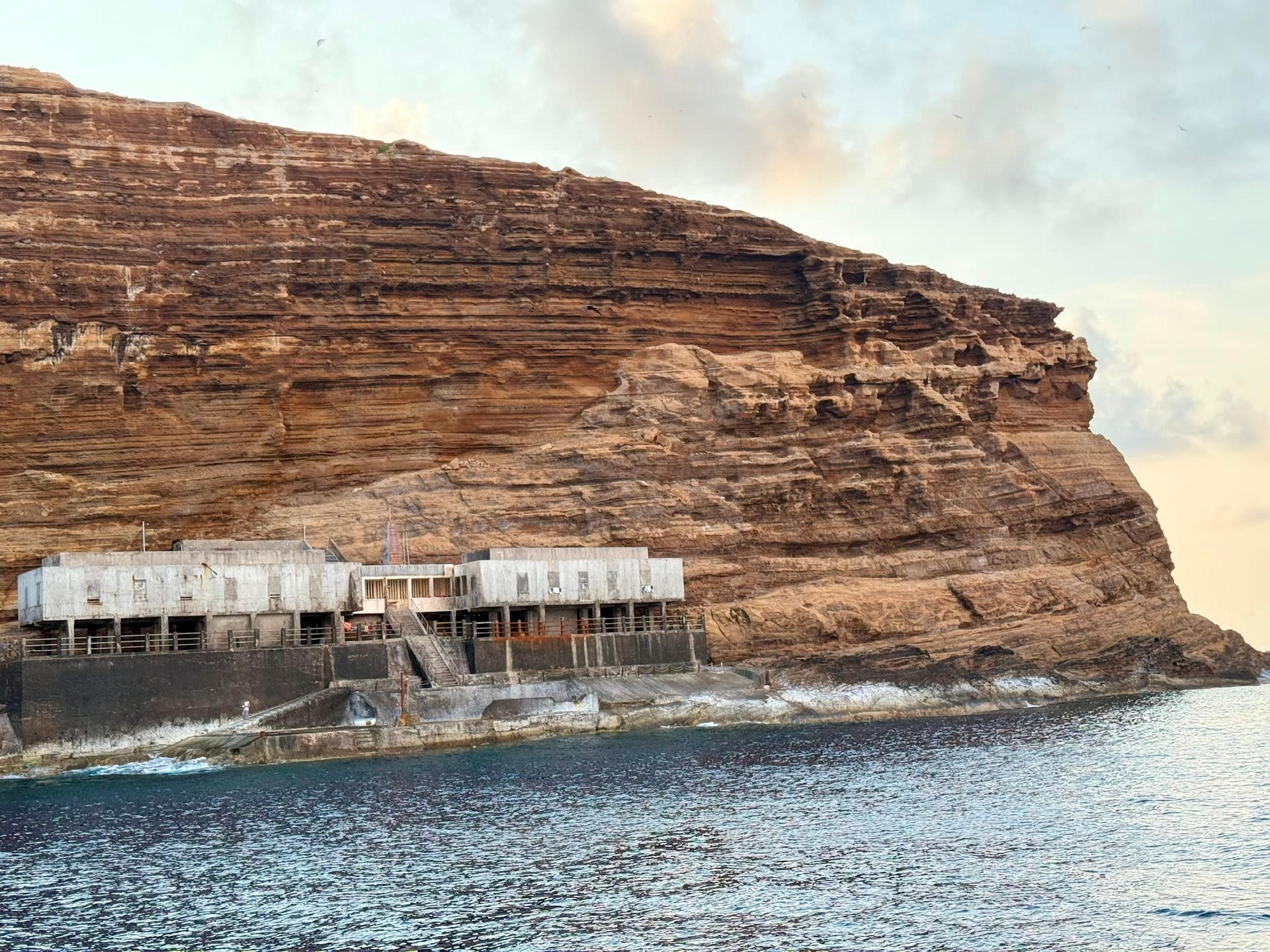
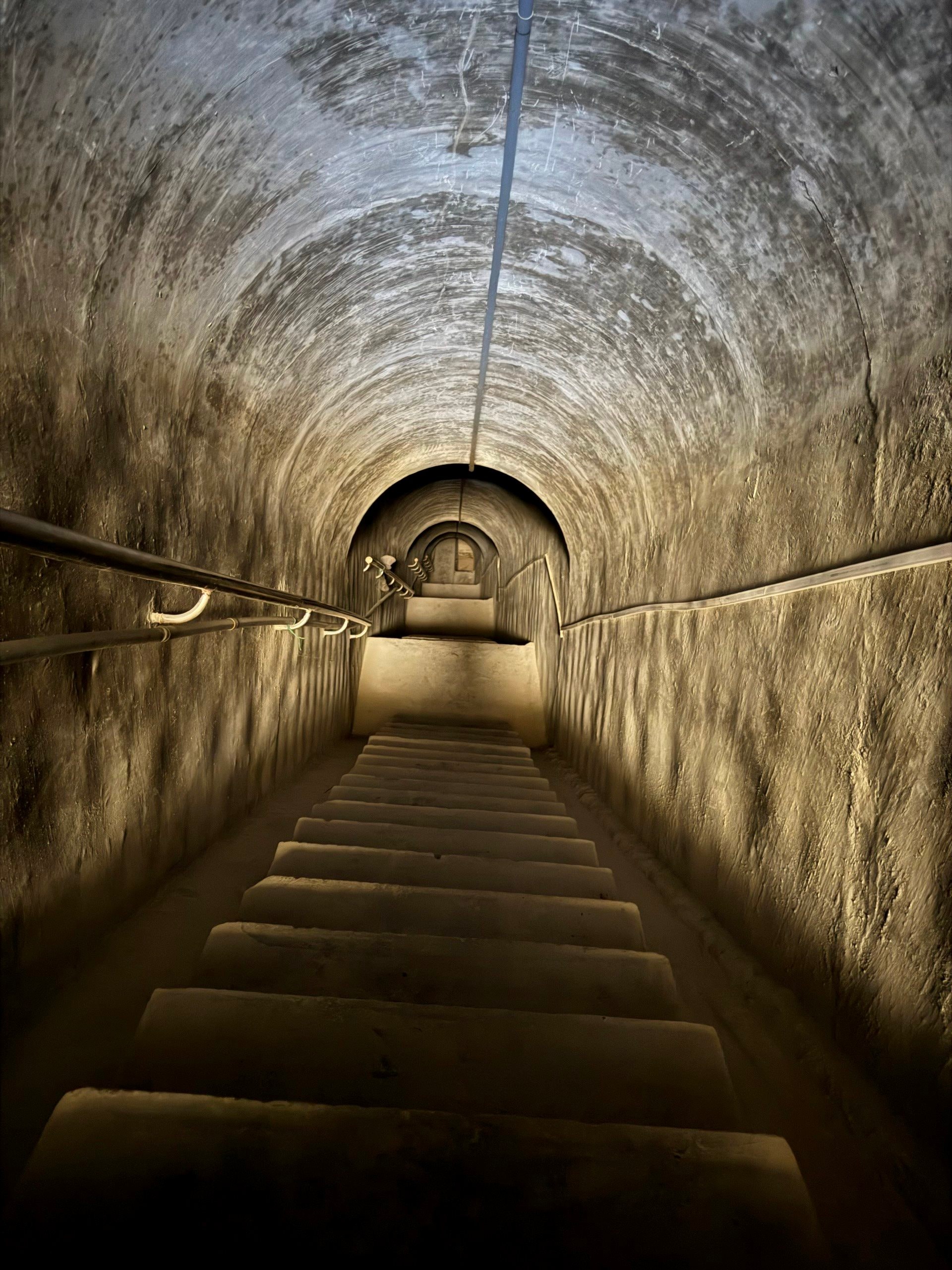
At the foot of the island is a concrete house - the workplace of officers and employees ensuring maritime safety. Also at this location, right above is the Vietnamese sovereignty landmark. Access to the island is often difficult due to strong and unexpected waves, even in calm seas, and there are dangerous reefs below. When arriving at the island, to reach the surface of the island, one must follow a tunnel with a slope cutting through the interior of the island with a length of about 170m.
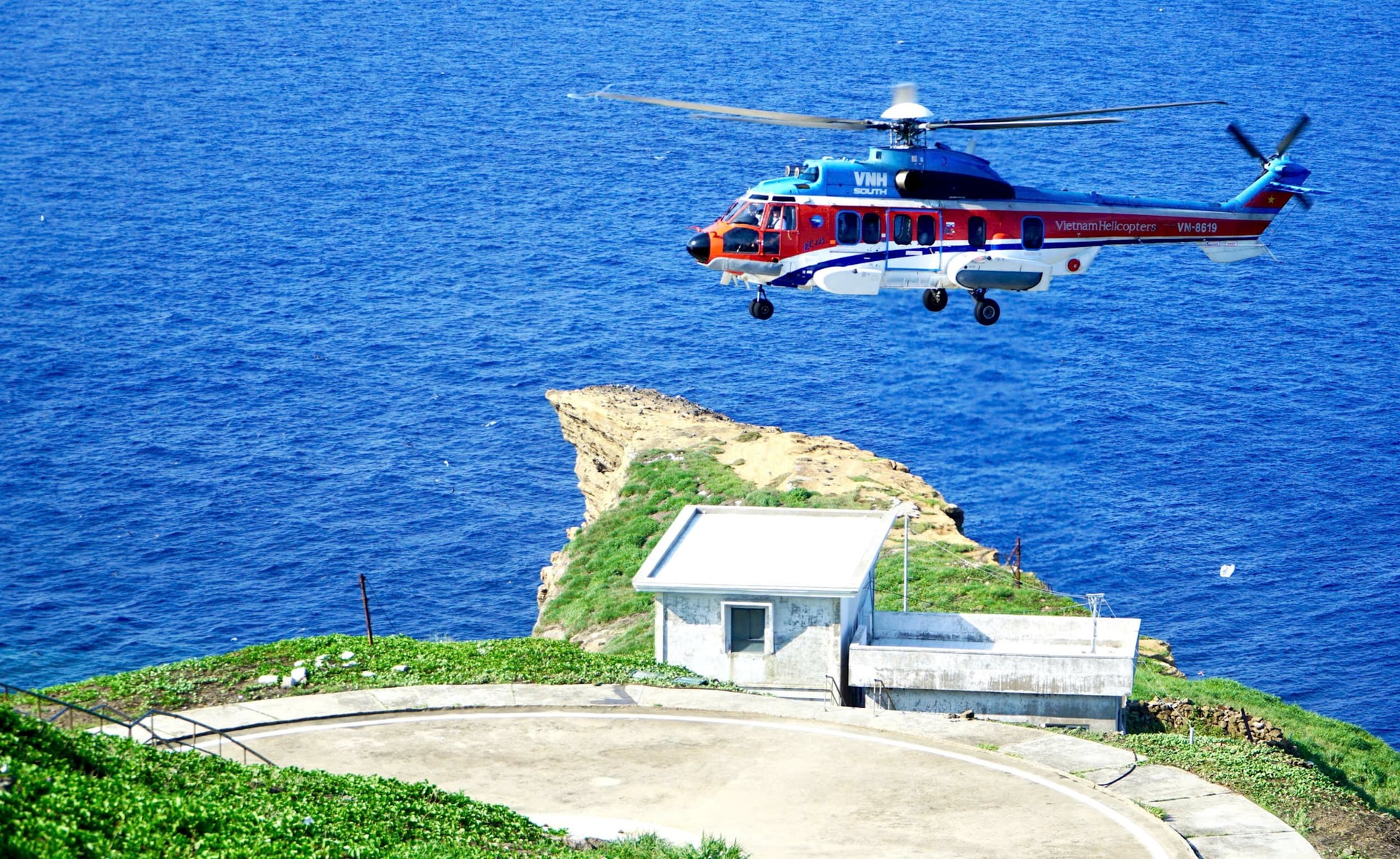
In addition to the offices of officers and employees ensuring maritime safety, the island currently has Hon Hai lighthouse, A6 landmark, and a helicopter landing pad.


Source: https://baobinhthuan.com.vn/dao-hon-hai-chu-quyen-thieng-lieng-cua-to-quoc-tren-vung-bien-binh-thuan-130369.html


Comment (0)