
Before 1975, when mentioning the two words Dong Bo, most Nha Trang people were hesitant. Hoang Nguu Son, commonly known as Dong Bo Mountain, has become an inviolable place. Both imbued with heroic legends as a stronghold of resistance forces since the time of fighting the French, and mysteriously dangerous, Dong Bo appears in everyone's mind as they themselves feel. Because, no one outside really knows what is hidden inside the majestic green mountain range running from East to West, bordering Dien Khanh, Cam Lam, Ninh Hoa, like a solid belt right next to the city embracing an entire area of empty fields and hundreds of hectares of mangrove forests. During the war, the sound of artillery shells and bombs echoed from there every day, sometimes planes circled the island with loudspeakers and dropped leaflets, the black smoke from fires and explosions rising from the mountain slopes kilometers away could still be clearly seen. Every night, from the windows in the inner city, I could see flares lighting up a corner of the western horizon, igniting many vague fears. It seemed like an unequal war was taking place there. My father worked at Nha Trang airport, and the fear of being shelled was real when the mountains there were less than 5km away as the crow flies. The most intense period was probably after the spring of Mau Than 1968, with fierce sweeps lasting for months, and it seemed like the entire Dong Bo mountain range would be leveled.
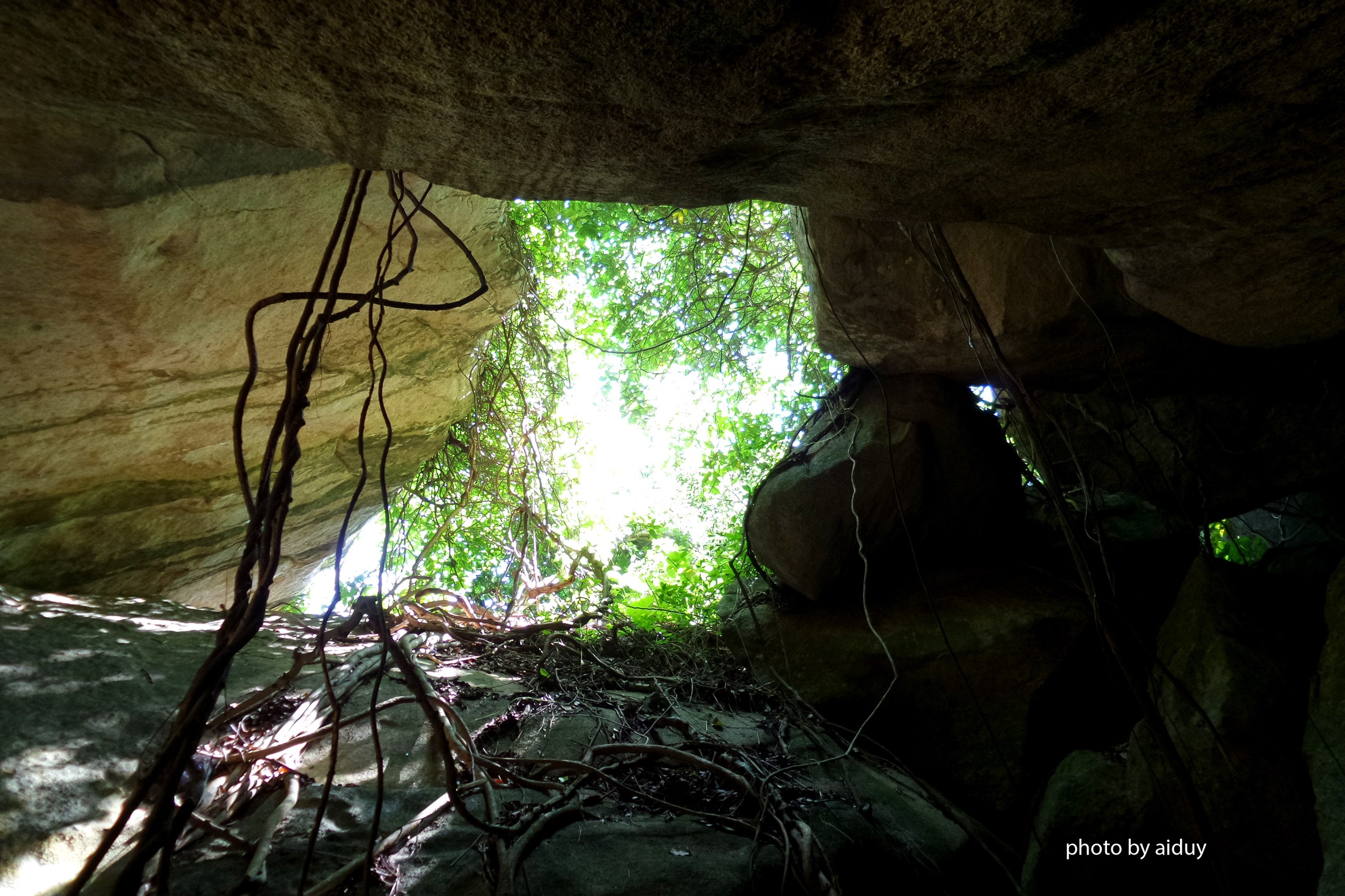 |
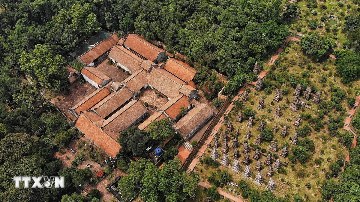
| Cave, Dong Bo Cave. |
At that time, the houses of the residential area were only located on this side of the Tac River, one of the branches of the river near the estuary, clinging to the vegetable fields outside the forest edge at the foot of the mountain. Everywhere you looked, you could see a desolate, undulating, forested area. In the dry season, the river slowly flowed through the mangrove forest, the mangrove forest, through the mangrove swamp to the estuary, the bottom was so shallow that you could barely walk across it. In the rainy season, it was the first time it flooded, everywhere you looked there were muddy, stagnant, stinking water, the land was salty and dry all year round. There were only a few winding, dusty, sun-burning trails leading to this area from behind Lu Gia Street (now Le Hong Phong Street), Dong Nai Street, Provincial Road... Children who were fond of having fun could only go as far as the rice fields to catch fish, not daring to go deeper or go to bed at dusk. Yet a gentle aunt of mine left everything behind to set up a hermitage there alone at home. The place where she established her hut was Thuy Tu, near the foot of Dong Bo Mountain. During the war, she remained quietly in seclusion in the hut, going back and forth to the city for two or three days a week and then stopping by my parents’ house. She gathered many bags of sugar, beans, fish sauce, salt, and medicine, an amount unimaginable for a monk like her. No one asked more, but perhaps everyone understood. Her hut was located at the edge of the forest by the river, where people who used the forest as their base would pass by on their way back to the city for work. Whether this supply was public or secret, it was still a precious and courageous thing. It was only much later, when I was old enough to ask her for confirmation, that she had passed away.
After 1975, the mountains and forests opened up, the children of the mountains and forests who had once suffered through hardships flew back to the plains with songs of triumph. The children of the city were hesitant and bewildered, going up the forest to touch the world that was once mysterious and taboo. During the post-war transitional period, full of famine and chaos, the Dong Bo mountains and forests became a shelter for many unfortunate people. Every early morning, across my house, groups of people would walk towards Dong Bo with hoes and machetes, carrying rice and water, and in the evening, they would carry their burdens and go back. That was the most popular job at that time: collecting firewood, burning charcoal, reclaiming land, hunting and gathering... Regardless of the thorny and pitiful trails up and down the fields, the salty alluvial reeds and mangroves that one had to wade through, everyone hurriedly went in. Even the threat to their lives from the old battlefields did not seem to discourage people. The mountains and forests always welcome people with open arms, regardless of who comes or goes.
 |
| The bridge on Phong Chau road leading to Dong Bo today. |
Students, cadres, and workers all contributed many working days in this land, clearing the land, building farms, and new economic zones. A vast resource area of thousands of hectares of wilderness was awakened, stirring to life. It was not until the 80s that it stopped, when the largest project, the city cemetery located at the end of the only road leading to it, was completed. This eternal resting place is dozens of hectares wide, cleared, leveled, hugging the mountainside, digging down a meter of land and hitting boulders. In the distance, the silent Hoang Nguu Son range is still there.
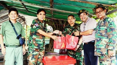
Finally, I was able to enter this mountain range, 9 years after the country's peace, with the very people who lived, ate, slept and fought throughout the war here. They are living witnesses to prove that once a person has determined an ideal, nothing can defeat him. That is Lieutenant Colonel Vo Hong Quan, who used his life to write the legendary "12 days and nights of fighting in the village" when he was the City Captain in 1968, which is passed down as part of the history of the revolutionary struggle of Nha Trang in particular and Khanh Hoa in general. That is a village boy named Giam, a member of the Grassroots Working Team who used to cross forests and wade through streams to return to the village like a shuttle to work as a liaison and mobilize the people. That is Cao Hoai Phong, a famous youth and student leader with secret activities in the inner city. They and many others, have grown up, sacrificed their youth and left from here. Standing with them on Hon Thi, looking at the city sparkling with electric lights in the sunset sky, I felt like I was immersed in the feeling of the years they lived and fought here.
The special geological structure of this area has created many large and small caves, the secret caves connecting each other along the vast mountain range. The caves go into the heart of the mountain, up and down with many nooks and crannies, the entrances are often narrow and hidden due to the large rocks piled up, but when going deep inside, they are very wide, airy and cool. Some caves can hold hundreds of people. The caves can connect with each other and have a water source underneath. No matter how quickly grenades and pepper balls are thrown into the mouth of the caves, they will roll down into the deep crevices and the people inside can still hold out because they can hide in the rocky crevices halfway up. With such terrain, it is easy to understand why, through many periods, from fighting the French to fighting the Americans, Dong Bo has always been a solid base, even though it is located next to the inner city and has always been a target for the contemporary government to concentrate firepower and fiercely attack. Famous for their large terrain and associated with historical events are the compounds that were named during the resistance war such as: Gop Da Hang, Gop Ong Phat, Gop Leo Day... in the east; in the west are Gop Kinh Tai, Gop Tuyen Huan, the frontline infirmary, Gop Suoi Lung... I saw with my own eyes the remaining traces of war, the bamboo stalls big enough for one person to lie on, tied to the cliff like a bird's nest, the field stoves located deep in the mountain to limit the smoke from escaping, the bags of chemical "powder" with the USA stamp still intact, left on the stream bank...
Nearly half a century of silence has passed, Dong Bo has gradually formed new urban areas with villa villages, high-rise buildings, and crisscrossing avenues with many different names, civilized and modern. The cave area and military bases have been renovated and invested in to bring visitors to the place. A clear water irrigation lake reflecting the poetic mountains and forests has also been formed - Kenh Ha Lake. Eco-tourism spots are expanding with beautiful names.
Does anyone remember having a Cow in their memory?
AI DUY
Source


Comment (0)