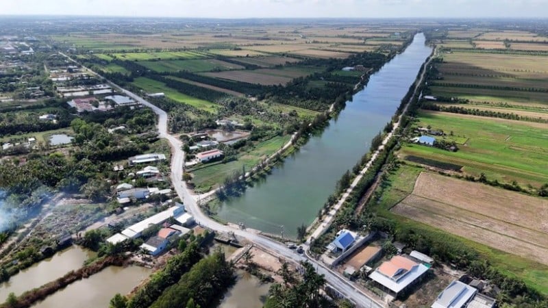
This is an important development step of remote sensing technology in Vietnam, opening up a new research direction in monitoring the quality of water ecosystems.
Chlorophyll-a (Chl-a) is a common biological indicator used to determine phytoplankton biomass in water. This substance is present in higher plants such as brown algae, green algae, cyanobacteria and is an indicator of the "health" and density of algae in aquatic ecosystems. The higher the density of algae, the lower the solubility of oxygen in water, causing harm to aquatic organisms.
Previously, monitoring Chlorophyll-a content often used automatic monitoring methods. However, this method is costly in terms of money, time and human resources when applied on a large scale.
Meanwhile, remote sensing technology can cover a large area, continuously updating information through satellite images. Currently, ocean remote sensing images are widely used to study suspended matter (SPM), Chl-a content or colored dissolved organic matter (CDOM).
The international cooperation task on science and technology at the Academy level "Research and development of Chlorophyll-a algorithm for VNREDSAT-1 images and equivalent", code: QTRU02.13/21-22 has been deployed and implemented on the basis of the seventh survey and research trip on biodiversity and biochemistry by the ship Academician Oparin in the waters of Vietnam between the Academy and the Pacific Institute of Bioorganic Chemistry (PIBOC), Far Eastern Branch - Russian Academy of Sciences - Russian Federation.
On the Vietnamese side, the Head of this research component is Master Chu Xuan Huy, Institute of Space Technology (now Vietnam Space Center) and on the Russian side, the Head of the mission is Dr. Dmitriy L.Aminin.
Master Chu Xuan Huy and his research team used remote sensing images from VNREDSAT-1 satellite, Vietnam's first satellite, and SENTINEL-2 satellite provided by the European Space Agency (ESA). The collected images were processed using mathematical formulas that combined the conversion of digital values of reflected energy images, geometric and atmospheric corrections suitable for practice, Acolite software...
The research team measured and collected water samples at 74 points, of which 52 points (70% of the samples) were used to build the model, and 22 points (30%) were used to evaluate the accuracy. The locations for collecting water samples were along the Huong River, Tam Giang Lagoon, Ha Trung Lagoon, Thuan An Estuary and the estuary and coastal areas of Hue City. This area is characterized by a coastal lagoon. Previously, the research team collected a set of spectral measurements and analyzed water samples at coastal estuaries in the Gulf of Tonkin, Nha Trang and the Mekong River.
According to Master Chu Xuan Huy, the study applied the OCx algorithm chain (x is from 1,2,3,4,5 to 6), which is the Chl-a calculation algorithm chain commonly used in marine research in the world from remote sensing images. However, in this research component, remote sensing images from VNREDSAT-1 satellite have four spectral channels (corresponding to wavelengths: Blue, Green, Red, Nir) and SENTINEL-2 satellite has an additional wavelength Blue 1, the research team determined that the OC3 and OC6 algorithms are suitable for calculating Chl-a content. In which, the OC3 algorithm has higher accuracy than OC6 and can be applied to coastal areas of Vietnam.
The results of water sample analysis in the laboratory when combined with the OC3 algorithm show that the coastal waters outside the sea have higher Chl-a concentrations than estuaries, lagoons, especially aquaculture areas. When comparing the Tam Giang lagoon area north of the Huong River with the Ha Trung lagoon in the south, the Chl-a concentration is higher towards the south. The OC3 algorithm applied to both types of satellite images achieved a determination coefficient R2 of more than 0.7 with VNREDSAT-1 and more than 0.8 with SENTINEL-2.
Dr. Nguyen Thanh Hoan, Institute of Earth Sciences, Vietnam Academy of Science and Technology said: The research contributes to training and fostering the young staff of the Vietnam Space Center and members participating in the mission. The research uses remote sensing methods, field measurements, modern object-oriented programming, suitable for the research content. The research selects a suitable algorithm to calculate Chl-a content for Vietnam's seas from satellite images VNREDSAT-1, SENTINEL-2...
The research results are the scientific basis for the application of remote sensing images in the management and monitoring of sea and river water quality on a large scale, helping to reduce time and costs compared to traditional methods.
Source: https://nhandan.vn/giam-sat-chat-luong-nuoc-ven-bien-bang-cong-nghe-vien-tham-post903154.html


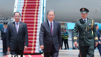
![[Photo] General Secretary To Lam receives Chairman of the National People's Congress of China Zhao Leji](https://vphoto.vietnam.vn/thumb/1200x675/vietnam/resource/IMAGE/2025/8/31/5af9b8d4ba2143348afe1c7ce6b7fa04)
![[Photo] The first meeting of the Cooperation Committee between the National Assembly of Vietnam and the National People's Congress of China](https://vphoto.vietnam.vn/thumb/1200x675/vietnam/resource/IMAGE/2025/8/31/f5ed4def2e8f48e1a69b31464d355e12)

![[Photo] Marching together in the hearts of the people](https://vphoto.vietnam.vn/thumb/1200x675/vietnam/resource/IMAGE/2025/8/31/8b778f9202e54a60919734e6f1d938c3)
![[Photo] National Assembly Chairman Tran Thanh Man welcomes and holds talks with Chairman of the National People's Congress of China Zhao Leji](https://vphoto.vietnam.vn/thumb/1200x675/vietnam/resource/IMAGE/2025/8/31/9fa5b4d3f67d450682c03d35cabba711)





![[Photo] The first meeting of the Cooperation Committee between the National Assembly of Vietnam and the National People's Congress of China](https://vphoto.vietnam.vn/thumb/402x226/vietnam/resource/IMAGE/2025/8/31/f5ed4def2e8f48e1a69b31464d355e12)

































Comment (0)