
In the past 24 hours, the city has had moderate rain, heavy rain, very heavy rain and thunderstorms, heavy rain concentrated from early morning on September 18. Total rainfall from 07:00/9/17 to 07:00/9/18 was commonly 20-60mm, some places had more such as Suoi Da 134.0mm, Linh Ung Pagoda 128.2mm, Da Nang 90.4mm, Thach Gian Lake 87.0mm, Son Tra 80.2mm, Cam Le 77.4mm.
Heavy rain has caused many roads and residential areas to be flooded, affecting people's lives and vehicle movement.
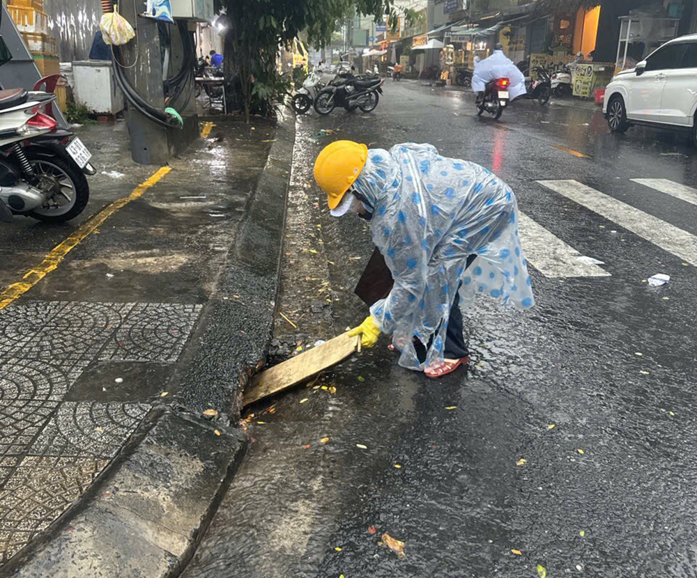
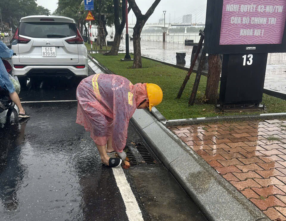
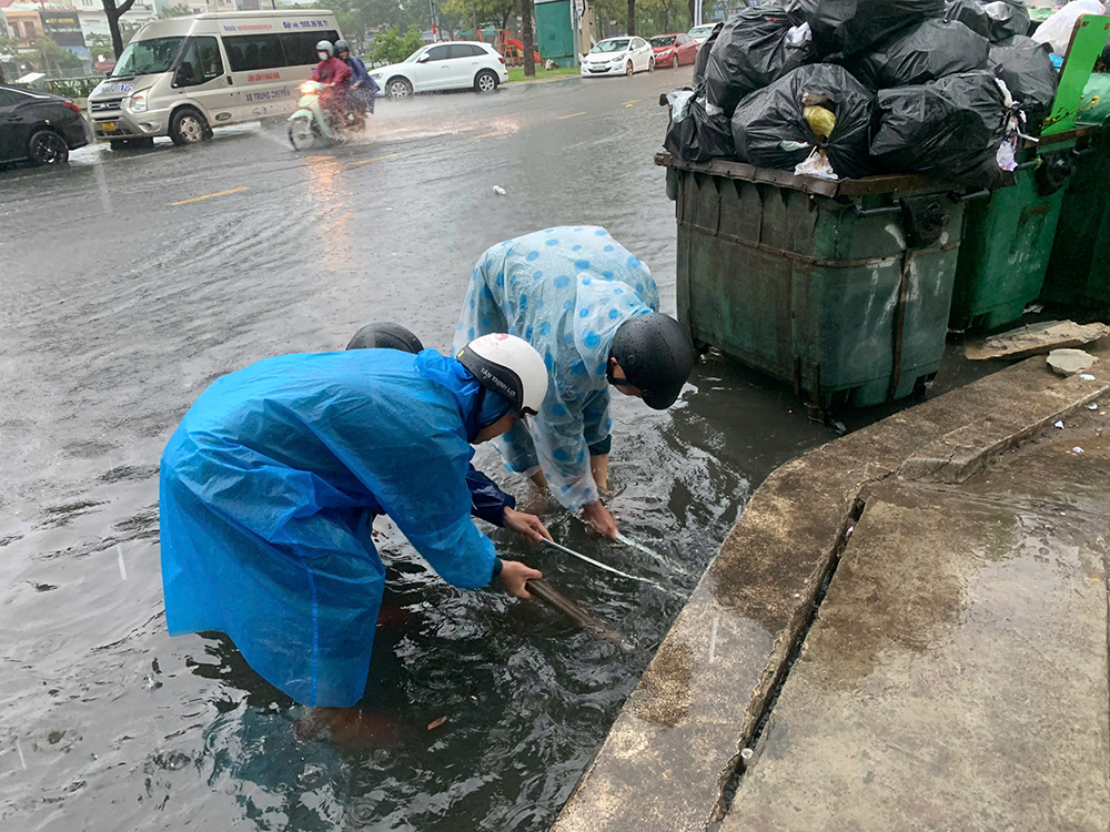
On the morning of September 18, while it was still raining heavily, environmental workers and local authorities urgently cleared manholes, sluices, and cleared water flows to help the water drain faster.
By 9:00 a.m. on September 18, the functional forces of Nai Hien Dong ward (Son Tra district) had handled local flooding, Van Don - Tran Thanh Tong street had good drainage; Ton Quang Phiet - Van Don street was still being handled.
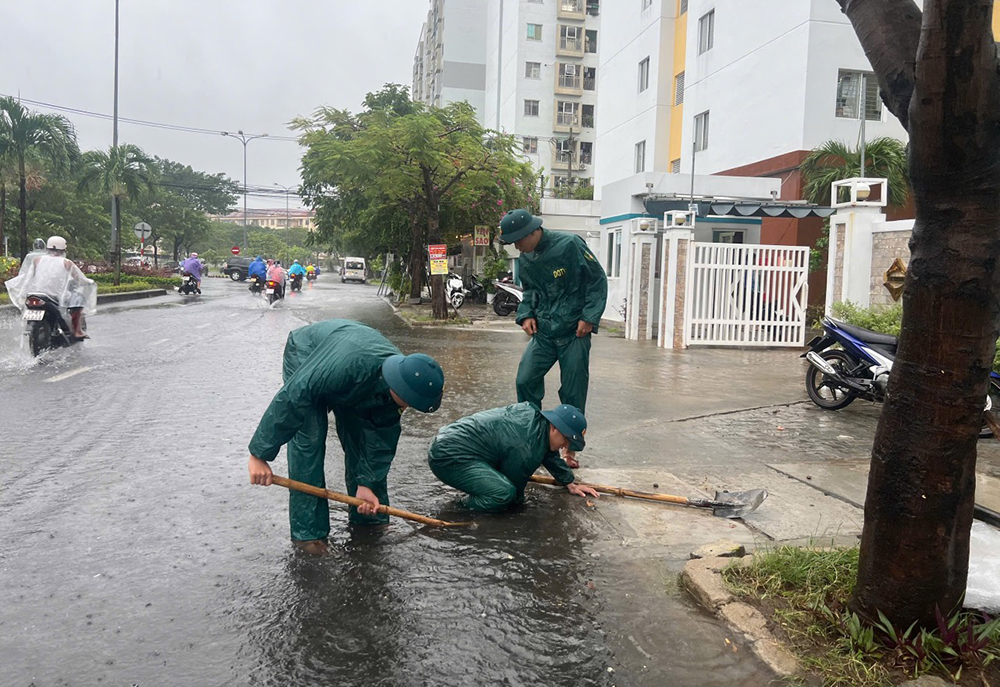
In Thanh Khe district, many forces coordinated to clear the flow of water so that the water could drain faster and vehicles could travel more conveniently.
According to the Urban Flood Prevention Scenario of the Department of Construction, the whole city has 124 locations at risk of flooding when heavy rain occurs. Of these, Hai Chau district has 12 locations; Thanh Khe district has 41 locations; Lien Chieu district has 29 locations; Son Tra district has 14 locations; Ngu Hanh Son district has 8 locations; Cam Le district has 18 locations; Hoa Vang district has 2 locations.
People can access the Flood Map of Da Nang City at: https://muangap.danang.gov.vn/ to monitor the situation and avoid traveling to areas and roads that are likely to be flooded.
According to the forecast of the Central Central Hydrometeorological Station, from today (September 18) to September 20, in Da Nang city, there will be heavy to very heavy rain: Lien Chieu, Thanh Khe, Hai Chau districts will have 100-300mm, some places over 400mm; Son Tra and Ngu Hanh Son districts will have 150-300mm, some places over 450mm; Cam Le and Hoa Vang districts will have 150-300mm, some places over 450mm; Hoang Sa island district will have 100-200mm, some places over 300mm.
Risk of flooding on roads and low-lying areas, especially high-risk wards such as: Nai Hien Dong, Man Thai, An Hai Bac, Phuoc My, An Hai Dong wards (Son Tra district); Thanh Khe Dong, Thanh Khe Tay Hoa Khe, An Khe, Tam Thuan, Chinh Gian, Thac Gian, Vinh Trung, Tan Chinh (Thanh Khe district); Thuan Phuoc, Hai Chau 1, Hai Chau 2, Phuoc Ninh, Binh Hien, Nam Duong, Thanh Binh, Thach Thang, Hoa Cuong Nam (Hai Chau district); Hoa Phat , Hoa An, Khue Trung (Cam Le district).
Maximum flooding depth is from 0.05-0.3m, deeper in some places. High risk of impact on residential areas, infrastructure in areas with steep slopes and narrow rivers and streams.
THANH NGUYEN
Source: https://www.danang.gov.vn/web/guest/chinh-quyen/chi-tiet?id=60773&_c=3


Comment (0)