
According to the National Center for Hydro-Meteorological Forecasting, currently (December 25), in the North, a cold air mass is moving south.
From around tomorrow night and December 27, this cold air mass will affect the Northeast and North Central regions.
From the night of December 27, the cold air will be strengthened and affect the Northwest and Central Central regions. The Northeast wind inland will strengthen to level 2-3, and coastal areas to level 3-4.

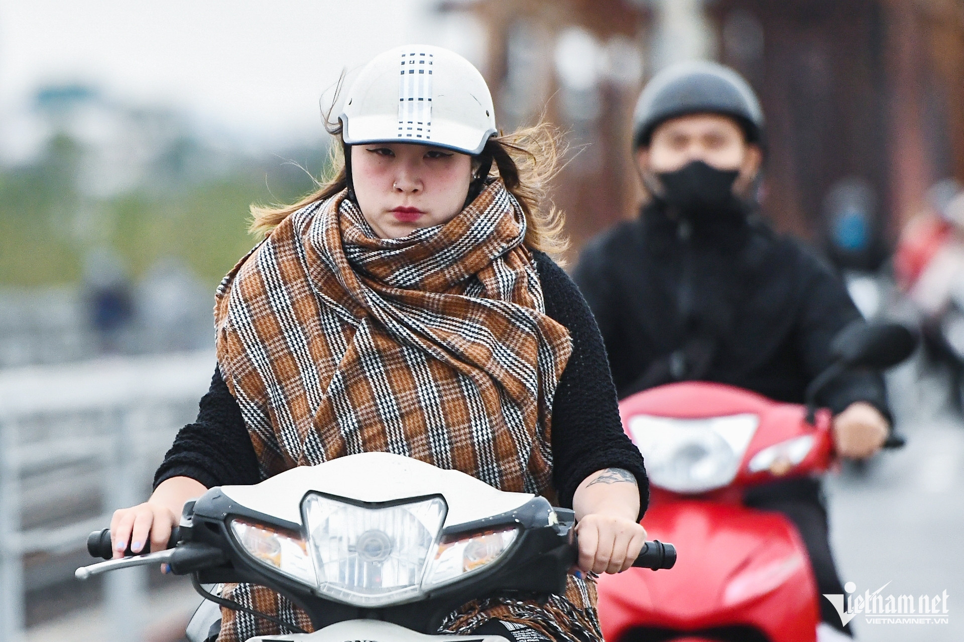
Due to the influence of cold air, in the North and the area from Thanh Hoa to Thua Thien Hue, the weather continues to be cold, with some mountainous areas in the North experiencing severe cold. The lowest temperature during this cold air mass in the North and North Central regions is generally between 12-15 degrees Celsius, with some mountainous areas below 10 degrees Celsius; in the area from Quang Binh to Thua Thien Hue, it is 15-18 degrees Celsius.
Hanoi weather is cold; lowest temperature is commonly 12-15 degrees.
Also due to the influence of the cold air strengthening, in the Central and South Central regions there will be rain, moderate rain, locally heavy rain and thunderstorms. During thunderstorms there is a possibility of tornadoes, lightning and strong gusts of wind.
In addition, from December 27, in the Gulf of Tonkin, the Northeast wind will increase to level 6, gusting to level 7-8; rough seas; waves will be 2-3m high. In the North East Sea (including the waters of the Hoang Sa archipelago), the Northeast wind will increase to level 7, gusting to level 9; rough seas; waves will be 4-6m high.
The sea area from Quang Tri to Ca Mau , the central East Sea area, the western sea area of the southern East Sea area (including the western sea area of Truong Sa archipelago) has strong northeast wind level 6, sometimes level 7, gusting to level 8-9; rough seas; waves 3-5m high.
The meteorological agency warns that thunderstorms accompanied by tornadoes, lightning and strong gusts of wind can affect agricultural production, cause trees to fall, damage houses, traffic works and infrastructure.
Heavy rain and localized heavy rain can cause flooding in low-lying areas; flash floods in small rivers and streams, and landslides on steep slopes.
Strong winds and large waves at sea are likely to affect boating and other activities.
Cold air is active, there is a possibility of many severe cold spells in the first month of the year.
Cold air is likely to be active, with many severe cold spells occurring in January and February 2025. ENSO is currently in a neutral state.
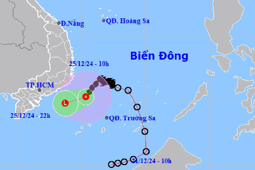
Storm No. 10 weakens into a tropical depression in the sea area of Khanh Hoa - Binh Thuan
Storm No. 10 (international name Pabuk) has weakened into a tropical depression in the offshore waters from Khanh Hoa to Binh Thuan.


![[Infographic] Circular guiding the functions, tasks and powers of the provincial Department of Culture, Sports and Tourism and the commune-level Department of Culture and Social Affairs](https://vphoto.vietnam.vn/thumb/402x226/vietnam/resource/IMAGE/2025/6/29/877f24989bb946358f33a80e4a4f4ef5)


Comment (0)