
Make sure you do it right the first time.
In accordance with Directive No. 22/CT-TTg dated July 23, 2024, of the Prime Minister on the 2024 land inventory and the guiding documents of the Ministry of Agriculture and Environment, the land inventory in Bac Ninh province has been implemented synchronously and systematically in the unique context of the province having just completed the administrative reorganization based on the merger of the former Bac Giang and Bac Ninh provinces. This is a large-scale inventory with a complex workload due to the need to simultaneously review administrative boundaries, cross-check historical data, and integrate data from the two provinces before the merger. The Provincial People's Committee promptly issued a detailed plan and guidelines; the Department of Agriculture and Environment organized professional training and established a Zalo group for 24/7 online technical support to promptly guide and answer questions for local authorities throughout the implementation process.
 |
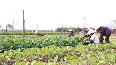
The inventory results show that industrial land has increased compared to the previous inventory. |
A key new feature of the 2024 land inventory is the standardized and comprehensively digitized implementation method, integrated into the unified software system of the Ministry of Agriculture and Environment . The process of delineating and mapping the current land use status is rigorously checked and verified, ensuring legality, consistency, and connectivity with the national land database.
According to the 2024 land inventory results, Nha Nam commune has a natural area of 3,438 hectares, accounting for approximately 0.73% of the total natural area of Bac Ninh province. The detailed inventory and mapping of each land parcel helps the locality clarify land use boundaries, limiting overlapping between residential land and agricultural land or public land – a problem that has existed for many years due to inconsistent cadastral records. According to Mr. Nguyen Van Viet, Head of the Economic Department of Nha Nam commune, from the beginning, the commune established a specialized working group, mobilizing officials to participate in reviewing records and unifying a single point of contact for data compilation. The inventory process was implemented according to the principle of "doing the easy things first, the difficult things later; ensuring accuracy at every step." Areas with complete cadastral records were mapped and updated early; complex land parcels with significant changes were subject to on-site inspections and cross-referencing with multiple sources before data compilation.
During the implementation process, the commune intensified exchanges and solicited opinions from residents in areas with significant land changes. This approach also helped Nha Nam to detect early cases of land misuse, abandoned land, or public land that was not being effectively utilized, thereby providing a basis for proposing appropriate management and utilization plans for the future.
Advantages in management and planning.
According to the 2024 land inventory results, Bac Ninh province currently has a total natural area of 471,375 hectares, distributed across 99 commune-level administrative units, including 33 wards and 66 communes. The land use structure shows that agricultural land accounts for the largest proportion with 342,545 hectares, equivalent to 72.67% of the natural area. Of this, rice cultivation land accounts for 102,730 hectares; perennial crop land accounts for 68,405 hectares; and forestry land accounts for 146,030 hectares, clearly reflecting the ecological characteristics and production structure of the midland and mountainous areas in the province. Notably, non-agricultural land covers 127,296 hectares, accounting for 27.01%, a significant increase compared to previous inventories. Residential land alone accounts for 32,357 hectares, with urban residential land showing a significant increase compared to the 2019 inventory. Non-agricultural production and business land is 11,942 hectares; industrial park and cluster land is 7,869 hectares, showing a clear trend towards industrialization and modernization. Unused land is only 1,534 hectares, accounting for 0.33% of the natural area. The majority of unused land has been put into use for infrastructure development, agricultural and forestry production, and other socio-economic objectives. It has also been reviewed and redefined according to administrative boundaries and actual measurements, thereby contributing to more efficient use of the local land resources.
Analysis of land use changes compared to the 2019 inventory shows that agricultural land decreased by 6,861 hectares, mainly due to conversion to residential land, industrial land, infrastructure land, and public works. Conversely, non-agricultural land increased by 8,424 hectares, notably the increase in urban residential land, industrial park land, production and business land, and land used for public purposes. This shift accurately reflects the pace of socio-economic development in Bac Ninh province in recent years, as industry continues to play a pivotal role, urbanization is progressing rapidly, and the demand for technical and social infrastructure is increasing. In particular, the accurate inventory of defense and security land has contributed to clarifying management boundaries and limiting overlaps and duplications as seen in some previous inventories.
The results of the land use inventory in the wards of Kinh Bac, Vo Cuong, Vu Ninh, Ninh Xa, Phu Khe, Dong Nguyen, etc., show a strong shift in land use structure towards increasing the proportion of urban residential land, technical infrastructure land, and service and commercial land, in line with urban development orientations. According to the head of the Economic Department of Vo Cuong ward, based on the inventory results and current land use maps, the ward will develop an effective land management plan with appropriate planning and development orientations for the future.
Based on the inventory results, Bac Ninh province clearly identifies the land fund currently in use according to each purpose, each user, and management. At the same time, it clarifies the unused land fund and its potential for future exploitation. This is an important basis for evaluating the implementation of the previous land use plan; and also serves to develop and adjust the land use plan for the next phase, in line with the two-tiered local government model and the requirements of sustainable development.
Source: https://baobacninhtv.vn/kiem-ke-dat-dai-2024-nen-tang-du-lieu-cho-quy-hoach-va-phat-trien-ben-vung-postid433502.bbg


![[Photo] Prime Minister Pham Minh Chinh attends the Conference on the Implementation of Tasks for 2026 of the Industry and Trade Sector](/_next/image?url=https%3A%2F%2Fvphoto.vietnam.vn%2Fthumb%2F1200x675%2Fvietnam%2Fresource%2FIMAGE%2F2025%2F12%2F19%2F1766159500458_ndo_br_shared31-jpg.webp&w=3840&q=75)


Comment (0)