
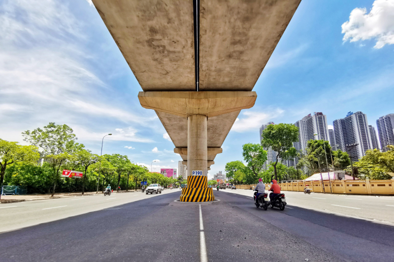
It is forecasted that today (August 4), severe and especially severe heat will continue to occur in the North (except Lai Chau and Dien Bien ) with the highest temperature commonly ranging from 36-38 degrees, some places above 39 degrees. The lowest relative humidity is commonly 55-60%. From August 5, the heat will gradually subside.
The area from Thanh Hoa to Da Nang , the East of the provinces from Quang Ngai to Dak Lak and Khanh Hoa, the highest temperature is commonly 35-38 degrees, some places over 38 degrees. The lowest relative humidity is commonly 50-55%. The heat here is likely to last for many days to come.
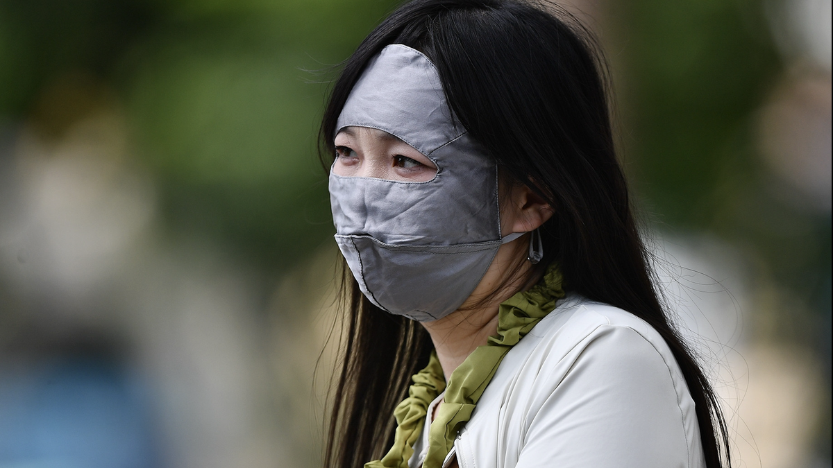
Due to the effects of heat and intense heat combined with low humidity in the air, there is a high risk of explosions and fires in residential areas due to increased demand for electricity and the risk of forest fires. In addition, heat can also cause dehydration, exhaustion, and heat stroke in the human body when exposed to high temperatures for a long time.
Hydrometeorological experts note that the forecast temperature and the actual felt temperature outside can differ by 2-4 degrees, or even higher depending on the conditions of the surface such as concrete and asphalt.
Weather nationwide on Monday (August 4), Hanoi capital is cloudy, hot and sunny during the day, especially hot in some places; cloudy in the evening and at night, with scattered showers and thunderstorms, locally heavy rain. Light wind. Lowest temperature 26-28 degrees. Highest temperature 37-39 degrees, some places over 39 degrees.
The Northwest is cloudy, hot and very hot during the day, with some places experiencing extremely hot weather (except Lai Chau and Dien Bien); cloudy in the evening and at night, with moderate rain, heavy rain and thunderstorms, with some places experiencing very heavy rain. Light wind. Lowest temperature 24-27 degrees, with some places experiencing below 27 degrees. Highest temperature 36-38 degrees, with some places experiencing above 39 degrees; Lai Chau-Dien Bien 30-33 degrees.
The Northeast is cloudy, hot and very hot during the day, especially hot in some places; cloudy in the evening and at night, with scattered showers and thunderstorms, locally heavy rain in some places, especially in the mountainous and midland areas with moderate rain, heavy rain and thunderstorms, locally very heavy rain in some places. Light wind. Lowest temperature 25-28 degrees, in mountainous areas below 24 degrees. Highest temperature 36-38 degrees, in some places above 39 degrees.
From Thanh Hoa to Hue, it is cloudy, hot and very hot during the day; showers and thunderstorms in some places in the afternoon and evening. Southwest wind level 2-3. Lowest temperature 28-31 degrees. Highest temperature 36-38 degrees, some places over 38 degrees.
The South Central Coast is cloudy, sunny and very hot during the day, especially in the East of Lam Dong province; showers and thunderstorms in some places in the afternoon and evening. Southwest wind level 2-3. Lowest temperature 26-29 degrees. Highest temperature 36-38 degrees, some places above 38 degrees; especially in the East of Lam Dong, 31-33 degrees.
Central Highlands: Cloudy, sunny during the day; showers and thunderstorms in some places in the evening and at night. Southwest wind level 2-3. Lowest temperature 21-24 degrees. Highest temperature 29-32 degrees.
The South is cloudy, sunny during the day; showers and thunderstorms in some places in the evening and at night. Southwest wind level 2-3. Lowest temperature 25-28 degrees. Highest temperature 32-35 degrees, some places over 35 degrees.
Ho Chi Minh City is cloudy, sunny during the day; showers and thunderstorms in some places in the evening and at night. Southwest wind level 2-3. Lowest temperature 26-28 degrees. Highest temperature 32-35 degrees, some places over 35 degrees.
Source: https://cand.com.vn/Xa-hoi/mien-bac-nang-rat-ngot-ngat-tren-39-do-c-chieu-toi-do-mua-i776929/


![[Infographic] Traditional friendship and good cooperation between Vietnam and Egypt](https://vphoto.vietnam.vn/thumb/402x226/vietnam/resource/IMAGE/2025/8/4/9a2112b4046e4c128fdcb5403489866a)


Comment (0)