
It can be affirmed that, through thousands of years of history, Ha Giang land bears the mark of the nation's construction and defense of the Vietnamese people. The vestiges of the Paleolithic period found in some archaeological sites show that the primitive inhabitants were present here over 80,000 years ago. The development process of the inhabitants of Ha Giang land continues to be recorded with many sites and artifacts discovered in the Neolithic period, Bronze Age and later periods. About 2,000 years ago, in the development of the Bronze Age, bronze drums with very sophisticated decorative art could be seen in many places in Ha Giang land, some bronze drums even exist in the daily life of the Lo Lo community to this day. Ha Giang today is the northernmost land on the map of Vietnam, where there is the sacred Lung Cu National Flagpole.
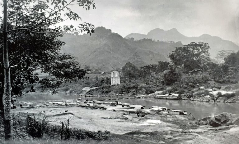
Scene of boats trading on the Lo River flowing through Ha Giang City
Regarding the current name of Ha Giang, according to the explanation of the elders in Ha Giang and the historical researchers we have discussed, it is known that the word Ha and the word Giang in Sino-Vietnamese both mean river. Ha is the word for a small river, Giang is a large, long river. With the terrain of Ha Giang, along the North-South axis, there are many small rivers and streams flowing into the large river, the Lo River, the most typical is in the center of Ha Giang City, where the Mien River flows into the Lo River, the main river in Ha Giang, with the connecting point at the Gac Di bridge area, in Quang Trung ward. This is also considered the origin of the Lo River from Ha Giang land. After many historical changes and the development of each period, the name Ha Giang may have originated from that characteristic.
Regarding the time of the appearance of the name Ha Giang, according to historical studies related to the land of Ha Giang in many documents provided and discussed with us by comrade Bui Van Tan, Director of Ha Giang Provincial Museum, Dr. Pham Van Trieu, an officer of the Vietnam Institute of Archaeology and a number of research experts, such as the books: Dai Nam Nhat Thong Chi; Hoang Viet Nhat Thong Chi; Khang Chien Chong the Yuan-Mongol army and the book Tu Binh Thuc Luc... Accordingly, the name of Ha Duong Pass (Ha Giang) has existed since at least the Tran Dynasty. The name Ha Duong could have appeared earlier, but we still do not have the conditions to research and investigate all the ancient documents.
According to ancient documents, from the Tran Dynasty, around the 13th century, the name Ha Duong was the name of a crowded residential and commercial area (from Duong Tien Han, it was also read as Giang). The crowded residential and commercial area of Ha Duong was identified as belonging to the area of Ha Giang City today. According to Dr. Pham Van Trieu, Vietnam Institute of Archaeology, the name Ha Duong means a bright land by the river, favorable for trade and development. The word Duong can also be read as Giang, so Ha Duong can be read as Ha Giang.
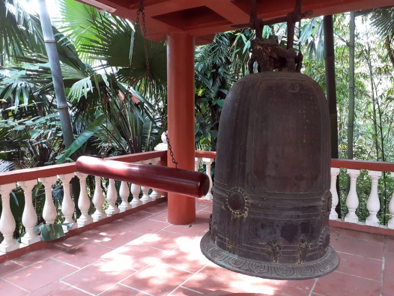
The specific name of the place name Ha Giang is mentioned on the inscription engraved on the bell of Sung Khanh pagoda, Dao Duc commune, Vi Xuyen, Le dynasty, year 1707.
Through the development process, until the early 18th century, the name Ha Duong was still maintained for the land of Ha Giang. The place name Ha Duong (Ha Giang) is specifically mentioned on the inscription on the bell of Sung Khanh pagoda, Dao Duc commune, Vi Xuyen district. This bell was cast in 1707 under the Le dynasty, at that time the land of Ha Giang (not as complete as it is now) was called Ha Duong fort.
Reviewing the development process of Ha Giang land in the history of building and defending the country of our people, according to historical data, from the Van Lang - Au Lac period, Ha Giang belonged to Tay Vu Department. During the period of domination by the Northern feudalism, Ha Giang area belonged to Tay Vu district, Giao Chi district. When the country gained independence, freed from the yoke of the Northern feudalism, from the Ly dynasty, Ha Giang land belonged to Binh Nguyen district. During the Tran dynasty, Ha Giang land belonged to Tuyen Quang district, Quoc Oai road. During the Nguyen dynasty, in 1842, Tuyen Quang was divided into 3 districts, including Ha Giang, Bac Quang and Tuyen Quang districts.
In 1858, French colonialists invaded our country. Faced with the weakness of the Nguyen Dynasty, the French colonialists gradually annexed the provinces. It was not until 1887 that they conquered the Ha Giang area. Under the rule of French colonialists, on August 20, 1891, Governor-General of Indochina De Lanetxang decided to divide the Second Military Zone (Ha Giang was then in the Second Military Zone) into three provinces, including: Lang Son Province, Cao Bang Province, and Ha Giang Province. Ha Giang Province at this time included Tuong Yen Prefecture and Vinh Tuy District. Before the August Revolution in 1945, Ha Giang had 4 districts and 1 town (Bac Quang, Vi Xuyen, Dong Van, Hoang Su Phi, Ha Giang Town). In 1959, President Ho signed a decree to merge Ha Giang Province into the Viet Bac Autonomous Region. In 1976, the two provinces of Ha Giang and Tuyen Quang were merged into Ha Tuyen Province. In 1991, the National Assembly decided to divide Ha Tuyen province into two provinces, Ha Giang and Tuyen Quang.
Up to now, through many administrative arrangements and changes, Ha Giang province has 11 districts, cities, 193 communes, wards and towns with a population of over 854 thousand people; area of 7,929.5 km2. In 2010, Ha Giang town, the center of the province, was recognized by the Central Government as a city, a type III urban area.
In the journey of thousands of years of building and defending the country of the nation and in 130 years of formation and development, Ha Giang is a locality with many disadvantages because it is located in a remote, isolated place, with difficult trade due to mountainous terrain and division. In the renovation process, from the conditions of a mountainous, border province, Ha Giang is considered the place with the most rocks in the country, the place with the least arable land in the country, the place that emerged from the war the latest in the country and is one of the most difficult provinces in the country... But now, the Party Committee, government and people of all ethnic groups in Ha Giang are rising day by day, strongly exploiting potentials, advantages, taking shortcuts, taking the lead; promoting the strength of great solidarity of ethnic groups; mobilizing maximum resources, gradually perfecting infrastructure, caring for people's lives; ensuring national defense and security, maintaining national border sovereignty; striving to develop Ha Giang's socio-economic development in the northern mountainous region in the coming time.
Huy Toan
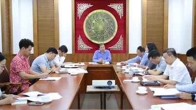
![[Photo] Standing member of the Secretariat Tran Cam Tu chaired a meeting with Party committees, offices, Party committees, agencies and Central organizations.](https://vphoto.vietnam.vn/thumb/1200x675/vietnam/resource/IMAGE/2025/7/1/b8922706fa384bbdadd4513b68879951)


Comment (0)