Geospatial technology, with its combination of advanced techniques, is making a significant contribution to solving interdisciplinary problems and to territorial and resource management.


Emphasizing that the movement of nature is constantly and continuously changing geographical phenomena, experts believe that in the coming time, Vietnam needs to continue focusing on investing in and applying "new technologies in the acquisition, processing, updating, and sharing of geospatial data" to develop socio -economic activities; prevent and mitigate natural disasters, conduct rescue operations, as well as address environmental incidents and respond to climate change more effectively.
To gain a better understanding of this issue, the TN&MT Newspaper conducted an interview with Dr. Nguyen Phi Son - Director of the Institute of Surveying and Mapping Science - regarding the role of geospatial data, as well as some research tasks and solutions, and the application of new technologies in the acquisition, processing, and updating of geospatial data in the future.

Mr. Nguyen Phi Son: Geospatial data plays a very important role in all national economies, especially in the 4.0 era. With the development of digitization programs, geospatial data serves as input for various fields, sectors, and levels in state management, social management, economic development, environmental protection, climate change adaptation, and national defense and security.
The national geographic database comprises seven basic data packages (topographic data, hydrological data, transportation data, vegetation cover data, population data, administrative boundary data, and surveying base data). Characterized by large-scale data sets, high spatial detail, and the maximum level of object attributes, it ensures maximum information exploitation for numerous ministries and sectors, making a significant contribution to the management, design, and construction activities of surveying industries and the creation of thematic and specialized maps in various fields. Furthermore, depending on the territorial scale and the size of the national geographic database, localities apply the national geographic database in territorial management, administrative management, and social management.

Furthermore, geospatial information plays a crucial role in natural resource management and environmental protection. Geographic data serves as a basis for supporting environmental impact assessments, strategic environmental assessments, environmental status assessments at all levels, ecosystem management, conservation and sustainable development of natural landscapes; it also supports the establishment of climate and meteorological states, and weather processes in space and territories. Having geographic data helps determine the extent of impacts in each locality and territory due to climate change, the extent of sea level rise, disaster risk assessment, the vulnerability of ecosystems, etc., and it also plays a role in many applications across nine fields within the Natural Resources and Environment sector.

Mr. Nguyen Phi Son: In our country, the Government and state management agencies have long recognized the importance and immense benefits of geospatial data. For many years, ministries and sectors in general, and the Ministry of Natural Resources and Environment in particular, have focused on investing in building a geospatial data system to serve the needs of state management, socio-economic development, and national defense and security.
From 2008 to 2012, the Government invested in the surveying and mapping sector, including two government projects: "Establishing a national geographic information database at a scale of 1:10,000 with a digital elevation model covering the entire country" and "Establishing a national geographic information database at scales of 1:2,000 and 1:5,000 for urban areas, industrial zones, and key economic zones." To date, the data serving the construction of the national geographic spatial data infrastructure includes both framework datasets and specialized data.

Basic surveying and mapping information and data, including the national surveying reference point system, national surveying networks, national geographic base, topographic maps, national borders and administrative maps, aerial photographs, remote sensing data, and place name data, are fully compiled according to unified data standards.
In addition, many specialized datasets have been created by various fields such as: land data, water resources, marine resources, forest resources, geology and mineral resources, meteorology and hydrology... all of which are basic survey data linked to location information, forming complete geospatial data, thereby helping management agencies make correct, timely and comprehensive decisions.
Among the fundamental measurements in the field of geodesy and cartography, the measurement of "gravitational acceleration," also known as "gravity," requires complex instruments and methods. Over the past years, the Institute of Surveying and Mapping Sciences has successfully implemented gravity measurement projects such as: "Building and perfecting the State gravity system"; Establishing a network of absolute gravity points on islands and along the Vietnamese coast to serve the monitoring of average sea level rise; and "Measuring the base gravity and satellite gravity of base gravity points in the period 2016-2018 within the national gravity system to determine changes in the gravitational field across Vietnam."
Currently, the Institute is participating in a project to conduct detailed aerial gravity measurements in mountainous areas using the aerial gravity method... This is an important task of basic research in our country, alongside other basic research projects. Gravity projects contribute to the completion of national basic data, which will serve many industries, fields, and purposes... The results of these gravity measurement projects carried out by the Institute of Surveying and Mapping Science have effectively served research in the field of Earth science.

Mr. Nguyen Phi Son: The process of socio-economic development and the movement of nature constantly and continuously change geographical objects and phenomena. This leads to the national geographic database becoming outdated over time if it is not updated in a timely manner. To have a foundational database that is updated promptly, unified, and synchronized nationwide, serving socio-economic development, national defense, security, resource and environmental management, disaster prevention and control, rescue operations, climate change adaptation, and public awareness, solutions in database creation and updating have gradually moved towards automation in the production process to replace the traditional methods.
In recent years, the Institute of Surveying and Mapping Science has intensified research and application of new and modern technologies in the acquisition, processing, updating, and sharing of geospatial data, such as combining data from multiple sources, applying quality control measures, and acquiring, processing, and extracting data using AI and voluntary geographic information systems (VGI)... These technologies help increase speed, accuracy, reliability, and reduce costs for data updating.

In the coming period, given the strong development of modern technologies in data acquisition, the Institute will continue to research, focus on investing in, and upgrade new technologies in geospatial data sharing. Along with that, the Institute will continue to form high-level specialized research groups in a number of complex research directions and those that are technologically oriented for the industry; strengthen research linkages between state management agencies, research organizations, universities, businesses, and independent experts in scientific research to research and develop technologies both globally and in accordance with Vietnam's conditions.

Nguyen Thuy (compiled)

Geographic Information Systems (GIS) are becoming increasingly important in many fields. However, as the amount of spatial data increases exponentially, traditional GIS methods face challenges in processing and analyzing such large datasets. In recent years, artificial intelligence (AI) has developed rapidly, and the combination of AI and GIS (GeoAI) is opening up enormous possibilities, improving productivity and work quality, quickly meeting user demands, and bringing incredible applications in many different fields.

According to Mr. Nguyen Van Thao, M.Sc., of the Vietnam Association of Surveying, Mapping and Remote Sensing, the GeoAI approach is a suitable choice for basic research and providing foundational data, such as in the field of Surveying and Mapping. Research and development of a system to support the automated updating of geographic databases is a necessary and highly relevant direction for Vietnam, especially for units responsible for establishing and updating large-scale national geographic databases in the context of national digital transformation.
In this context, AI is transforming spatial data analysis by providing advanced tools and techniques for processing and analyzing vast amounts of spatial data, including information about the Earth's surface, such as remote sensing imagery, aerial imagery, and GIS data. AI algorithms and computer vision techniques are used to detect and extract meaningful objects from spatial data. These techniques enable automated data processing, pattern recognition, and advanced analysis, significantly improving the efficiency and accuracy of spatial data analysis.
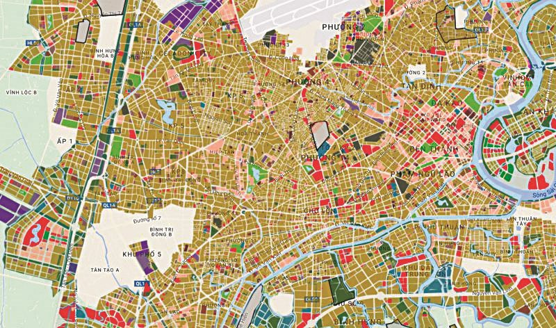
In particular, the use of AI in GIS is a new development direction in the 4.0 Revolution, bringing practical and significant benefits to geographic science to improve the efficiency of data processing and analysis, and to make decisions quickly and accurately, bringing sustainable benefits to commercial organizations and governments to promote innovation and maintain sustainable development of the world.
For the field of natural resources and environment, the use of integrated technologies such as geographic information systems, remote sensing, and global positioning systems allows for the creation of an updated solution for data building, efficient analysis of changes, and rapid decision-making support on a wide scale at the lowest cost compared to traditional methods in land and environmental resource management.

The combination of AI and geographic information systems (GeoAI) is opening up enormous possibilities. Seizing this opportunity, the Institute of Surveying and Mapping Science has recently been researching and developing new applications and products in the field of surveying and mapping. Dr. Nguyen Thanh Thuy, Head of the Department of Science, Training, International Cooperation and Journals at the Institute of Surveying and Mapping Science, stated that through scientific projects, experts and scientists have established practical theories, providing a foundation for the surveying and mapping industry to take the right steps, ensuring alignment with the global development of GeoAI and its connection to socio-economic development, resource management, and environmental protection.

In Vietnam, the Strategy for the Development of the Surveying and Mapping Industry and the Construction of the National Geographic Spatial Data Infrastructure to 2030, with a vision to 2045, was approved by the Government in Resolution No. 40/NQ-CP dated March 27, 2023. The Strategy prioritizes research into several core technologies such as cloud computing, artificial intelligence, and big data analytics in the acquisition, updating, processing, and provision of information, data, surveying and mapping products, and the national geographic spatial data infrastructure. This is a crucial direction for developing the national geographic spatial data infrastructure as a fundamental foundation, providing geographic spatial data services to various sectors and fields to meet state management requirements, support digital transformation, build e-government, and move towards a digital government, digital economy, digital society, and smart cities. Therefore, researching the use of AI in GIS in Vietnam is a top priority that scientists are interested in, researching, and promoting in the coming time.
According to Ms. Nguyen Thanh Thuy, the top priority is currently training and developing high-quality human resources for the surveying and mapping industry to access advanced technologies worldwide. In addition, businesses, organizations, and individuals need to innovate technology and invest resources to keep up with trends... To achieve this, an effective and efficient collaboration between the "three stakeholders" is needed: Science and Technology - the State - Businesses.
Viet Anh

Regulations on the establishment and updating of the national geographic database are specifically stipulated in Articles 10, 15, and 16 of the 2018 Law on Surveying and Mapping. Accordingly, the national geographic database and national topographic maps must be fully and accurately updated according to national technical standards and regulations, promptly meeting the requirements of state management by ministries, sectors, and localities; serving economic and social development, national defense, security, and disaster prevention.

According to the Law on Surveying and Mapping of 2018, the Ministry of Natural Resources and Environment (MONRE) is the focal agency assisting the Government in the state management of surveying and mapping nationwide. MONRE is responsible for managing, storing, and providing information, data, and products of the national geographic database and national topographic maps; it is responsible for building and updating the national geographic database on land, the national topographic map system on land, the national topographic database and maps for islands and archipelagos, and seabed topographic maps at a scale of 1:10,000 and smaller; and operating the national geographic database within its management scope.
Accordingly, the process of establishing and updating the national geographic database is carried out using satellite imagery, aerial imagery combined with field surveying. On the other hand, due to societal demands for geographic information that is faster and more timely—meaning data must always be updated to ensure its timeliness—the process of updating geographic spatial data and the Spatial Data Infrastructure (SDI) is now shifting to being event-based—rather than cyclical time-based.

Furthermore, the regulations on the establishment and updating of the national geographic database and topographic maps are specifically stipulated in the Law on Surveying and Mapping, stating that the national geographic database must be updated every 5 years, including traffic and population data, with periodic updates, immediate updates for areas experiencing unusual changes, or renewal when changes exceed 40%.
Although specific regulations exist regarding the establishment and updating of the national geographic database and topographic map, in recent times, the updating of the national geographic database and topographic map has not been timely. Many areas of information in the national geographic database and topographic map are outdated, no longer relevant, lack new information, and are not very effective...

The surveying and mapping industry, with its responsibility to provide timely, accurate, and complete information to society, all levels of government, sectors, and economic components, requires technological solutions to make updating faster, more timely, more continuous, and especially to reduce product costs. This is requiring the Institute of Surveying and Mapping Science to prioritize research towards gradually "automating" the updating process based on technologies such as digital imagery, point cloud, machine learning, and deep learning.
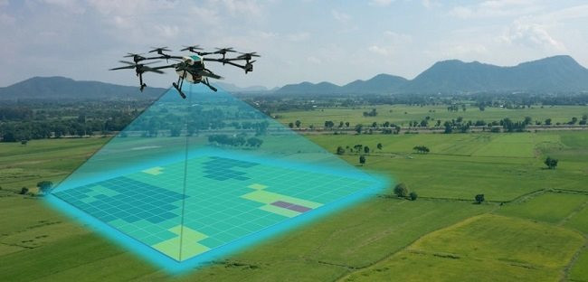
To gradually "automate" the process of updating the national geographic database, the Institute is also focusing on researching and applying advanced methods and technologies to build systems for acquiring, processing, integrating, storing, and providing surveying and mapping data, and a national geographic information system to ensure the construction of a map database that meets the needs of socio-economic development and national security and defense.
Minh Khang
Source





![[Image] Ho Chi Minh City simultaneously commences construction and breaks ground on 4 key projects.](https://vphoto.vietnam.vn/thumb/1200x675/vietnam/resource/IMAGE/2026/01/15/1768472922847_image.jpeg)


Comment (0)