
According to historical records, from the 17th century onwards, groups of "Ngũ Quảng migrants," following the policies of Lord Nguyễn, sailed to Bình Thuận in particular and the South in general to reclaim land and establish settlements. Along the way, some boats docked on either side of a promontory jutting out into the sea, which later became Mũi Né, forming two beaches, Front and Back, convenient for boats to anchor and shelter from the wind (waves) during the south and north seasons. In those early days, villages and hamlets were named according to nature. A portion of the population went deep into the forest to reclaim land, relying on natural water sources for daily life. In the lowlands, they established vegetable gardens, coconut and banana plantations; in the higher lands, they cultivated fields for sesame, beans, melons, and potatoes... thus forming villages and hamlets associated with the names of these natural water sources. In the area of Thien Nghiep commune today alone, there are a total of 13 large and small ponds: Bau Me, Bau Queo, Bau Tang, Bau Sen, Bau Ghe, Bau Dien, Bau Noi, Bau Ron, Bau Niem, Bau Chai, Bau Don, Bau Chat, Bau Quy…
According to the family genealogy and the teachings of our ancestors, in the early days, the population concentrated in the Bau Me area because the land there was the most fertile in the region. The flat terrain was ideal for establishing coconut and banana plantations, and especially, there was a small plot of rice paddies with a lush green color amidst a vast area of dry, high-lying land. Typical of this Bau Me area is a hamlet, whose name, Dien Vien, meaning "fields and gardens," evokes a peaceful, harmonious, and reunited life. The folk name Bau Me comes from the large pond surrounded by tamarind trees. Over the years, land exploitation, environmental changes, and the destruction of war, only one towering tamarind tree remained a few decades ago, its trunk so large that two people couldn't encircle it. Sadly, someone cut down this last remaining tree for its wood and charcoal.
From the center of Bau Me, a trail leads upwards to Bau Ghe. At Bau Ghe, like other clusters of lakes, the mountains and the lake are interconnected. Water flows down from the mountains to the base, forming the lake. The Bau Ghe mountain casts its shadow onto Bau Ghe, and from above, it resembles a large boat with a pointed bow, long hull, and wide interior, hence the name Bau Ghe (meaning boat). Around Bau Ghe are many other smaller lakes, such as Bau Noi (because it sits on a high mound), Bau Dien (square like the character "Dien"), Bau Quy (because the mountain beside the lake resembles a turtle), and Bau Niem, Bau Don, and Bau Chai, which are located close together and have water year-round, though the younger generation hasn't yet been able to explain their significance. From here, following the low mountain ranges gradually down to the Rang beach in the south, unnamed small streams meander along the foothills and forest edges to the Bau Chat section (located below Bau Me) flowing down to Rang Bridge at km 18 of road 706 (Nguyen Dinh Chieu), forming the Suoi Tien (Fairy Stream) scenic spot with cool water at foot, and stalactites of various shapes evoking a fairy-like image on the earthen cliffs, an indispensable attraction for tourists every time they visit Mui Ne National Tourist Area.


Along with the central area of Bau Me, Thien Nghiep also has two long-standing residential areas: Bau Sen and Bau Tang. Turning left from Bau Me leads to Bau Sen, and going straight leads to Bau Tang. It's called Bau Sen because in the past, the area was covered with lotus flowers, and a mountain rising against the sky was also called Bau Sen Mountain. Bau Tang Mountain, standing beside the pond, with clumps of trees that from a distance resembled natural canopies, was also called Bau Tang. Now, Bau Sen no longer has lotus flowers but has been converted to freshwater fish farming, a popular spot for young people to fish, admire the Bau Sen Mountain reflecting its image in the rippling water, and watch familiar birds like egrets, green parrots, and doves flying back and forth. Bau Tang has always been famous for its firm custard apples grown on sandy soil: thin skin, few seeds, thick flesh, and a sweet taste…
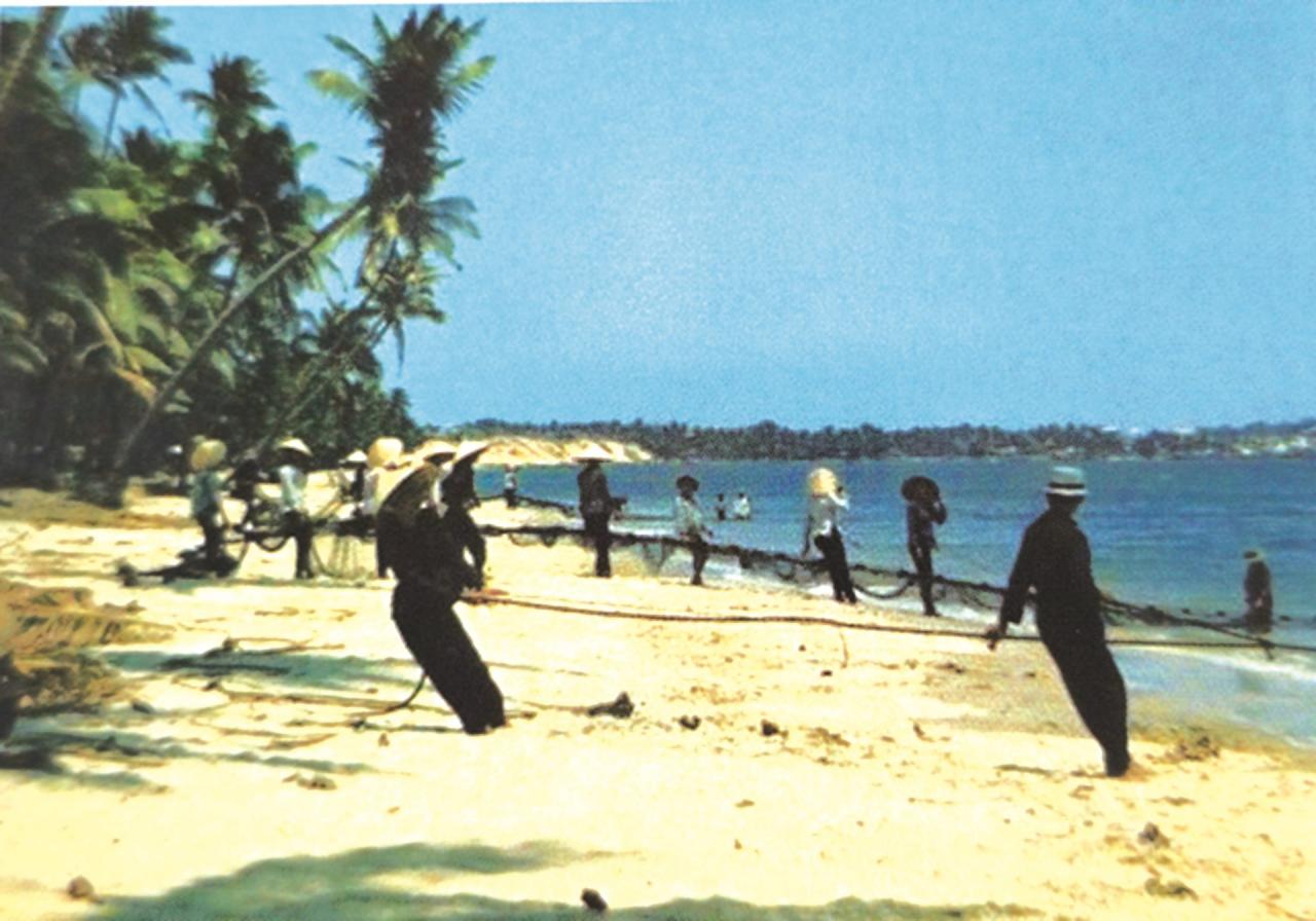
Returning to the early days of settlement, after a period of accumulating land, a portion of the Bau Me population spread out to exploit the Rang sea area. This area, extending from Bai Truoc (Mui Ne) downwards, forms a coastal arc where a small headland juts out, known as Mui Da (Stone Headland) because of the many rocks there. The beach is called Bai Rang (Resistance Beach) because about 2 nautical miles offshore, there are three clusters of submerged rocks deep beneath the seabed, forming the crevices of a reef area where many marine species gather and thrive year-round. From this headland and reef, coconut trees with thick roots cling to the sweet groundwater flowing from the small sand dunes, and fishing boats and seine nets reach out to sea, providing warmth to the thatched houses with their daily cooking fires.
During the Nguyen Dynasty's land registration period, this coastal area, traversed by a main road, was named Thien Khanh village (present-day Ham Tien), where the Thuan Tinh station was located (popularly known as the Station Hamlet). According to the Mai family genealogy, preserved by Mr. Mai Hoang Nhan, a former teacher at Ham Tien Secondary School and a fourth-generation descendant, his great-grandfather was a member of the Mai family who was assigned to run the station; while the vast area with a population formed around the ponds belonged to Thien Nghiep village. Before 1945, both villages belonged to Mui Ne district, Thach An commune, Ham Thuan prefecture. Over centuries of upheaval and war, the ancestral temple of Thien Nghiep village, built in the central Bau Me area, was damaged. After liberation, the villagers restored it on the old site as a place of worship for the village's guardian deity and the ancestors who contributed to the reclamation and establishment of the village. The villagers still preserve 12 royal decrees from the Nguyen Dynasty dating back to the 5th year of Tu Duc's reign. The ancestral shrine of Thien Khanh village, located on the coast, has been preserved and renovated by the people, with a spacious place of worship nestled amidst the lush coconut groves of Rang. However, the ancestral shrine of Thien Nghiep village is the ancestral source, so every year on the 18th day of the second lunar month, families from Rang, Mui Ne, and the surrounding Bau areas, along with families who work and live far away, return to Bau Me to attend the spring prayer ceremony and commemorate the ancestors.
After the August 1945 Revolution, during the resistance against the French, the former Thien Khanh village was renamed Quang Canh commune. This was the name of a native of Rang, whose full name was Ho Quang Canh. Ho Quang Canh was the son of Ho Si Lam, originally from Nghe An , a patriotic intellectual during the Duy Tan era who worked as a traditional medicine practitioner in the coastal village of Rang in Binh Thuan. In 1926, Ho Quang Canh graduated from the French-Vietnamese primary school in Phan Thiet. He went to Saigon to work as a railway worker. In the spring of 1930, he joined the Indochinese Communist Party. In 1931, during the summer break, he returned to Rang to open a private tutoring class and sow the seeds of revolution in his hometown. In 1933, he died in Ban Me Thuot prison. Currently, a paved road from Rang intersection (706 Nguyen Dinh Chieu) to Bau Me and Bau Sen (Thien Nghiep commune), 7,500 meters long and 6 meters wide, is named after him, and the commune's primary school also bears the name Ho Quang Canh.


The village of Thien Nghiep, associated with the Le Hong Phong war zone, was extremely fiercely contested, especially during the resistance against the Americans. I remember in the early 1960s, the Saigon government actively built a system of strategic hamlets. In this area, the coastal hamlets included Rang and Ba La, while the forest side included Giong Thay Ba. The large area named Giong Thay Ba dates back to ancient times, when a third teacher, whose real name was Huynh Lien, from Binh Dinh, a scholar skilled in both literature and medicine, gathered people here to cultivate the land. Teacher Ba was admired by the people for his virtue, teaching classical literature and healing the sick. Over time, the people came to name the land "Giong Thay Ba." Standing on this high point, one can see the Rang coastline to the south, Bau Me mountain to the east, Bau Sen mountain to the west, and Bau Tang mountain to the north. In August 1962, the enemy swept through and forced the people of Bau Tang, Bau Me, and Bau Sen into the strategic hamlet of Giong Thay Ba. In May 1965, the Giong Thay Ba hamlet was dismantled, and nearly 5,000 people revolted and returned to their old land. The enemy gathered the remaining people and moved them to Rang and Ba La hamlets, located near the sea. The name Ba La hamlet comes from the name of Ba La village, a seaside village located at the end of Rang beach, bordering Bai Truoc beach of Mui Ne, with a story still passed down. In the past, there was an old woman in the village who was straightforward and outspoken. Whenever she saw someone doing wrong, she would loudly scold them, regardless of who they were, rich or poor, family members or strangers... Her scolding echoed throughout the village, and from then on, people called the village Ba La village, and the slope before entering Mui Ne was called Ba La slope (!?).
After April 30, 1975, within a short period, the people of Ba La left the hamlet, dismantled their houses, and moved their belongings back to their old villages. At that time, Thien Khanh commune was called Hong Hai and Thien Nghiep commune was called Hong Tien, both belonging to Thuan Phong district. In October 1975, Thuan Phong district was merged into Ham Thuan district, and in November, the two communes of Hong Hai and Hong Tien were merged to form Ham Tien commune. From then on, Ham Tien commune was an administrative unit at the commune level under Ham Thuan district. In 1983, Ham Tien commune was transferred to the direct administration of Phan Thiet town. However, the name has become ingrained in folk culture; people living along the coast call them "Rang people," while those living deep in the fields are called "Bau people"...
Source


