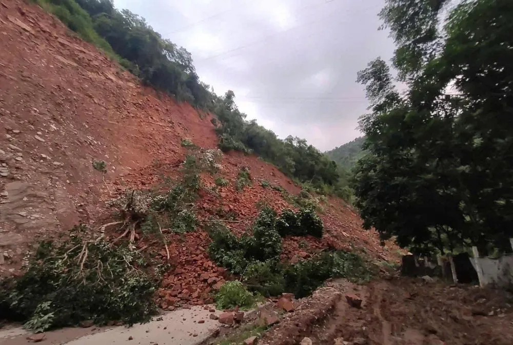
On the morning of July 5, a landslide occurred on National Highway 279D, passing through the old Ta Bu commune (Muong La district) (now Muong Bu commune, Son La province). Rocks and soil spilled onto the road, paralyzing traffic and posing a potential safety risk to people and vehicles.
Currently, authorities are urgently cleaning up and removing obstacles to reopen the road later in the day.
Previously, on the afternoon of July 3, at Km20+430 of National Highway 4G, through Chieng Mai commune (Son La province), a large landslide occurred, causing rocks and soil from the positive slope to spill onto the road surface, stretching about 70m. The incident injured a pedestrian due to flying rocks and soil and caused a complete traffic jam.
Heavy rains since early July have caused serious landslides in Chieng Mai and Muong Chien communes (Son La province). Many households living near the slopes were affected, including Mr. Lo Van Thien's family whose house was flooded with rocks and soil. Authorities have urgently evacuated these households to safety, while also assisting them in building temporary shelters and stabilizing their initial housing.
*The National Center for Hydro-Meteorological Forecasting said that storm No. 2 in the East Sea (international name Danas) formed in the early morning of July 5 from a tropical depression in the Northeast of the East Sea.
According to the assessment, storm No. 2 will not make landfall and will not directly affect the mainland of Vietnam, but may cause scattered thunderstorms in the coastal areas of the North and Central regions in the coming days.
Currently, the storm is active in the Northeast of the East Sea. The storm intensity at 8:00 a.m. on July 5 reached level 8 (62-74 km/h), gusting to level 10.
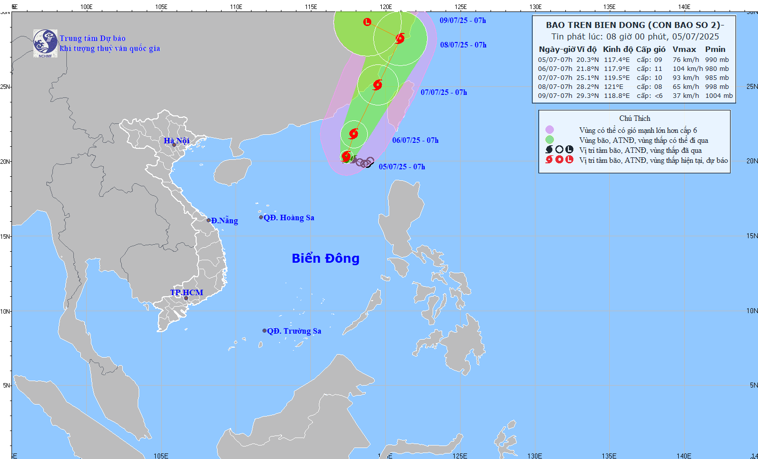
The storm is moving slowly in a West Northwest direction at a speed of about 5-10km/hour.
In the next 24 to 72 hours, storm No. 2 will continue to move north, then turn north-northeast at a speed of about 10-15km/hour. It is forecasted that by the morning of July 6, the storm center will be at about 21.8 degrees north latitude and 117.9 degrees east longitude, in the northeastern sea of the East Sea, with a strong intensity of level 10-11, gusting to level 13.
By the morning of July 7, the storm was moving in a North-Northeast direction at a speed of about 15km/hour, with its center located over the sea of Fujian province (China), maintaining a level 10 intensity, gusting to level 12.
By the morning of July 8, the storm continued to move in a North-Northeast direction at a speed of about 15km/hour, entering the mainland of Zhejiang province (China), with its intensity decreasing to level 8, gusting to level 12.
During this process, the northeastern sea area of the North East Sea is in a dangerous zone and is directly affected by level 3 natural disaster risk.
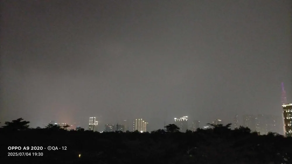
The most notable impact of storm No. 2 is strong winds and large waves in the northeastern sea of the North East Sea. There is currently stormy rain, strong winds of level 7, near the center of the storm there are winds of level 8-10, gusts of level 12. Waves are 3-5m high, very rough seas. Ships operating in the dangerous area are at high risk of being affected by tornadoes, thunderstorms and large waves, and need to pay special attention to proactively prevent them.
As of the morning of July 5, storm No. 2 has not shown any signs of directly affecting Vietnam’s mainland. However, scattered thunderstorms in the northern and central coastal regions may still occur due to the storm’s circulation in the coming days.
Source: https://www.sggp.org.vn/sat-lo-tren-quoc-lo-279d-gay-te-liet-giao-thong-post802558.html




![[Photo] National Assembly Chairman attends the seminar "Building and operating an international financial center and recommendations for Vietnam"](https://vphoto.vietnam.vn/thumb/1200x675/vietnam/resource/IMAGE/2025/7/28/76393436936e457db31ec84433289f72)













Comment (0)