
BHG - Recently, visitors to Ha Giang , in addition to the Km0 milestone and Lung Cu National Flagpole, many people have visited the Northernmost point, in Seo Lung village, Lung Cu commune, Dong Van district. In reality, this is the tip of the cone on the map of Vietnam. That is because until now, many people still think that Lung Cu National Flagpole means reaching the highest point on the map of Vietnam.
Standing on the poetic observation deck at the sacred land of the Northernmost Point, looking to the Northwest is the territory of Phu Ninh district of the neighboring country of China. The distance is a gorge of Nho Que River that feels almost within reach. But in reality, it is a distance that if you walk across the river and gorge, it will take hours, so it is like an extremely solid natural fence at the Northernmost point of the Fatherland.
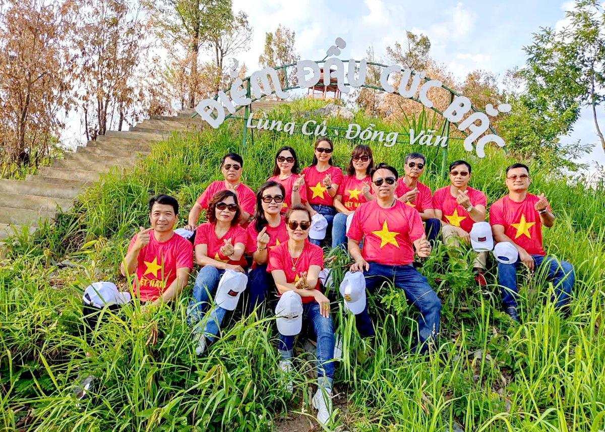 |
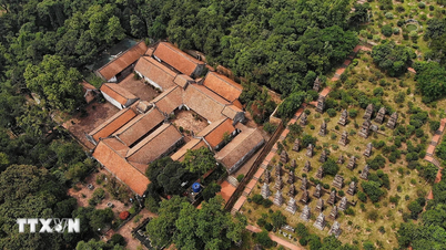
| Tourists visit the Northernmost point. |
The Nho Que River here is more special than any other river in Vietnam. Because this is not only one of the rivers in Vietnam at the highest altitude compared to sea level, but also the river in the deepest canyon. Geological formation has created a very deep canyon in Lung Cu, if measured here, the depth of this canyon is comparable to Tu San canyon in Meo Vac. The beginning of Lung Cu is also where the Nho Que River flows from China into Vietnam, the mountains and deep canyons here truly create an extremely beautiful majestic landscape.
Standing on the North Pole in the evening, amidst the peaceful space, we seem to get lost in the song “border afternoon, my dear, is there any place higher…” In the vast and romantic space, floating clouds and wind here, we cannot help but be moved by the sacredness of the North Pole’s land and sky. The space here makes everyone feel small before nature.
Looming on the side of the border canyon, the rocky hillsides, the ethnic people diligently plowing each patch of land to grow corn, that image makes this place less lonely. Among the many beautiful border spaces of Ha Giang, perhaps the space in Tot Bac evokes the most special and poetic emotions. Even the concrete road leading to Tot Bac with the canyon below, although it has been invested in and expanded more than before, is still an interesting experience for tourists. It is not too easy to go for those who do not have much experience driving a car, especially when having to go in the opposite direction with another car on this narrow road. However, for those who love exploration and adventure, this road is worth it for couples traveling by motorbike, the person sitting behind sometimes has to... hold their breath, hugging the person sitting in front tightly. As for those sitting in a car, going through the road leading to Tot Bac, there are probably many sections where they do not dare to look down at the deep canyon as if challenging everyone's feelings. Over the years, many people when setting foot on the Stone Plateau have to find the Northernmost Cape to satisfy their curiosity, adventure and pride in having once set foot on this emotional and proud cape.
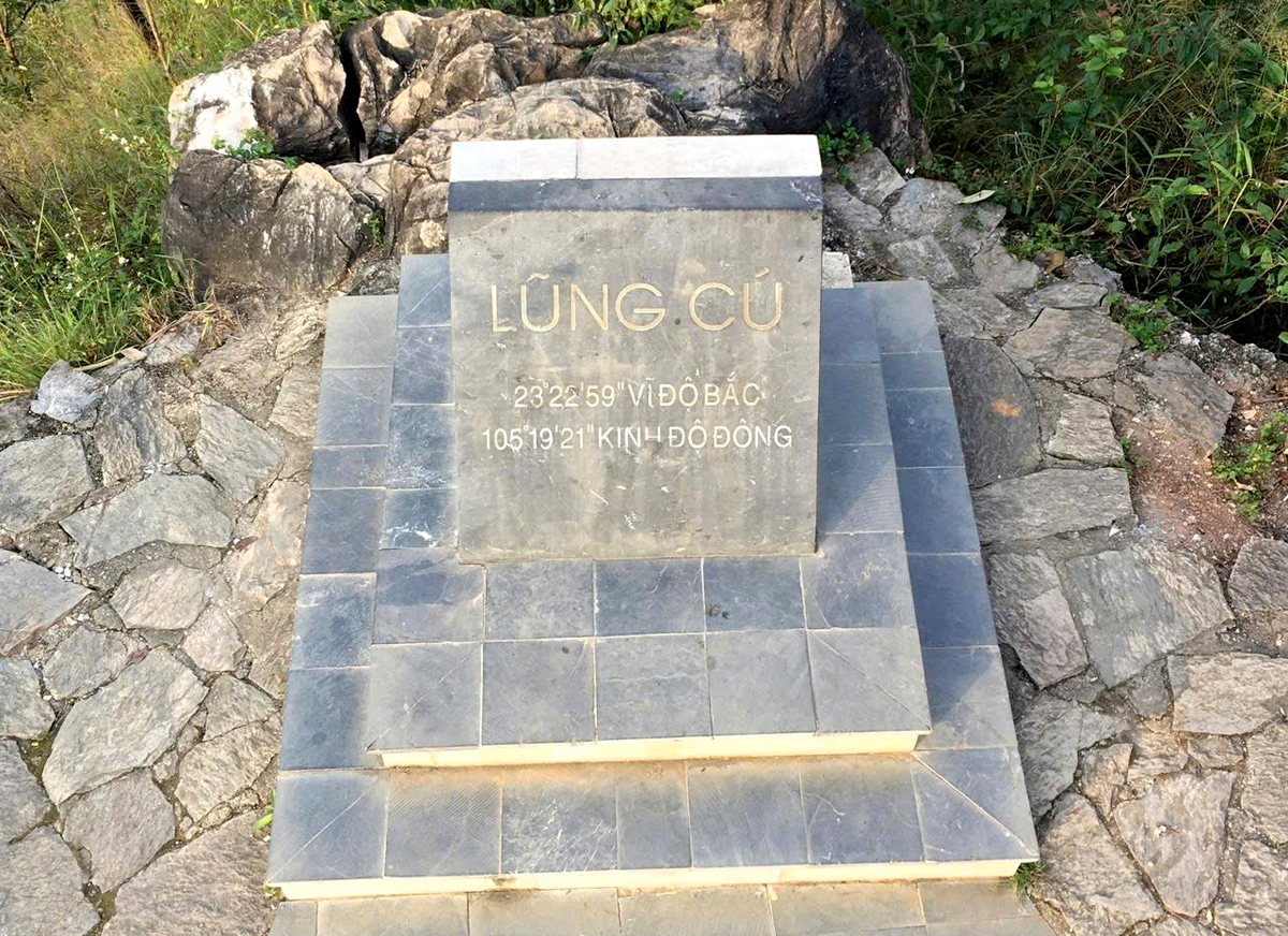 |
| The stone stele records the coordinates of the northernmost point of the Fatherland. |
Many times when I brought my friends to the North Pole in the afternoon, I always had a feeling that somehow time passed very quickly here. Perhaps at this height of about 1,400 - 1,500m, the sun seemed to set faster, and the quiet border space also made us feel that time passed faster. Especially here, in the very quiet space between the clouds, the mountains and the canyons sometimes touching each other, we can clearly hear the sound of the wind in the afternoon sky, a little rustling of the river water flowing through the rocky rapids.
Mom Tot Bac is a very attractive check-in space for those who love to experience and leave their mark. High mountains, deep canyons, clouds and sky together create a majestic, magical landscape. On days with nice weather, the space is extremely clear, ideal for pictures that satisfy anyone who is meticulous. This place is becoming an unmissable tourist destination and needs more research and construction to make it worthy of becoming a destination, a special experience next to the famous destinations in the Stone Park. This is not only a cultural, historical, geographical, geological science destination but also a destination of national pride.
That is why about 65 years ago, despite the difficult road conditions, the great writer Nguyen Tuan still took the trouble to travel to Seo Lung village, with special feelings for the article "Mom Tot Bac". The story tells of the writer Nguyen Tuan taking a small rope from Mot Tot Bac straight down to Ca Mau Cape and surprisingly affirming that this is the real Mot Tot Bac of our Fatherland. From there, it was affirmed that Ha Giang is exactly the northernmost land of the Fatherland. Among the impressive places in Ha Giang, along with the great Ma Pi Leng pass, Mot Tot Bac is the place that left special and sacred feelings for the writer considered the most "arrogant" in the Vietnamese literary world.
Article and photos: Phung Nguyen
Source: https://baohagiang.vn/van-hoa/202506/thieng-lieng-giua-dat-troi-tot-bac-16a175f/


Comment (0)