
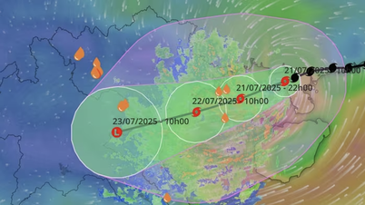
Mr. Mai Van Khiem, Director of the National Center for Hydro-Meteorological Forecasting (NCHMF), commented: "At around noon to afternoon on July 22, the center of storm No. 3 will make landfall in the provinces from Hai Phong to North Thanh Hoa; coastal areas of Hai Phong, coastal areas of Hung Yen (formerly Thai Binh ), winds of level 9-10, gusts of level 13-14. Coastal areas of Ninh Binh, winds of level 8-9, gusts of level 13; Coastal areas of Thanh Hoa (concentrated in the North), winds of level 7-8, gusts of level 8-9. In the Hanoi area, tomorrow afternoon and afternoon (July 22), there will be strong winds of level 5-6, gusts of 7-8".
High tides (including storm surges) are forecast to occur in the afternoon of July 22. Specifically, at Ba Lat (Hung Yen), the tide will be 2.4-2.6m (13-16 hours); at Hon Dau ( Hai Phong), the tide will be 3.9-4.3m (13-16 hours); at Cua Ong (Quang Ninh), the tide will be 4.6-5.0m (14-17 hours); and at Tra Co (Quang Ninh), the tide will be 3.6-4.0m (14-17 hours).
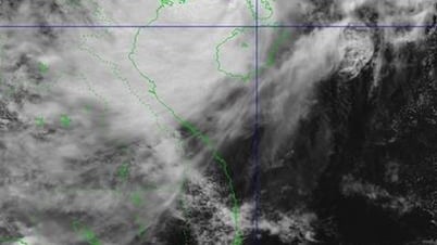
Storm No. 3 will cause widespread heavy rain from tonight and night of July 21 to morning of July 23, focusing on Hung Yen, Ninh Binh, South Phu Tho, Thanh Hoa, Nghe An, generally 200-350mm, locally over 600mm; other places in the Northern region and Ha Tinh will have moderate rain, heavy rain, locally very heavy rain and thunderstorms with common rainfall of 100-200mm, locally over 300mm. Warning of the risk of heavy rain (>150mm/3h). Heavy rain in a short period of time can cause flash floods, landslides in mountainous areas, flooding in low-lying areas.
From tonight (July 21) to July 25, there will be a flood on rivers in the North, Thanh Hoa, and Nghe An, with a flood amplitude of 3-6m on rivers. During this flood, the flood peak on small rivers, the upper Ma River is likely to reach alert level 2 - alert level 3 (BĐ2-BĐ3); the flood peak on Thao River, Lo River, Da River at Hoa Binh Lake, Thai Binh River, Hoang Long River, the upper Ca River will reach alert level 1-BĐ2, some rivers will be above BĐ2; the flood peak downstream of the Red River will be below alert level 1; the lower Ma River and Ca River will fluctuate at alert level 1. There is a high risk of flooding in low-lying areas along rivers, urban areas in the Northern Delta, Thanh Hoa, and Nghe An.
Areas requiring special attention to strong winds, waves and rising water
According to Mr. Mai Van Khiem, in Quang Ninh province, Bai Chay, Ha Tu, Hong Gai, Ha Long, Mong Cai 1, 2, 3 wards; Co To and Van Don special zones.
In Hai Phong: Bach Long Vy Special Zone, Cat Hai Special Zone; Hai An, Duong Kinh, Do Son Wards and Kien Thuy and Tien Lang communes.
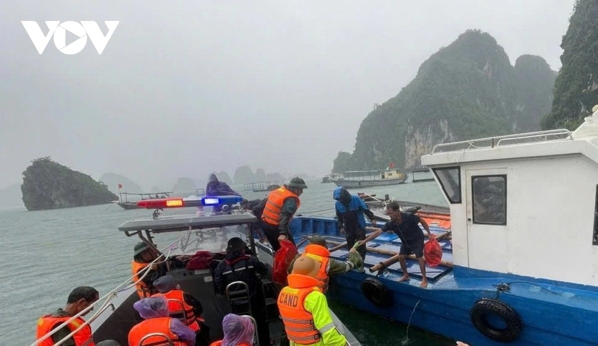
In Ninh Binh, there are 15 coastal communes: Giao Minh, Giao Hoa, Giao Phuc, Giao Hung, Giao Binh, Giao Ninh, Hai Hung, Hai Quang, Hai Tien, Hai Xuan, Hai Thinh, Rang Dong, Nghia Lam, Kim Dong, Binh Minh; Con Tron dyke section from K20+000 - K21+633; Hai Hau sea dyke; Con Tron dyke, Hai Thinh II, Hai Thinh III.
In Hung Yen: Thai Thuy commune and Tien Hai commune; In Thanh Hoa, there are 16 communes and wards in the waterfront area, namely Nga An, Tan Tien, Van Loc, Hoa Loc, Hoang Tien, Hoang Thanh communes, Sam Son ward, Nam Sam Son ward, Quang Ninh commune, Quang Binh commune, Tien Trang commune, Ngoc Son commune, Tan Dan commune, Hai Linh ward, Tinh Gia ward, Hai Binh ward and Nghi Son ward.
Source: https://baohaiphongplus.vn/thoi-diem-nao-bao-so-3-gay-ra-nguy-hiem-nhat-cho-dat-lien-416919.html




















![[Photo] National Assembly Chairman Tran Thanh Man visits Vietnamese Heroic Mother Ta Thi Tran](https://vphoto.vietnam.vn/thumb/1200x675/vietnam/resource/IMAGE/2025/7/20/765c0bd057dd44ad83ab89fe0255b783)

























































Comment (0)