
Video : Ms. Nguyen Thanh Binh gives the latest update on storm number 3. (Source: Fanpage of the Department of Hydrometeorology)
The National Center for Hydro-Meteorological Forecasting said that at 12 noon on July 21, the center of storm No. 3 Wipha was about 140km from Quang Ninh, about 280km east of Hai Phong , about 300km from Hung Yen, and about 330km east-northeast of Ninh Binh.
At this time, the storm tends to strengthen again, the strongest wind near the storm center is level 9-10 (75-102 km/h), gusting to level 12.
Forecast in the next 3 hours, the storm moves in the West Southwest direction, speed about 15km/h.
Ms. Nguyen Thanh Binh, Chief Forecaster of the Remote Sensing Forecast Department, National Center for Hydro-Meteorological Forecasting, said that the center of storm No. 3 has changed its course, making landfall in the southern region of China before moving across the Leizhou peninsula (China).
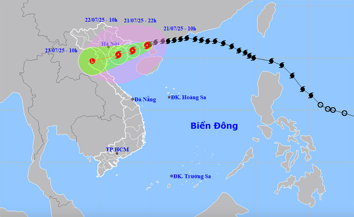
Forecast map of the trajectory and intensity of storm No. 3. (Source: NCHMF)
Early this morning, from Leizhou Peninsula, Typhoon No. 3 Wipha moved down to the Gulf of Tonkin, with a slowing down trend. In the past few hours, when it moved down to the Gulf of Tonkin, the storm has shown a tendency to accelerate. Currently, the average speed of the storm is 15km/h.
The circulation of storm clouds is quite wide. Currently, satellite cloud images show that clouds have covered the entire Northeast and one side has extended to the East of the Leizhou Peninsula (China).
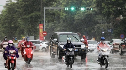
"However, the thick clouds and convective clouds that can cause rain are in a narrow range. Therefore, today, July 21, in Hanoi and some provinces in the Northern Delta, there is no sunshine and not much rain. But with the movement of storm No. 3 Wipha when it goes down to the Gulf of Tonkin, the cloud organization will stabilize and the intensity may increase.
In the coming hours, as the storm moves closer to our coastal areas, convective clouds will get closer and rain will increase," Ms. Binh said.
According to Ms. Binh, calculations by the National Center for Hydro-Meteorological Forecasting show that rain will increase this evening and will rain the most tonight until tomorrow morning when the storm center approaches the coast of our country.
Extreme rainfall can cause flooding in low-lying areas and is particularly likely to cause flash floods and serious landslides in mountainous areas.
Ms. Nguyen Thanh Binh also noted that landslides do not only occur during the heaviest rains. Even after the storm has passed, the rain continues, although not as intense, but the risk of flash floods and landslides remains high. In many cases, the rain has subsided but landslides still occur seriously.
Nguyen Hue - Vtcnews.vn
Source: https://vtcnews.vn/bao-so-3-wipha-tang-cap-mua-lon-dinh-diem-trong-dem-nay-den-sang-mai-ar955497.html


![[Photo] Cutting hills to make way for people to travel on route 14E that suffered landslides](https://vphoto.vietnam.vn/thumb/1200x675/vietnam/resource/IMAGE/2025/11/08/1762599969318_ndo_br_thiet-ke-chua-co-ten-2025-11-08t154639923-png.webp)


![[Video] Hue Monuments reopen to welcome visitors](https://vphoto.vietnam.vn/thumb/402x226/vietnam/resource/IMAGE/2025/11/05/1762301089171_dung01-05-43-09still013-jpg.webp)


Comment (0)