Ho Chi Minh City approves the Ben Thanh - Can Gio Metro route.
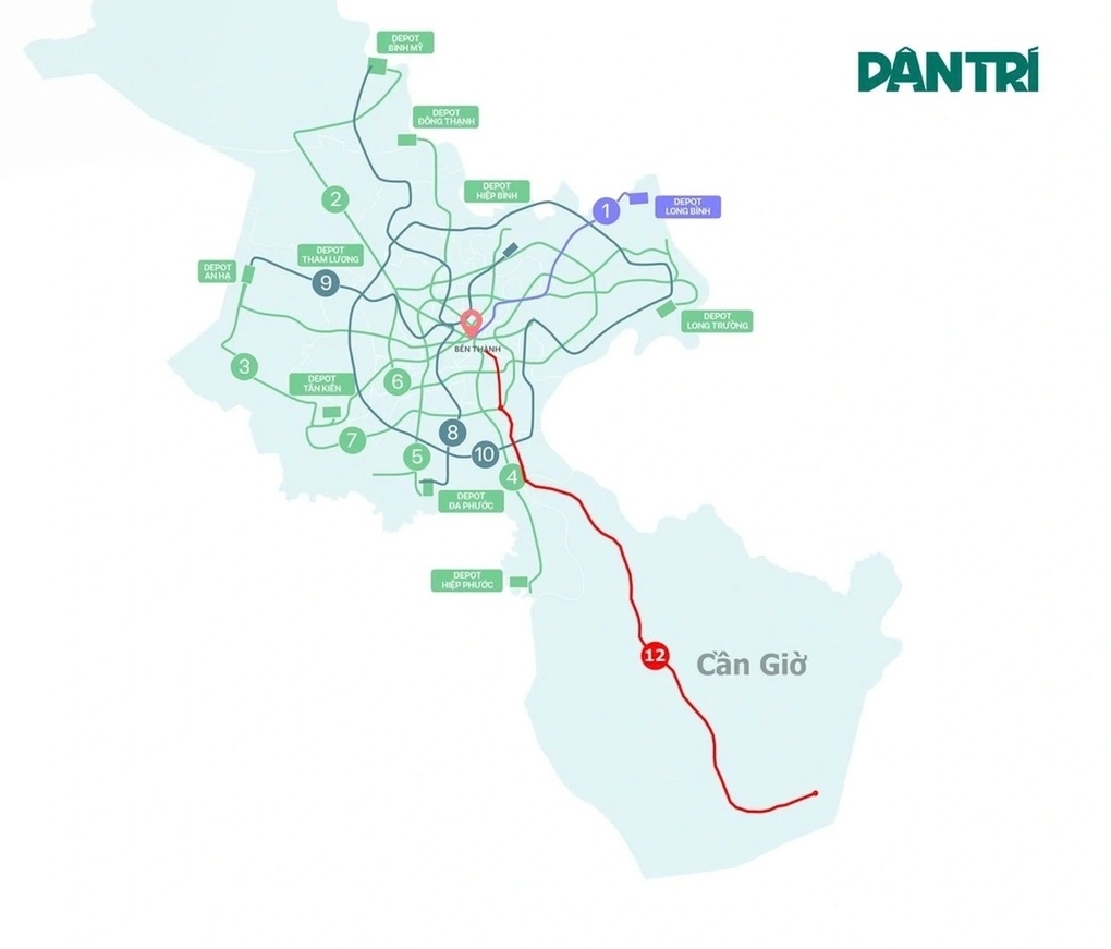
The 53.8km railway line connects the center of Ho Chi Minh City with the Can Gio urban area. The project currently has only two terminal stations in phase 1 and will add four more stations in the future.
Báo Sài Gòn Giải phóng•20/05/2026
The Ho Chi Minh City People's Committee has just issued a decision approving the route plan and station locations for the Ben Thanh - Can Gio railway project.
According to the decision, the railway line will have its starting point at Ben Thanh station and its end point at Can Gio depot, with a total length of approximately 53.8km. The project's starting point is located in the September 23rd Park area (Ben Thanh ward), while the end point is situated on a 39-hectare plot of land in Can Gio commune.
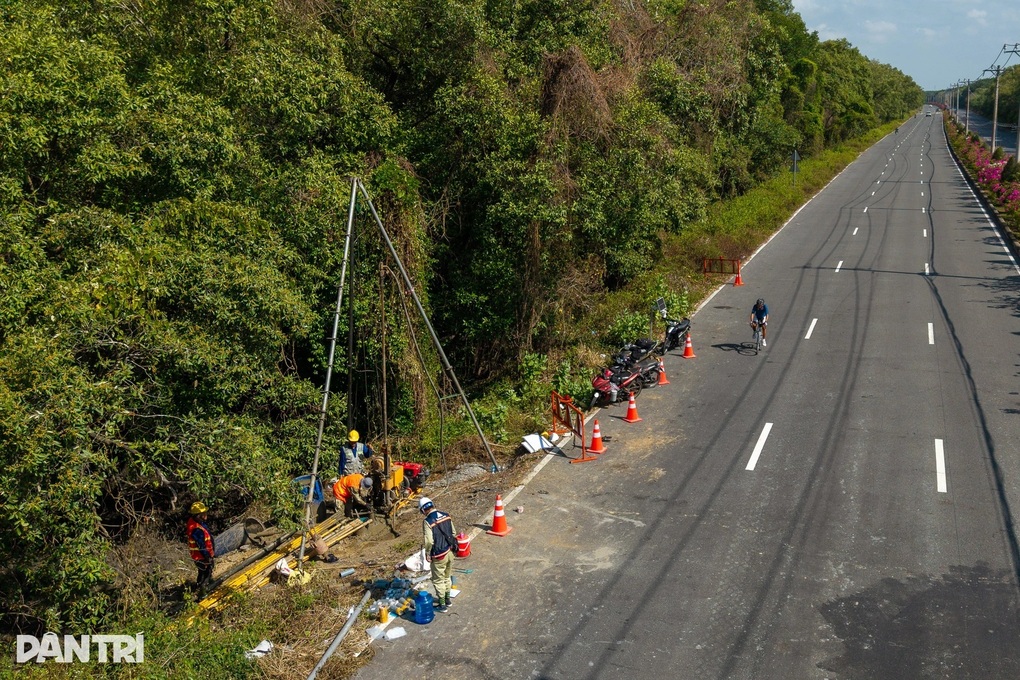
Workers are drilling for geological surveys to support the construction of the Ben Thanh - Can Gio railway (Photo: Khoa Nguyen).
The metro line passes through Ben Thanh, Khanh Hoi, Xom Chieu, Tan Thuan, Tan My wards and Nha Be, Binh Khanh, An Thoi Dong, and Can Gio communes.
According to the approved plan, starting from the September 23rd Park area, the route will run along Ky Con Street, cross the Ben Nghe canal to Vinh Khanh Street, then cut across Hoang Dieu Street and enter Nguyen Tat Thanh Street.
Approaching Tan Thuan 2 Bridge, the route turns southeast onto Nguyen Van Linh Street, passes the Phu My Bridge intersection, and continues onto Nguyen Luong Bang Street. The route then runs between Nguyen Luong Bang Street, Road 15B, and Road D1, crossing the Rach Dia River into Nha Be District.
After passing through Nha Be, the route continues through the Van Phat Hung resettlement area, the Phu Xuan residential area, and then crosses the Soai Rap river to Binh Khanh commune.
Diagram of the Ben Thanh - Can Gio railway line connecting to Ho Chi Minh City's metro network (Graphic: Ngoc Tan).
In the Binh Khanh area, the route runs parallel to the Ben Luc - Long Thanh expressway, then crosses it to join the Rung Sac road corridor. The route continues along the Rung Sac road, crossing many rivers and canals before entering the territory of Can Gio commune.
According to the decision of the Ho Chi Minh City People's Committee, the chosen route passes through the buffer zone of the Can Gio Biosphere Reserve and does not enter the core zone.
The investor plans to include two stations in phase 1, namely Ben Thanh station and Can Gio station. Phase 2 will add four more stations: Tan Thuan, Tan My, Nha Be, and Binh Khanh. The depot and OCC (Operations Control Center) are expected to be located in Can Gio commune.
The Ho Chi Minh City People's Committee has assigned Vinspeed High-Speed Railway Investment and Development Joint Stock Company to finalize the route plan and project location documents in accordance with the approved content; and at the same time, organize the selection of architectural designs for the stations, railway bridges, and related items.
The city also instructed relevant departments, agencies, and localities to coordinate in reviewing the feasibility of land acquisition and adjusting the zoning plan and detailed plan to facilitate the project's implementation.


![[Photo] Secretary of the National Assembly Party Committee, Chairman of the National Assembly presides over the meeting of the Standing Committee and Executive Committee of the National Assembly Party Committee.](https://vphoto.vietnam.vn/thumb/1200x675/vietnam/resource/IMAGE/2026/06/03/1780480353201_ndo_br_bnd-2585-jpg.webp)


![[Photo] First session of the 14th Congress of the Vietnam Trade Union](https://vphoto.vietnam.vn/thumb/1200x675/vietnam/resource/IMAGE/2026/06/03/1780465947883_ndo_br_img-3852-jpg.webp)
![[Photo] General Secretary and President To Lam presides over a meeting with the Central Organizing Committee.](https://vphoto.vietnam.vn/thumb/1200x675/vietnam/resource/IMAGE/2026/06/03/1780482764658_a1-bnd-4741-3342-jpg.webp)


![[Video] Sunset at Lap An Lagoon – Where the sun sets over the fishing nets](https://vphoto.vietnam.vn/thumb/1200x675/vietnam/resource/IMAGE/2026/05/31/1780192137701_beach-landscape-sea-water-nature-grass-745871-pxhere-com.jpeg)


Comment (0)