
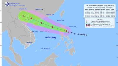
According to the National Center for Hydro-Meteorological Forecasting, on the night of September 23, the tropical depression east of the Philippines strengthened into a storm, internationally named Bualoi.
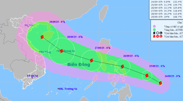
At 7:00 a.m. on September 24, the center of storm Bualoi was at about 9.8 degrees North latitude; 132.4 degrees East longitude. The strongest wind near the center of the storm was level 9 (75–88 km/h), gusting to level 11. The storm moved in a West Northwest direction at a speed of about 15 km/h.
 |
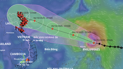
| It is forecasted that around the night of September 26, storm Bualoi will enter the East Sea and become storm number 10 in 2025. Source: National Center for Hydro-Meteorological Forecasting |
It is forecasted that around the night of September 26, storm Bualoi will enter the East Sea and become storm number 10 in 2025. Source: National Center for Hydro-Meteorological Forecasting
The National Center for Hydro-Meteorological Forecasting predicts that in the next 24 hours, at 7:00 a.m. on September 25, storm Bualoi will be at about 11.3 degrees North latitude; 129.7 degrees East longitude, with intensity of level 9-10, gusting to level 12.
At 7:00 a.m. on September 26, storm Bualoi was located at about 13.1 degrees North latitude; 124.8 degrees East longitude, continuing to strengthen to level 10, gusting to level 12.
Storm Bualoi causes 5-7 meter high waves
It is forecasted that around the night of September 26, storm Bualoi will enter the East Sea and become storm number 10 in 2025.
As of 7:00 a.m. on September 27, the center of storm No. 10 was at about 14.3 degrees North latitude; 118.6 degrees East longitude, intensity level 11, gust level 14. The dangerous area is from the North of latitude 12.0 degrees North to 17.0 degrees North latitude, East of longitude 117.0 degrees East longitude. Natural disaster risk level 3 in the sea area east of the North and Central East Sea.
It is forecasted that in the next 72-120 hours, storm Bualoi will likely move rapidly in the West-Northwest direction, at a speed of 20-25 km/hour and may further strengthen.
Due to the influence of storm Bualoi, from the evening and night of September 26, the northeastern and central East Sea areas will gradually increase in wind strength to level 6-7, then increase to level 8-9. The area near the storm center will have strong winds of level 10-11, gusting to level 14, waves 5-7 m high, and rough seas. Dangerous for ships operating in the northern and central East Sea areas.
Storm No. 9 Ragasa is nearly 600 km from Mong Cai ( Quang Ninh ) At 10:00 a.m. on September 24, the center of storm No. 9 Ragasa was at about 21.3 degrees north latitude; 113.2 degrees east longitude, about 570 km east of Mong Cai (Quang Ninh). The strongest wind near the center of the storm was level 15 (167–183 km/h), gusting to level 17. Forecast in the next 3 hours, the storm moves west at a speed of about 20 km/hour. |
According to Thuy Linh/nld.com.vn
Source: https://baovinhlong.com.vn/thoi-su/202509/bao-chong-bao-xuat-hien-them-con-bao-rat-manh-moi-huong-vao-bien-dong-0022f6f/


![[Photo] Binh Trieu 1 Bridge has been completed, raised by 1.1m, and will open to traffic at the end of November.](https://vphoto.vietnam.vn/thumb/1200x675/vietnam/resource/IMAGE/2025/10/2/a6549e2a3b5848a1ba76a1ded6141fae)


Comment (0)