
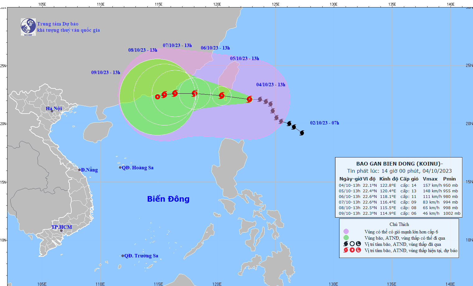
The National Center for Hydro-Meteorological Forecasting has issued the above forecast, and also forecasted the development of typhoon KOINU in the next 24 to 72 hours. Accordingly, at 1:00 p.m. on October 5, typhoon KOINU in the southern area of Taiwan island, with the strongest wind near the center of the storm at level 13, gusting to level 16, changed direction, moving to the West Northwest, speed reduced to 10km/h.
At 1:00 p.m. on October 6, this storm was 150km south of Fujian (China), with the strongest wind near the storm center at level 10-11, gusting to level 13, continuing to move in a West Northwest direction, maintaining a speed of about 10km/h, moving into the East Sea and gradually weakening.
At 1:00 p.m. on October 7, the storm in the sea southeast of Guangdong province (China), the strongest wind near the storm's center decreased to level 8-9, gusting to level 11, changed direction of movement, to the West, speed decreased to 5-10km/h and weakened further.
From the next 72 to 120 hours, the storm will move mainly in the West Southwest direction, about 5km per hour, and its intensity will continue to weaken.
The northeastern sea area of the North East Sea has strong winds of level 6-7, from the night of October 4, it will increase to level 8-10, from the afternoon of October 5, the area near the storm center will have winds of level 11-12, gusting to level 15; the sea will be very rough. The northeastern sea area of the North East Sea has waves 2-4m high; from the night of October 4, the waves are 4-6m high, from the afternoon of October 5, the area near the storm center will have waves of 6-8m high.
Source


Comment (0)