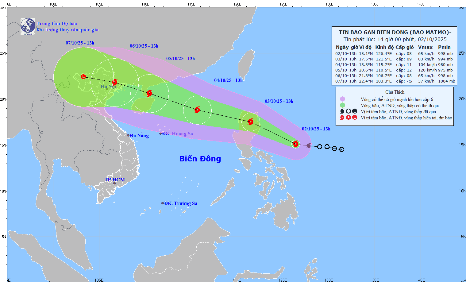
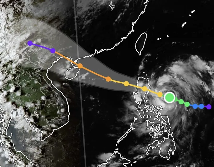
As of the afternoon of October 2nd, the typhoon's center was located at approximately 15.1 degrees North latitude and 126.4 degrees East longitude, over the sea east of the Philippines. The strongest winds near the center of the typhoon reached level 8 (62-74 km/h), with gusts up to level 10. The typhoon is moving west-northwest at a rapid speed of about 25 km/h.

The Vietnamese meteorological agency forecasts that in the next 24 hours, Typhoon Matmo will continue to strengthen and move towards Luzon Island (Philippines) with an intensity of level 9, gusting to level 11. By October 4th, the typhoon will enter the northern South China Sea (becoming typhoon number 11) with an intensity of level 10-11, gusting to level 13, approximately 430km northeast of the Hoang Sa archipelago.
Over the next 72 hours, Typhoon Matmo is likely to continue strengthening, reaching Category 12 on October 5th , with gusts up to Category 15 as it approaches the Leizhou Peninsula (China). An updated model from the National Center for Meteorological and Hydrological Forecasting on the afternoon of October 2nd predicts the typhoon will make landfall in northern Vietnam (with the epicenter in Mong Cai, Quang Ninh province) on October 6th.

International forecasting models such as JTWC (USA) and JMA (Japan) also presented similar scenarios, both predicting that Typhoon Matmo is likely to enter the South China Sea on October 4th and head towards the Gulf of Tonkin .
Therefore, from around the 5th to the 10th, the weather at sea and on land will become bad and dangerous again. Coastal residents and fishermen operating offshore need to closely monitor subsequent weather reports to proactively respond.
Source: https://www.sggp.org.vn/bao-matmo-dang-ap-sat-bien-dong-post816011.html


![[Photo] National Assembly Chairman Tran Thanh Man concludes official visit to Italy, departs for IPU-152](https://vphoto.vietnam.vn/thumb/1200x675/vietnam/resource/IMAGE/2026/04/15/1776253436109_vna-potal-chu-tich-quoc-hoi-ket-thuc-tham-chinh-thuc-italy-len-duong-du-ipu-152-tai-tho-nhi-ky-8702876-7969-jpg.webp)
![[Image] Overview of the Tam Trinh-Giai Phong connecting road section after land clearance is completed.](https://vphoto.vietnam.vn/thumb/1200x675/vietnam/resource/IMAGE/2026/04/15/1776245679644_ndo_br_dji-0195-jpg.webp)
![[Photo] General Secretary and President To Lam and General Secretary and President Xi Jinping meet with youth from both countries.](https://vphoto.vietnam.vn/thumb/1200x675/vietnam/resource/IMAGE/2026/04/15/1776245687540_vna-potal-tong-bi-thu-chu-tich-nuoc-to-lam-va-tong-bi-thu-chu-tich-nuoc-tap-can-binh-gap-go-thanh-nien-hai-nuoc-8702371-jpg.webp)
![[Image] Current status of the land area of over 5.5 hectares that Ho Chi Minh City is considering reclaiming.](https://vphoto.vietnam.vn/thumb/1200x675/vietnam/resource/IMAGE/2026/04/15/1776245690095_1-3102-8409-jpg.webp)
![[Photo] General Secretary and President To Lam and his wife, along with General Secretary and President Xi Jinping and his wife, attending a tea party.](https://vphoto.vietnam.vn/thumb/1200x675/vietnam/resource/IMAGE/2026/04/15/1776245678527_vna-potal-tong-bi-thu-chu-tich-nuoc-to-lam-va-phu-nhan-cung-tong-bi-thu-chu-tich-nuoc-tap-can-binh-va-phu-nhan-du-tiec-tra-8702812-9829-jpg.webp)
![[Photo] Capturing each moment at the "People We Meet" photography exhibition.](https://vphoto.vietnam.vn/thumb/1200x675/vietnam/resource/IMAGE/2026/04/15/1776245695648_1-8944-jpg.webp)


Comment (0)