
In the next 24 hours, the northwest sea of the North East Sea will have strong winds of level 6-7, near the storm center will have strong winds of level 8-9, gusting to level 12; very rough seas.
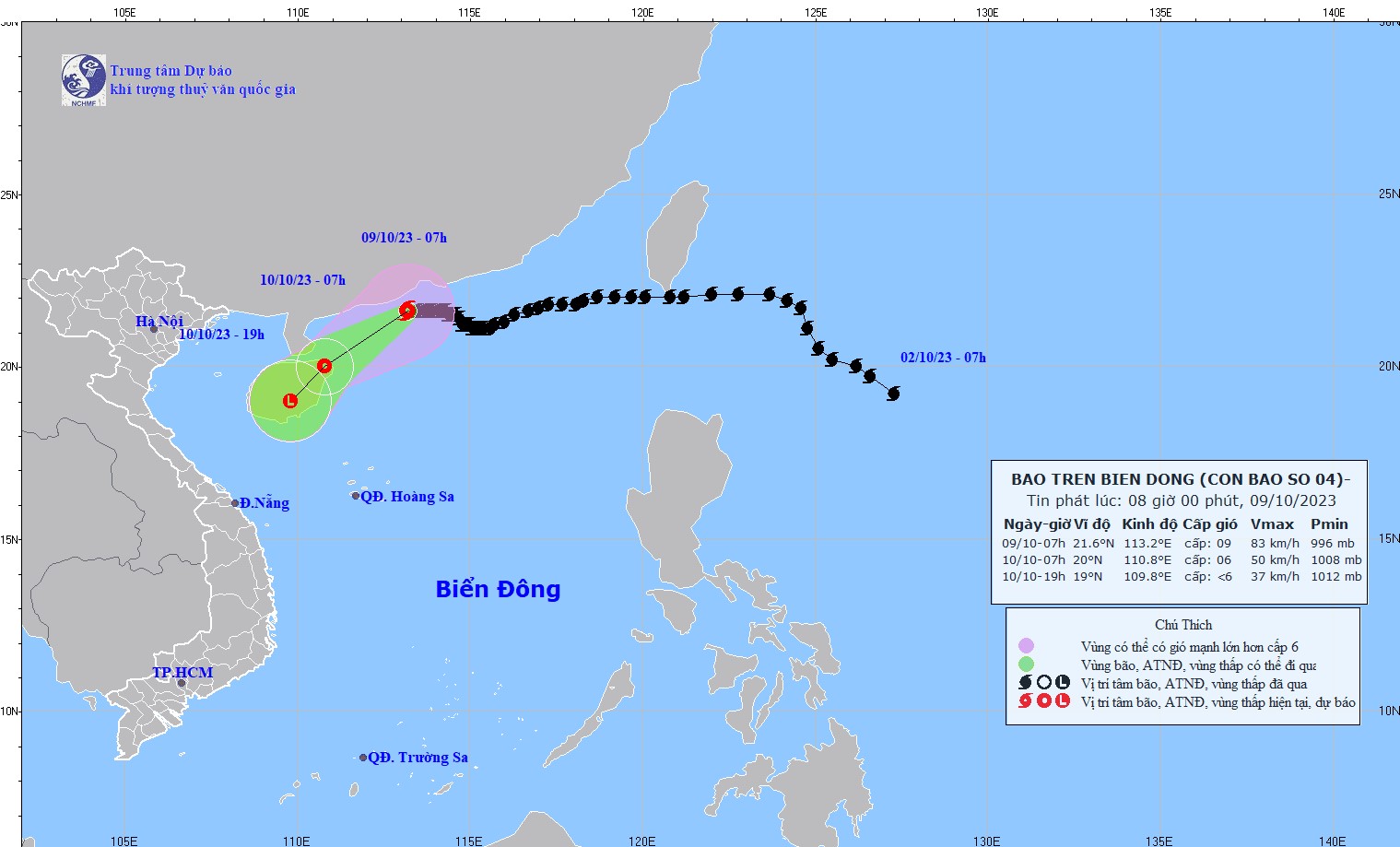
According to the National Center for Hydro-Meteorological Forecasting, at 7:00 a.m. on October 9, the eye of the storm was located at approximately 21.6 degrees North latitude; 113.2 degrees East longitude, in the sea south of Guangdong province (China). The strongest wind near the eye of the storm was level 9 (75-88 km/h), gusting to level 12, moving slowly westward at a speed of approximately 5 km/h.
Forecast for the storm (next 24 to 72 hours), at 7am on October 10, storm No. 4 will move southwest at a speed of 10-15km/h and weaken into a tropical depression. At 7pm on October 10, the storm will weaken into a low pressure area.
 |
Due to the impact of the storm, at sea, in the next 24 hours, the northwest sea area of the North East Sea will have strong winds of level 6-7, near the storm center will have strong winds of level 8-9, gusting to level 12; very rough seas.
In addition, due to the influence of the cold air strengthening, from early morning on October 10, the sea area of Bac Bo Gulf has strong northeast wind level 6, gusting to level 8; rough sea.
In the North East Sea, waves are 2.0-3.0m high, near the storm center, waves are 3.0-5.0m high. From the morning of October 10, in the Gulf of Tonkin, waves are 2.0-3.0m high.
All vessels operating in these areas are subject to strong winds and large waves.
According to PV/VOV.VN
Source


![[Maritime News] More than 80% of global container shipping capacity is in the hands of MSC and major shipping alliances](https://vphoto.vietnam.vn/thumb/402x226/vietnam/resource/IMAGE/2025/7/16/6b4d586c984b4cbf8c5680352b9eaeb0)


Comment (0)