
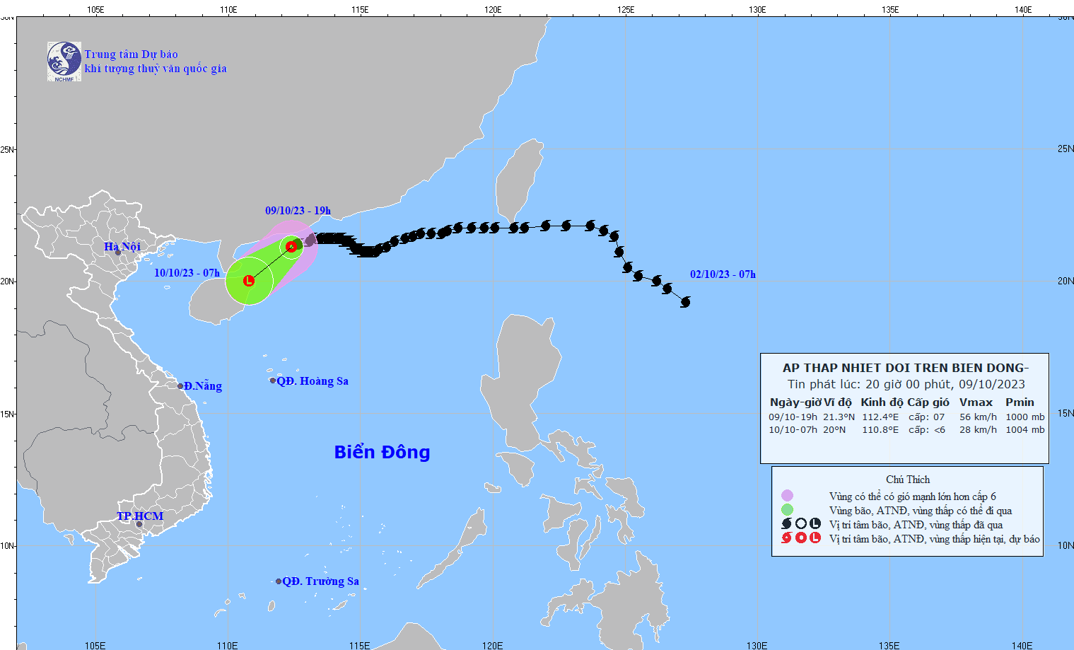
At 7 PM, the center of the tropical depression was located at approximately 21.3 degrees North latitude and 112.4 degrees East longitude, over the sea south of Guangdong province (China). The strongest winds near the center of the tropical depression were at force 6-7 (39-61 km/h), gusting to force 9, moving in a west-southwest direction at a speed of about 10 km/h.
Forecasts indicate that by 7:00 AM on October 10th, the tropical depression will move southwest at a speed of approximately 15 km/h, weakening into a low-pressure area over Hainan Island, with an intensity lower than level 6.
Over the next 12 hours, the northwestern part of the North East Sea will experience strong winds of force 6-7, gusting to force 9; with rough seas. Additionally, due to the influence of a strengthening cold front, from early morning on October 10th, the Gulf of Tonkin will experience strong northeasterly winds of force 6, gusting to force 8; with rough seas.
In the northern South China Sea, waves are 1-2 meters high, while near the center of the tropical depression, waves are 2-4 meters high. From the morning of October 10th, waves in the Gulf of Tonkin are 2-3 meters high. All vessels operating in these areas are affected by strong winds and high waves.
Source


![[Photo] General Secretary and President To Lam presides over the meeting to approve the draft report on the results of the second inspection by the Politburo of the Standing Committee of the Hanoi City Party Committee.](https://vphoto.vietnam.vn/thumb/1200x675/vietnam/resource/IMAGE/2026/05/26/1779789811432_a2-bnd-4430-9620-jpg.webp)


Comment (0)