
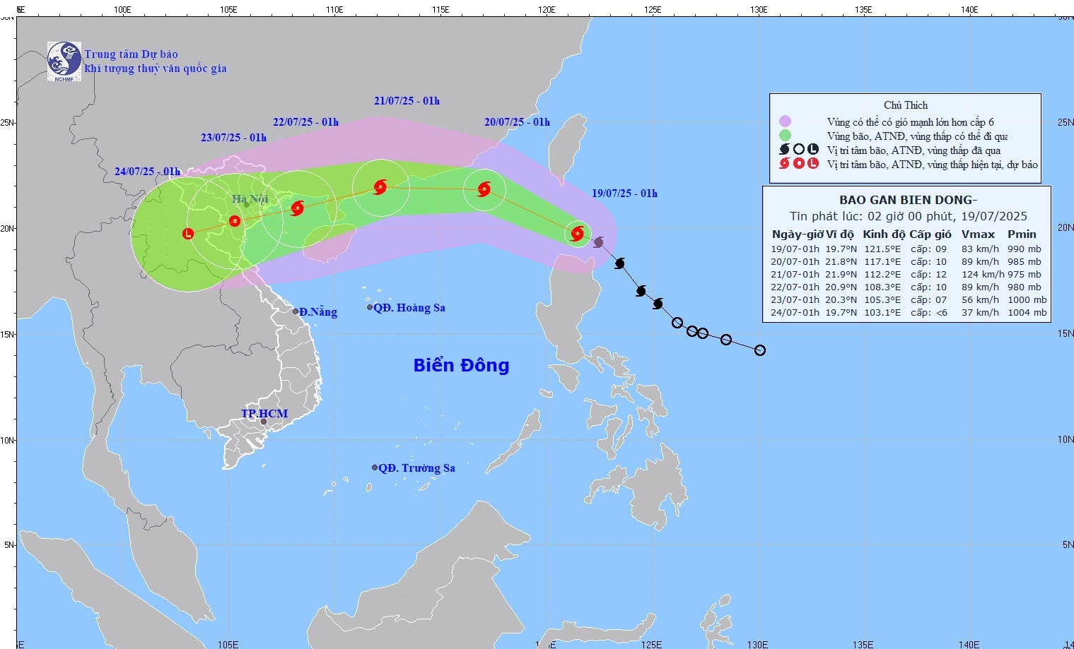
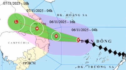
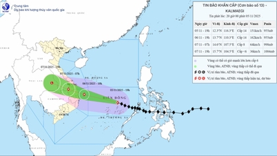
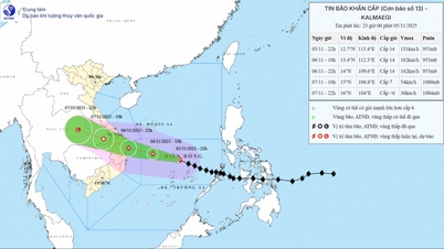
 Path of storm wipha
At 1:00 a.m. on July 19, the center of the storm was at approximately 19.7 degrees North latitude; 121.5 degrees East longitude. The strongest wind near the center of the storm was level 9 (75 - 88 km/h), gusting to level 11. The storm moved northwest at a speed of 20 km/h.
It is forecasted that in the next 24 hours, the storm will enter the northern East Sea and tend to strengthen. At 1:00 a.m. on July 20, the storm center was at about 21.8 degrees North latitude; 117.1 degrees East longitude. The strongest wind is level 10 (89 - 102 km/h), gusting to level 12.
During the next 24 to 48 hours, the storm will continue to move westward at about 20km per hour and is likely to strengthen.
By 1:00 a.m. on July 21, the storm will be in the sea south of Guangdong province (China), with the strongest wind speed at level 11-12 (103-133km/h), gusting to level 14. After that, the storm may gradually weaken as it approaches mainland China and affect the weather in the northern and north central provinces of our country from July 21 to 24.
Due to the storm's influence, from today, the North East Sea will have strong winds of level 9-10, gusts of level 12-14, waves of 4-6 m high, and rough seas. The Central and South East Sea, including the Truong Sa archipelago and the area from Binh Thuan to Ca Mau, will have strong southwest winds of level 6-7, gusts of level 8-9, and rough seas.
The warning level for natural disaster risk due to storms in the North East Sea is level 3.
Coastal localities and vessels operating at sea need to regularly monitor storm developments and proactively take preventive measures to ensure safety of people and property.
PVSource: https://baohaiphongplus.vn/bao-wipha-dang-tien-vao-bien-dong-co-kha-nang-manh-len-cap-11-12-416683.html


![[Photo] Opening of the 14th Conference of the 13th Party Central Committee](https://vphoto.vietnam.vn/thumb/1200x675/vietnam/resource/IMAGE/2025/11/05/1762310995216_a5-bnd-5742-5255-jpg.webp)


![[Photo] Panorama of the Patriotic Emulation Congress of Nhan Dan Newspaper for the period 2025-2030](https://vphoto.vietnam.vn/thumb/1200x675/vietnam/resource/IMAGE/2025/11/04/1762252775462_ndo_br_dhthiduayeuncbaond-6125-jpg.webp)


Comment (0)