

Deputy Minister Nguyen Hoang Hiep directed at an urgent meeting on response to storm Wipha.
On the afternoon of July 18, the Ministry of Agriculture and Environment held an urgent meeting on response to storm Wipha, chaired by Deputy Minister Nguyen Hoang Hiep.
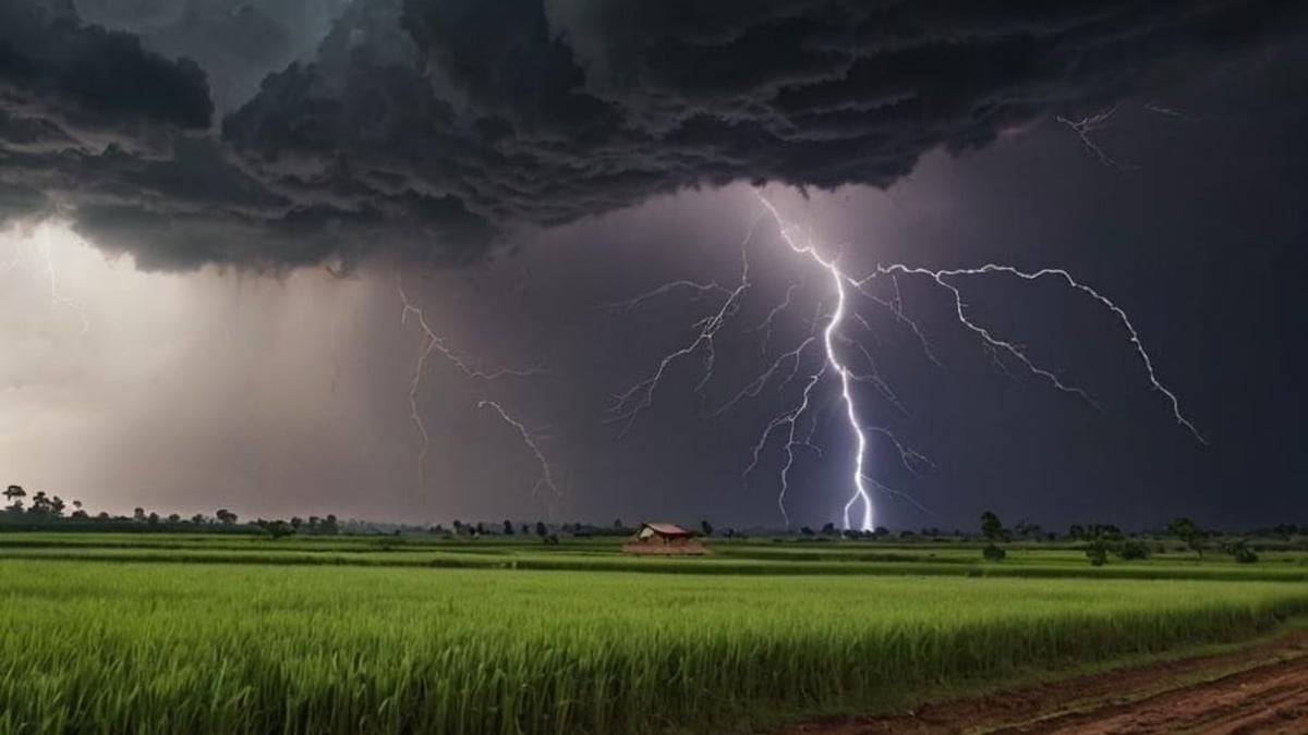
Typhoon Wipha's path is still uncertain, rain could reach 500mm
Typhoon Wipha is likely to strengthen and may directly impact the mainland. At the meeting, Mr. Mai Van Khiem, Director of the National Center for Hydro-Meteorological Forecasting, said: Typhoon Wipha has formed in the sea east of Ludong Island (Philippines) and is showing signs of strengthening. It is forecasted that on the morning of July 19, the storm will enter the East Sea and become the third storm this year.
“After entering the East Sea, atmospheric and oceanic conditions are relatively favorable for this storm to strengthen, with a probability of reaching high levels of about 90%,” Mr. Khiem said.
Regarding the route, according to Mr. Khiem, the forecast models are still not unified, with reliability only at the "average" level. The difference between the models is up to more than 100km, which can completely change the area directly affected by strong winds and heavy rain.
It is forecasted that by July 21, when the storm moves close to the east of Leizhou (China), its intensity may reach level 12, gusting to level 15. If it continues to move as fast as it is now, on the evening of July 21, the storm will directly affect our mainland, with strong winds of level 9-10.
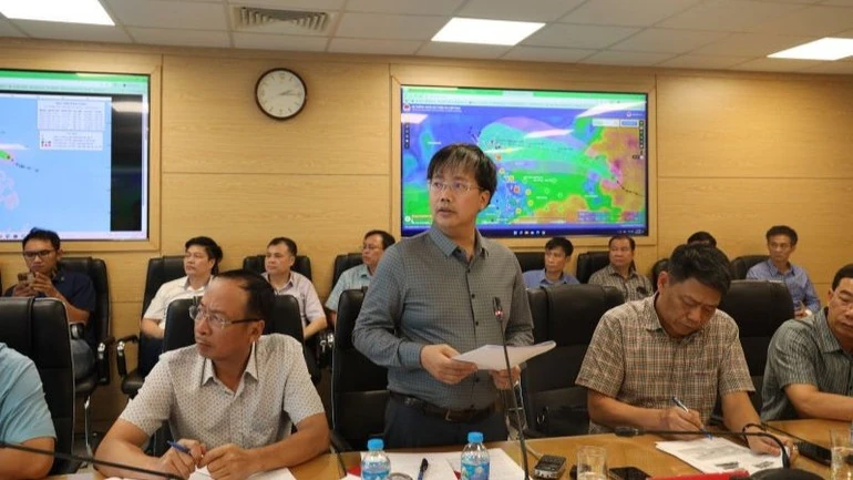
Mr. Mai Van Khiem, Director of the National Center for Hydro-Meteorological Forecasting, informed about storm Wipha.
According to Mr. Khiem, due to the impact of the storm, from July 21 to July 24, the Northern and North Central regions, including Nghe An and Northern Ha Tinh , are likely to experience heavy to very heavy rain. The forecast rainfall is generally from 200mm-300mm, up to 500mm in some places, but the distribution and specific rainfall still depend on the final path of the storm. In case the storm shifts north, along the coast of Guangxi (China), the level of rain and wind impact in our country will decrease.
Notably, Mr. Khiem also informed that after Typhoon Wipha makes landfall, another rain-causing system is likely to form behind this storm. On this system, a trough may appear from the East of the Philippines to the Gulf of Tonkin, maintaining heavy rains until July 24-25.
Ready with the "4 on-site" motto, hundreds of cadres will go to key localities
Speaking at the meeting, Deputy Minister Nguyen Hoang Hiep warned that 2025 is likely to repeat the cycle of "two consecutive years", meaning that if the previous year had strong natural disasters, this year is also likely to continue.
“Last year there was a very big storm that caused widespread flooding; this year there is a high possibility of a similar event. We are very worried about the possibility of localized extreme rainfall,” the Deputy Minister said.
According to Deputy Minister Nguyen Hoang Hiep, initial forecasts show that there will be two heavy rains: the first from July 21 to July 23, concentrated in the North and North Central regions; the second may appear from July 24 to July 26, related to the low trough after the storm.
According to a report from the Department of Dyke Management and Natural Disaster Prevention and Control, large reservoirs in the Red River basin such as Hoa Binh and Tuyen Quang are at high water levels, many reservoirs are having to discharge floodwaters to welcome the main flood season. Small reservoirs in the midlands and mountainous areas in the north have reached 90% of their design capacity in some places. The sea dike system from Quang Ninh to Thanh Hoa still has 20 key weak points, 7 projects are under construction.

Representatives of the Department of Fisheries and Fisheries Surveillance reported at the meeting.
“This time coincides with the summer tourist season and the beginning of the agricultural and aquaculture production season. There are more than 126,000 hectares of coastal aquaculture, nearly 20,000 cages, and nearly 3,700 watchtowers at risk of being affected by storms,” Deputy Minister Nguyen Hoang Hiep warned.
Deputy Minister Nguyen Hoang Hiep requested all units and localities to prepare response plans according to the “4 on-site” principle. He also said that the Ministry of Agriculture and Environment will send hundreds of officials to key communes to directly coordinate and conduct field inspections.
“We need to consider the response to storm No. 3 as a real drill, not only to prevent storms but also to test the ability to command and operate at the new commune level,” said the Deputy Minister.
The Deputy Minister requested functional units such as the Department of Irrigation Works Management and Construction, the Department of Fisheries and Fisheries Control, the Department of Crop Production and Plant Protection, the dike system, traffic... to inspect and review all works, ensuring the safety of workers, equipment and assets.
According to the report of the Border Guard's Civil Defense, Disaster Prevention and Search and Rescue Command: As of noon on July 18, 35,183 ships, with more than 147,000 workers, had been notified and counted. However, 790 ships were still operating near the storm-affected area and needed to be closely monitored. Naval, border guard and fisheries control units were asked to coordinate closely and guide ships to take shelter safely. The Ministry of Foreign Affairs also sent a diplomatic note to regional countries, requesting that they create conditions for Vietnamese ships to avoid the storm if necessary.
On land, local authorities are required to review and prepare plans to evacuate people in areas at high risk of flooding and landslides, especially in mountainous, riverside and estuary communes. Urban areas such as Hanoi and Thai Nguyen are required to develop scenarios to prevent flooding and protect critical infrastructure.
“If the storm develops more complicatedly on July 20, a meeting is expected to be chaired by Deputy Prime Minister Tran Hong Ha or the Prime Minister. All functional forces are in position, the forecasting system is on duty 24/7, ready for any situation when storm Wipha makes landfall,” Deputy Minister Nguyen Hoang Hiep emphasized.
Deputy Minister Nguyen Hoang Hiep emphasized: “We must not be subjective. This storm, although not the strongest, is a real test for the entire disaster prevention system from the central to the communal level.”
(According to nhandan.vn)
Source: https://baophutho.vn/bao-wipha-dien-bien-phuc-tap-mua-lon-tren-dien-rong-kich-hoat-ung-pho-cap-do-cao-236373.htm


![[Video] More than 100 universities announce tuition fees for the 2025–2026 academic year](https://vphoto.vietnam.vn/thumb/1200x675/vietnam/resource/IMAGE/2025/7/18/7eacdc721552429494cf919b3a65b42e)


![[Infographic] In 2025, 47 products will achieve national OCOP](https://vphoto.vietnam.vn/thumb/402x226/vietnam/resource/IMAGE/2025/7/16/5d672398b0744db3ab920e05db8e5b7d)


Comment (0)