
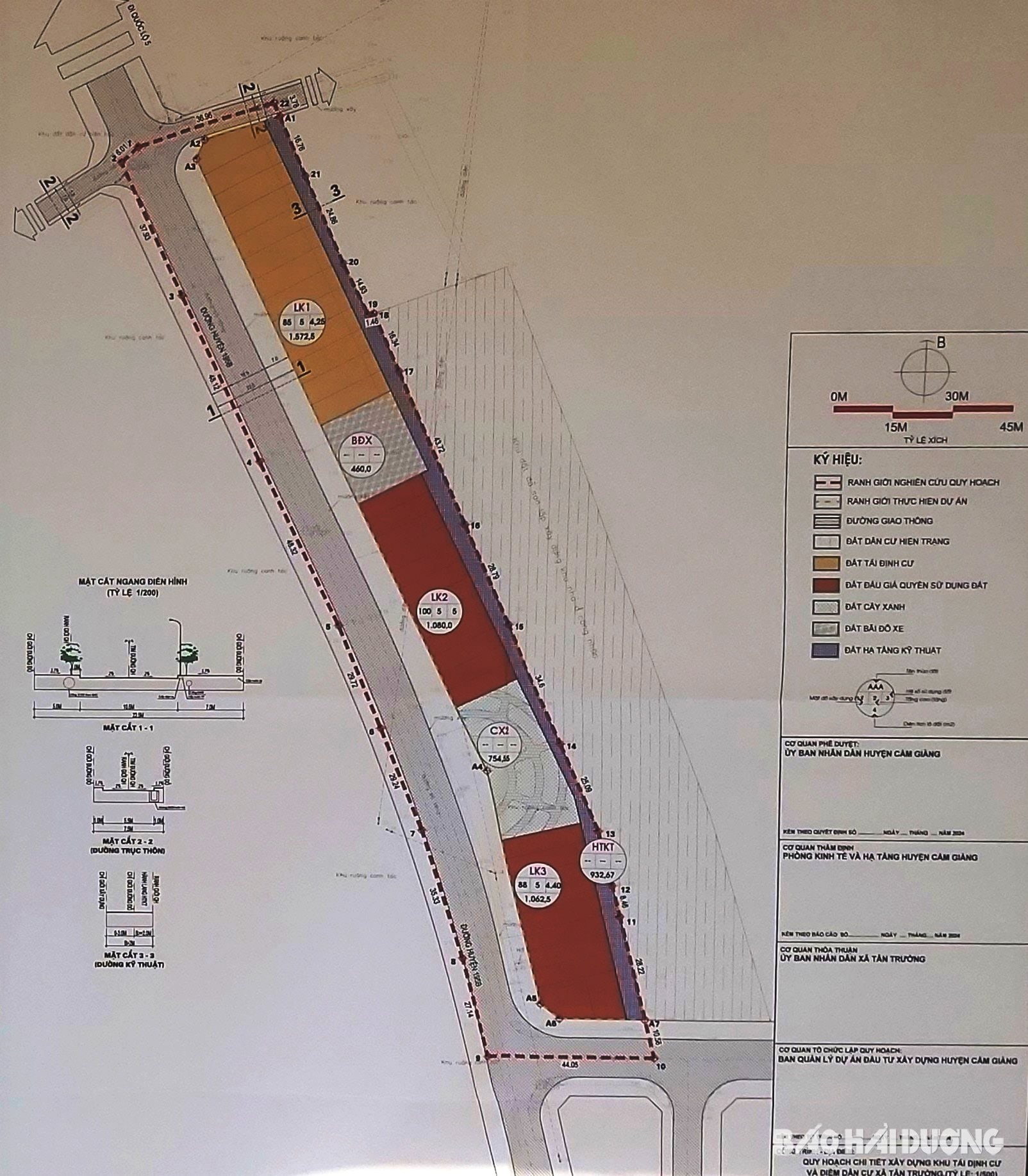
The People's Committee of Cam Giang district has just announced the detailed planning for the construction of resettlement areas and residential areas in Tan Truong commune, at a scale of 1/500. The purpose is to create a land fund for resettlement when reclaiming and clearing land for projects in Tan Truong commune; to complete the construction planning, orientation and serve as a basis for synchronous development of technical infrastructure to build Tan Truong into a type V urban area.
According to the planning of this resettlement area and residential area, the north of the land borders the road to the Trang Ky village cemetery, the east borders the workers' housing area, the south borders the road to the residential area and the west borders district road 195B. The total planned land area is more than 11,131 m2 . Of which, there are 3,715 m2 of residential land divided into 35 lots; 754 m2 of green land; more than 932 m2 of technical infrastructure land...
Over 5,700 m2 of land is planned for traffic works. In particular, the internal traffic routes of the resettlement area are connected to the existing district road 195B, with an expected cross-section of 20.5 m wide. The clean water supply, drainage, electricity supply, communication, fire prevention and fighting, environmental sanitation systems... are all reasonably connected to the area.
PVSource: https://baohaiduong.vn/cong-bo-quy-hoach-khu-tai-dinh-cu-va-diem-dan-cu-xa-tan-truong-cam-giang-398630.html


![[Video] More than 100 universities announce tuition fees for the 2025–2026 academic year](https://vphoto.vietnam.vn/thumb/1200x675/vietnam/resource/IMAGE/2025/7/18/7eacdc721552429494cf919b3a65b42e)


![[Infographic] In 2025, 47 products will achieve national OCOP](https://vphoto.vietnam.vn/thumb/402x226/vietnam/resource/IMAGE/2025/7/16/5d672398b0744db3ab920e05db8e5b7d)


Comment (0)