According to the draft adjustment of the road network planning, the North-South expressway in the East will be extended by 90 km.
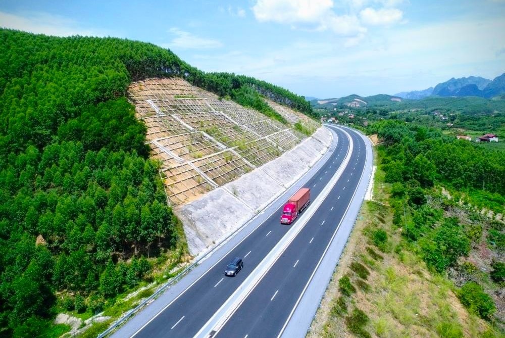
A section of the North-South Expressway in the East has been completed and put into operation. (Illustration photo)
The Ministry of Transport is consulting with localities and relevant units on the draft adjustment of the road network planning for the 2021-2030 period, with a vision to 2050.
The notable new point in the draft is the extension of the North-South expressway in the East to Dat Mui and the addition of the Quang Ngai - Kon Tum expressway.
Specifically, according to the draft adjustment of the road network planning prepared by the Vietnam Road Administration, the North-South Eastern Expressway will add a 90 km long, 4-lane Ca Mau - Dat Mui section, to be invested before 2030. With this additional km, the North-South Eastern Expressway will be 2,153 km long, with a scale of 4-10 lanes (currently planned at 2,063 km).
Thus, the North-South expressway in the East will run from Huu Nghi border gate (Lang Son) to Dat Mui (Dat Mui commune, Ngoc Hien district, Ca Mau) instead of to Ca Mau city as currently planned.
According to the planning unit, the addition of the Ca Mau - Dat Mui expressway is based on the forecast of traffic volume by 2030 from Ca Mau City to Dat Mui of about 18,300 - 20,100 PCU (converted cars/day and night), so it is necessary to form a 4-lane expressway to ensure synchronization of the Can Tho - Ca Mau section.
At the same time, it is associated with the planning of Ca Mau province on the development of Hon Khoai general seaport, Nam Can Economic Zone, Mui Ca Mau National Tourist Area...
The Ben Luc (Long An) - Trung Luong (Tien Giang) expressway section of the North-South expressway in the East is also proposed to increase to 8 lanes instead of 6 lanes as currently planned.
The increase in the number of lanes aims to meet the transportation demand of about 78,700 - 85,100 PCU/day and night on the Ben Luc - Trung Luong section (40 km long), which is the driving axis connecting the economic and social center of the Mekong Delta with Ho Chi Minh City.
For the Central Highlands region, the draft proposes to add to the planning the 136 km, 4-lane Quang Ngai - Kon Tum expressway. This is the 11th expressway in the region, starting in Duc Pho district (Quang Ngai) and ending in Kon Tum city. This expressway is proposed to be invested before 2030.
The addition of the Quang Ngai - Kom Tum expressway to form an additional East - West axis connecting the Central Highlands with the South Central Coast region when National Highway 24 is forecasted to not be able to meet the traffic volume by 2030 of about 14,800 - 18,100 PCU/day and night.
In addition, the draft planning adjustment proposes early investment, increasing the number of lanes, adjusting the length of 5 northern expressways, 3 expressways through the Central Highlands and 5 southern expressways.
With the above proposed adjustment, the national highway system will have 42 routes (an additional route from Quang Ngai to Kon Tum), with a total length of 9,263 km (currently planned at 9,014 km). Of which, the North-South Eastern Expressway is 2,153 km long; the Northern Expressway (14 routes) is 2,313 km long, with a scale of 4-6 lanes (currently planned for 2,305 km); the Central - Central Highlands Expressway (from 10 to 11 routes) is 1,532 km long, with a scale of 4-6 lanes (currently planned for 1,431 km); the Southern Expressway (10 routes) is 1,340 km long, with a scale of 4-10 lanes (currently planned for 1,290 km). The expressways remain as planned, including the North-South Expressway in the West from Tuyen Quang City to Rach Gia City, approximately 1,205 km long, with 4-6 lanes; 3 urban beltways of Hanoi capital, approximately 429 km long, with 6 lanes; 2 urban beltways of Ho Chi Minh City, approximately 291 km long, with 8 lanes. |
According to Traffic Newspaper
Source






















Comment (0)