Due to the influence of storm No. 6, many stations recorded strong winds: Bach Long Vi level 7, gust 9; Co To level 7, gust 8; Hon Ngu level 6, gust 9, waves 2.5m high; Con Co level 6, gust 8; Do Luong (Nghe An) gust 10; Hoanh Son ( Ha Tinh ) level 6, gust 7; many other places had gusts of level 7.
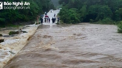
Provinces from Nghe An to Da Nang have had heavy rain, some places have very heavy rain over 200mm.
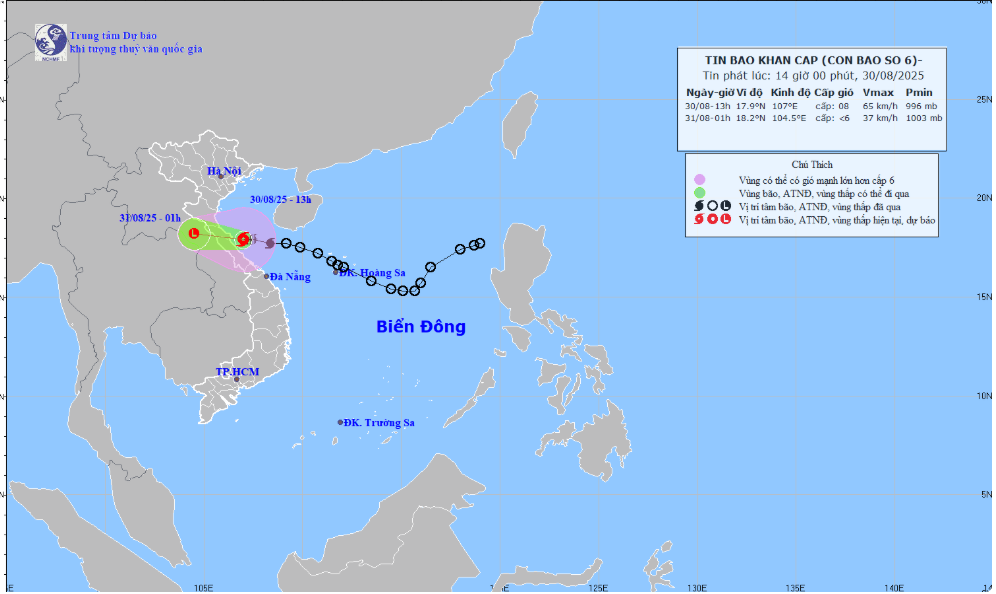
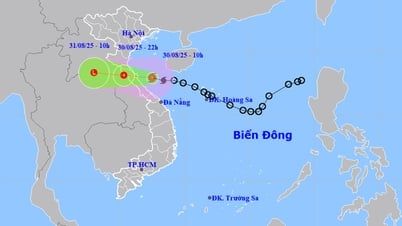
At 1:00 p.m. on August 30, the storm center was at 17.9°N – 107.0°E (coastal Ha Tinh – Quang Tri ). The strongest wind was level 8 (62–74 km/h), gusting to 10–11. The storm moved west at a speed of 20–25 km/h.
Strong winds of level 8, gusts of 10-11 can cause broken tree branches, roofs to be blown off, rough seas, very dangerous for boats and rafts.
Forecast (next 12 hours)
01:00 August 31: Storm moves West Northwest at 20 km/h, enters Ha Tinh - Northern Quang Tri, weakens into a tropical depression, then into a low pressure area.
Location: 18.2°N – 104.5°E (Central Laos). Intensity < level 6.
Danger zone: 16.5°–20.0°N, west of 110.0°E.
Disaster risk level: level 3, Thanh Hoa - Quang Tri sea area (including Hon Ngu, Con Co).
Impact Forecast
At sea: Thanh Hoa - Quang Tri (Hon Ngu, Con Co) has wind level 6-7, near the storm center level 8, gust 10; waves 2.0-4.0m, near the storm center 3.0-5.0m, rough sea. Northern Bac Bo Gulf wind level 6-7, gust 9; waves 2.0-4.0m.
Rising water: Coastal Nghe An - Hue City 0.2-0.4m high.
On land: Nghe An - Quang Tri wind level 6, gust 8; Ha Tinh - Northern Quang Tri level 6-7, near the storm center level 8, gust 10.
Heavy rain: Afternoon of August 30 - end of August 31: Thanh Hoa - Quang Tri heavy to very heavy rain, 100-220mm, some places >400mm. Midland and Northern Delta rain 50-120mm, some places >250mm.
LP
Source: https://baothanhhoa.vn/dem-nay-bao-so-6-suy-yeu-thanh-ap-thap-nhiet-doi-260110.htm





![[Photo] People eagerly lined up to receive special publications of Nhan Dan Newspaper](https://vphoto.vietnam.vn/thumb/1200x675/vietnam/resource/IMAGE/2025/8/30/53437c4c70834dacab351b96e943ec5c)







































Comment (0)