1. Geographical location
Ha Giang is a mountainous border province in the far north of the country, with a particularly important strategic position. To the north and west, it borders the People's Republic of China with a length of 274 km; to the east, it borders Cao Bang province; to the south, it borders Tuyen Quang province; to the west and southwest, it borders Lao Cai and Yen Bai provinces.
Ha Giang has a natural area of 7,929.5 km².
At the northernmost point of Ha Giang territory, which is also the northernmost point of the Fatherland, about 3 km east of Lung Cu, with latitude 23013'00"; the westernmost point is about 10 km southwest of Xin Man, with longitude 104024'05"; the easternmost point is 16 km east-southeast of Meo Vac with longitude 105030'04".
Up to now, Ha Giang has 01 city, 10 districts, 05 wards, 13 towns and 177 communes.
Ha Giang city 5 wards and 3 communes
Bac Me District 1 town and 12 communes
Bac Quang District 2 towns and 21 communes
Dong Van District 2 towns and 17 communes
Hoang Su Phi District 1 town and 24 communes
Meo Vac District 1 town and 17 communes
Quan Ba District 1 town and 12 communes
Quang Binh District 1 town and 14 communes
Vi Xuyen district 2 towns and 22 communes
Xin Man District 1 town and 18 communes
Yen Minh District 1 town and 17 communes
The average population of the whole province in 2021 is estimated at 887,086 people, of which: Female population is 438,715 people, accounting for 49.46%, urban population is 140,327 people, accounting for 15.82%. The gender ratio of the whole province's population in 2021 is 102.2 males/100 females, of which urban areas are 98.12 males/100 females; rural areas are 102.99 males/100 females.
2. Terrain
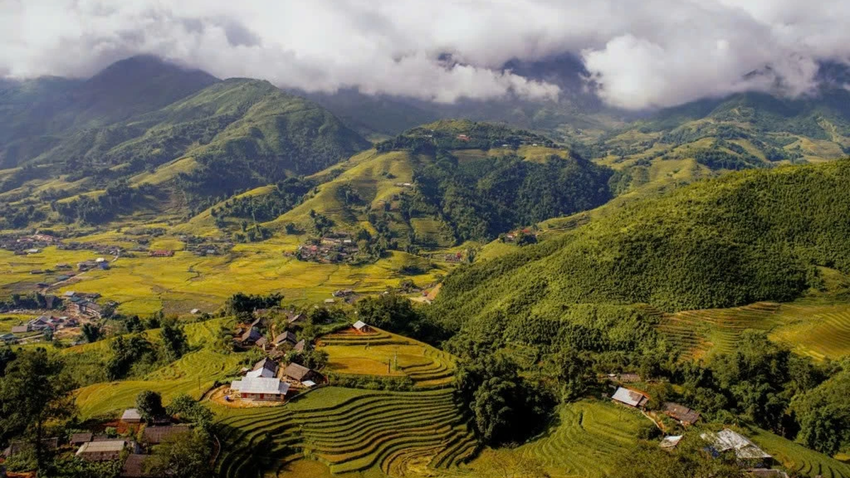
Located in the mountainous region of the North of Vietnam, Ha Giang is a majestic mountain range, rugged terrain, with an average height of 800m to 1,200m above sea level. This is an area with many high mountains. According to statistics, on the Ha Giang land strip of less than 8,000 km2, there are 49 mountains from 500 m to 2,500 m high (10 peaks 500 - 1,000 m high, 24 peaks 1,000 - 1,500 m high, 10 peaks 1,500 - 2,000 m high and 5 peaks 2,000 - 2,500 m high). However, Ha Giang's terrain can basically be divided into the following 3 regions:
- The northern highlands are also known as Dong Van Stone Plateau, including the districts of Quan Ba, Yen Minh, Dong Van, Meo Vac, with 90% of the area being limestone mountains, typical of Karst terrain. This place has sharp cat-ear stone ranges, deep and narrow ravines, and many steep cliffs. On October 3, 2010, Dong Van Stone Plateau joined the global Geopark network with the name: Dong Van Stone Plateau Global Geopark.
- The western highlands include Hoang Su Phi and Xin Man districts; part of the Bac Ha plateau, commonly known as the Chay River arch, with an altitude of 1,000m to over 2,000m. The terrain here is commonly dome or semi-dome, pear-shaped, saddle-shaped, interspersed with steep terrain, sometimes sharp or steeply jagged, strongly dissected, with many folds.
- The low mountainous area includes the remaining districts and towns, stretching from Bac Me, Ha Giang city, through Vi Xuyen to Bac Quang. This area has strips of old forest interspersed with relatively flat valleys along rivers and streams.
3. Hydrology
The major rivers in Ha Giang belong to the Red River system. This place has a relatively high density of rivers and streams. Most of the rivers have uneven depths, steep slopes, many rapids and waterfalls, and are not very convenient for water transport.
Lo River is a large river in Ha Giang, originating from Luu Lung, Yunnan (China), flowing through the Vietnam - China border (Thanh Thuy area), through Ha Giang city, Bac Quang to Tuyen Quang . This is the main source of water supply for the central region of the province.
Chay River originates from the southwest slope of Tay Con Linh peak and the northeast slope of Kieu Lien Ti peak. The density of tributaries is high (1.1km/km2), the water concentration coefficient reaches 2.0km/km2. Although only the upstream section is within the province, it is the main source of water for the western region of Ha Giang.
Gam River originates from Nghiem Son, Tay Tru (China) flows through Lung Cu commune, Meo Vac district to near Tuyen Quang city and joins Lo river. This is the main water supply for the eastern part of the province.
In addition, in Ha Giang province there are also shorter and smaller rivers such as Nho Que River, Mien River, Bac River, Chung River, many large and small streams providing water for production and people's lives.
4. Climate
Located in the tropical monsoon region and a high mountainous area, Ha Giang's climate basically has the characteristics of the Viet Bac - Hoang Lien Son mountainous region, but also has its own characteristics, cooler and colder than the Northeastern provinces, but warmer than the Northwestern provinces.
The rainfall regime in Ha Giang is quite diverse. The whole province has an average annual rainfall of about 2,300 - 2,400 mm, with Bac Quang alone receiving more than 4,000 mm, making it one of the regions with the highest rainfall in our country. The rainfall fluctuation between regions, years and months of the year is quite large.
The average annual humidity in Ha Giang is 85% and the fluctuation is not large. The highest time (June, July, August) is about 87 - 88%, the lowest time (January, February, March) is also about 81%: Especially here, the boundary between the dry season and the rainy season is not clear. Ha Giang is a cloudy province (average cloudiness is about 7.5/10, late winter up to 8 - 9/10) and relatively little sunshine (the whole year has 1,427 hours of sunshine, the most sunny month is 181 hours, the least sunny month is only 74 hours).
Wind directions in Ha Giang depend on the valley terrain. The Lo River Valley has almost only one Southeast wind direction all year round with a frequency exceeding 50%. In general, the wind is weak, with an average speed of about 1-1.5m/s. This is also a place with a high number of stormy days, up to 103 days/year, with drizzle and fog, but especially little frost. The outstanding features of Ha Giang's climate are high humidity throughout the year, heavy and prolonged rain, cool and cold temperatures, all of which affect production and life.























Comment (0)