
GEOGRAPHIC LOCATION
Dong Thap is a province in the Mekong Delta region (13 provinces and cities).
- Natural area: 3,283 km 2 .
- Population: Over 1.6 million people.
- Population density: 506 people/km 2 .
- 165 km southwest of Ho Chi Minh City .
- North and Northwest: Bordering the Kingdom of Cambodia.
- South and Southeast: Bordering Vinh Long province.
- East: Bordering Tien Giang province and Long An province.
- West: Bordering An Giang province and Can Tho city.
- Includes 12 districts and cities:
+ 03 cities: Cao Lanh (Provincial capital), Sa Dec, Hong Ngu.
+ 09 districts: Cao Lanh, Chau Thanh, Hong Ngu, Lai Vung, Lap Vo, Tam Nong, Tan Hong, Thanh Binh, Thap Muoi.
- Nation:
+ Kinh ethnic group: 99.3% of population.
+ Other ethnic groups (Chinese, Khmer): 0.7% of population.
- Religion: Buddhism, Hoa Hao, Cao Dai, Catholicism, Protestantism.
- Climate: Tropical monsoon.
- Average temperature: 27.19 0 C.
- Humidity: 83%.
- River system:
+ 02 main river branches: Tien River and Hau River.
+ Alluvial deposits all year round.
+ Advantages: Aquaculture; waterway transportation; eco-tourism.
- River port system: 02 ports on the banks of Tien River, convenient transportation of goods to the East Sea and neighboring country - Kingdom of Cambodia
- Border gates: Thuong Phuoc international border gate (Hong Ngu district), Dinh Ba international border gate (Tan Hong district) and 05 pairs of secondary border gates.
RESOURCES
* Forest:
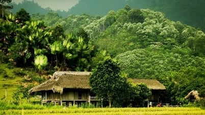
- Many special-use forests: Tram Chim National Park (Tam Nong district), Xeo Quit Relic Site (Cao Lanh district), Gao Giong Melaleuca Forest (Cao Lanh district), Go Thap Relic Site (Thap Muoi district).
+ Value of historical, cultural and scientific research preservation.
+ Attracts many species: birds, reptiles, fish, shrimp, crabs, snails, medicinal herbs, etc.
- Extremely rich ecosystem and flora and fauna: 198 species of birds, dozens of species of reptiles, 40 species of fish, 140 species of medicinal plants, etc.
+ Habitat of many rare animals and plants: Snakes, Turtles, Red-crowned Cranes (Crane), Pelicans, White-winged Ducks, Mallards, etc.
- Ecotourism.
- Conservation of wetland ecosystems in the Mekong Delta region.
- Preserve rare animal and plant genetic resources.
* Water:
- Surface water:
+ Sweet all year round, not salty.
+ Tien River water flow: Average 11,500 m 3 / second, largest 41,504 m 3 cubic / second and smallest 2,000 m 3 / second.
- Groundwater: Abundant water source, at many different depths.
- Favorable nature: Extremely rich seafood resources, naturally growing and multiplying; many types of crops have high economic value.
* Land:
- Alluvial soil:
+ Area 191,769 ha, accounting for 59.06% of natural land area.
+ Every year, new alluvium is added, favorable for planting.
+ Crops: Corn, Potato, Lotus, Morning Glory, etc.
+ Short-term industrial crops: Soybeans, Sesame, Peanuts, etc.
+ Fruit trees: Mango, Orange, Tangerine, Lemon, Longan, etc.
- Acid sulfate soil:
+ Area 84,382 ha, accounting for 25.99% of natural land area.
+ Most have been sweetened.
+ Can grow rice and raise aquatic products with high productivity and quality.
- Grey soil:
+ Area 28,155 ha, accounting for 8.67% of natural land area.
+ Concentrated mainly on high terrain in districts: Tan Hong, Tam Nong, Hong Ngu, Hong Ngu city.
- Sandy land: Area 120 ha, accounting for 0.04% of the province's natural land area.
* Minerals:
- Construction sand:
+ The largest and best reserves and quality compared to the provinces and cities of the Mekong Delta and the Southeast region.
+ Located along the sand dunes, sandbanks, and large river islands, convenient for exploitation and transportation.
- Brick and tile clay: Large reserves; widespread throughout the province.
- Kaolin clay: Originates from river sediments; distributed in districts and cities in the North of the province.
- Peat: Formed in the 4th century; reserves of about 2 million m3 ; distributed in Tam Nong and Thap Muoi districts.
Provincial Information Portal


![[Maritime News] More than 80% of global container shipping capacity is in the hands of MSC and major shipping alliances](https://vphoto.vietnam.vn/thumb/402x226/vietnam/resource/IMAGE/2025/7/16/6b4d586c984b4cbf8c5680352b9eaeb0)


Comment (0)