Due to the influence of low pressure and the Northeast monsoon, from the night of September 21 to the morning of September 23, many districts, towns and cities of Thanh Hoa had moderate rain, heavy rain, and in some places very heavy rain.
Heavy rain and flood water from upstream caused water levels in rivers and streams to rise.
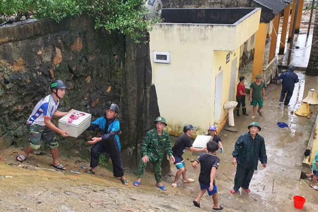
Thousands of people and students in the localities have been evacuated (Photo: Van Lon).
Specifically, the water level of the Ma River is above alert level 3 (0.1m); the Len River is below alert level 2 (0.37m); the Buoi River is above alert level 2 (0.19m); the Cau Chay River is above alert level 1 (0.49m); and the Chu River is above alert level 2.
Complex rains and floods also caused flooding and landslides in many areas, especially mountainous districts of Thanh Hoa.

Flood water over Bai Thuong dam, Thuong Xuan district (Photo: Thanh Tung).
According to a quick report, by noon on September 23, to ensure safety, many localities in Thanh Hoa had to evacuate more than 1,200 households with nearly 5,000 people living along riverbanks and streams at risk of landslides, flash floods, and flash floods.
Specifically, Quan Son district has 116 households, with 543 people; Quan Hoa has 71 households, with 279 people; Muong Lat has 443 households, with 1,479 people; Lang Chanh has 7 households, with 28 people; Ba Thuoc has 14 households, with 55 people; Ngoc Lac has 53 households, with 198 people; Thach Thanh has 54 households, with 186 people; Tho Xuan has 252 households, with 953 people; Thuong Xuan has 273 households, with 1,057 people.
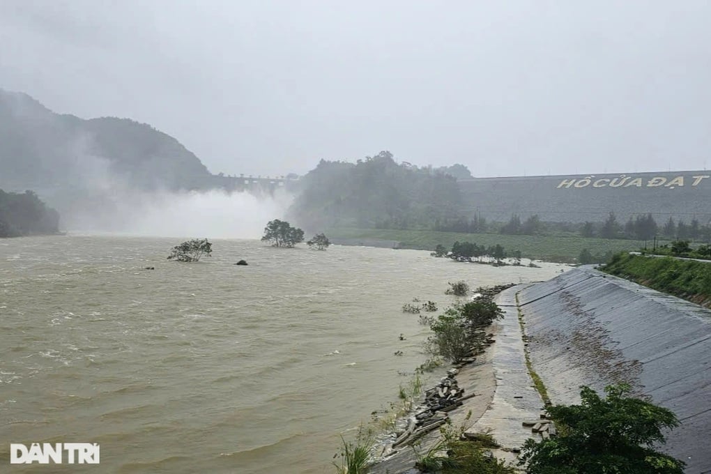
Cua Dat Lake releases floodwaters (Photo: Thanh Tung).
The floods also caused 113 houses in Muong Lat, Quan Son, and Quan Hoa districts to have their roofs blown off and landslides; 12 hectares of rice fields were flooded; 7 schools were affected by landslides; National Highways 15C and 16 to Muong Lat district and Highway 217 to Quan Son were eroded at some points, isolating and separating many villages.
Source: https://dantri.com.vn/xa-hoi/gan-5000-nguoi-dan-tai-thanh-hoa-phai-so-tan-do-mua-lu-sat-lo-20240923150536294.htm














![[Photo] National Assembly Chairman Tran Thanh Man visits Vietnamese Heroic Mother Ta Thi Tran](https://vphoto.vietnam.vn/thumb/1200x675/vietnam/resource/IMAGE/2025/7/20/765c0bd057dd44ad83ab89fe0255b783)
















Comment (0)