
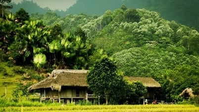
(QBĐT) - We grew up from the rice grains of the village fields. The village has hamlets. The hamlets of my hometown Nam Ly ward today are located on low hills running from West to East, with the names: Village Hamlet, Big Nam Hamlet, Small Nam Hamlet.
On both sides of the hamlets were fields where our grandparents and parents had grown rice and potatoes from generation to generation. The fields were where we herded buffaloes, cut grass, and were also our playgrounds.
Growing up, I was used to hearing the names of the fields. To the southwest of the village, there were narrow fields, stretching out in succession with popular names: Quai Mo, Dong Loi, Coc Dai, Bac Nam. The fields in the east were wider, located on the right bank of the Cau Rao River. On the other side were the fields of Phu Ninh village (today's Dong Phu ward).
The names of the eastern rice fields are associated with the characteristics of the land: Sac Vang and Sac Ro, right next to Cau Rao River, are rice fields that were formerly mangrove forests with typical mangrove trees such as mangroves, rhododendrons, and mangroves; later they were diked and converted into rice fields. There are also rice fields with names associated with historical events, including Nen Dien, which is the place where there is a temple to worship Confucius (now area 525, where there are SAM service complex, Department of Justice, Departmentof Education and Training). This temple was built by the scholar (doctor) Nguyen Luong Quy (1771-1776), during the reign of Lord Vo Nguyen Phuc Khoat, to encourage the virtue of studiousness and the spirit of examinations for the families in the village.
 |
Doctor Nguyen Luong Quy is the 8th generation descendant of the Nguyen Luong family in Bac Ly and Nam Ly wards today. He passed the provincial examination at the age of 23. He passed the highest examination at the age of 30, worked as a Confucian scholar for 10 years and then held the positions of: Khang Loc District Governor, Tan Binh District Governor, Han Lam Academy Governor, Prime Minister (not yet revised), Chief Examiner of the Three-level Examination...
The old people told me that during the war against the French, the fields near the Cau Rao River were densely forested with tigers and leopards living there. In the Bac Nam fields (in the West, near the Bac Nam Brick and Tile Factory), there were large trees that the villagers exploited to make pillars and house beams.
These plains were originally formed by the annual deposition of alluvium from primitive rivers and streams. Typical traces of the sea and tides deep inland are still preserved in the soil layers of the Cooc Dai and Dong Cooc plains, such as bright and relatively intact scallop layers. In some places of these plains, the groundwater is still quite salty.
Rice from the western rice fields is not as delicious and rich as rice from the eastern rice fields - which were later washed away by the rice farmers who migrated from the North, so the soil in these rice fields still retains a certain amount of salt and minerals from the ocean, making the rice here more flavorful. In the middle of the rice fields, there are also high plots of land that are very suitable for growing potatoes in the winter-spring crop. Sweet potatoes grown in Mui Coi area (now part of the campus of the Provincial People's Procuracy and part of the campus of Quang Binh University) are famous for their deliciousness. When I was in high school, my parents gave some Mui Coi potatoes to my classmate's family, who was a state official. My friend's parents kept saying, "I've never eaten such delicious potatoes!"
During the two times of fighting against the destructive war of the US, not only my hometown was destroyed, many people were killed by American bombs, but the other villages also suffered the same fate. Cau Rao, the concrete bridge across Cau Rao River (on Tran Hung Dao Street today) was an important bridge on the route of transporting weapons from Nhat Le Port to Highway 15A (now Ho Chi Minh Road) and was fiercely attacked. The bomb exploded right next to the foot of the bridge on the East side, causing the pillars and beams to collapse and leaving a large bomb crater.
Around the Cau Rao area before the 1980s, there were still many bomb craters. There were large, long double bomb craters formed by many bombs dropped and exploded close together. We kids gave the bomb craters some pretty cool names: Jumping and Diving Bomb Crater because the bomb craters were so deep that you could jump headfirst into the water without fear of hitting the bottom; Cha Cooc bomb crater in the middle of Cha Cooc fields; Sac Vang crater in the middle of Sac Vang fields... The American bomb craters became natural swimming pools for us kids and contained lots of delicious wild fish.
Living on rice, but many seasons suffered from crop failure. Every year, only the winter-spring crop was safe due to the abundant fresh water source. But the summer-autumn crop was unstable, with a harvest in a rainy year, but a drought in a drought year. In those years, the Cau Rao River was low, salty and could not irrigate the fields. In those years, every family had to eat rice mixed with cassava and sweet potatoes, sometimes porridge to get through the meal. After the Phu Vinh reservoir irrigation project was built, the water source was abundant, and two rice crops were safe, and people's lives gradually improved.
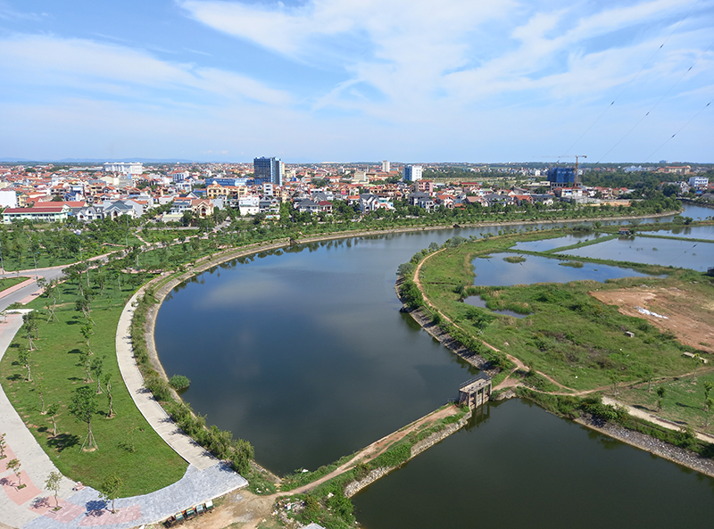
Nowadays, the eastern rice fields have given way to residential areas, agency headquarters, parks... forming the most beautiful urban areas of the young city of Dong Hoi, but the memories of the rice fields still live forever in my childhood memories.
Nguyen Luong Cuong
Source: https://www.baoquangbinh.vn/van-hoa/202410/ky-uc-nhung-xu-dong-lang-2221893/


![[Maritime News] More than 80% of global container shipping capacity is in the hands of MSC and major shipping alliances](https://vphoto.vietnam.vn/thumb/402x226/vietnam/resource/IMAGE/2025/7/16/6b4d586c984b4cbf8c5680352b9eaeb0)


Comment (0)